-
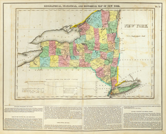
Carey, Henry Charles & Lea, Isaac. Geographical, Statistical, and Historical Map of New York. Philadelphia, 1822.
Regular price $ 220.00 USDRegular priceUnit price per -
Jaillot, Alexis-Hubert. Le Golfe de Venise avec ses Principaux. Paris: 1692 [Italy]
Regular price $ 400.00 USDRegular priceUnit price per -
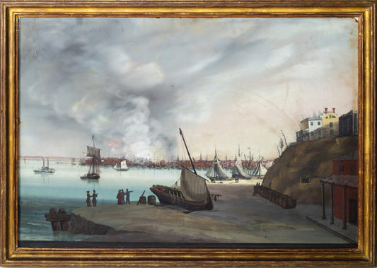
AMERICAN SCHOOL (19TH CENTURY). View of New York taken from Brooklyn on the Hudson (?) Fire...December..1835
Regular price $ 65,000.00 USDRegular priceUnit price per -
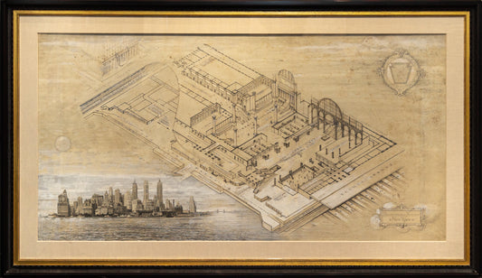
ANGELO MAGNANTI (1879-1969) Pennsylvania Station New York. 1946; HAWLEY HUGHSON (1850-1936), after Pennsylvania Station, New York City Seventh Avenue and Thirty-Second Street. 1910
Regular price $ 125,000.00 USDRegular priceUnit price per -
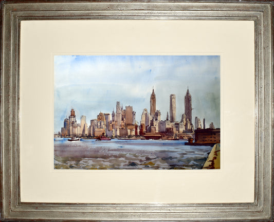
REGINALD MARSH (1898-1954) New York Skyline
Regular price $ 36,000.00 USDRegular priceUnit price per -
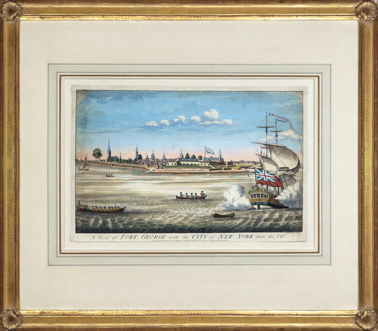
JOHN CARWITHAM (1723-1741). A View of Fort George with the City of New York from the SW. 1764
Regular price $ 12,000.00 USDRegular priceUnit price per -
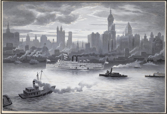
RUDOLF DANIEL LUDWIG CRONAU (1855 - 1939) Lower Manhattan Island in 1894
Regular price $ 15,000.00 USDRegular priceUnit price per -
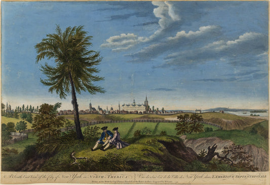
LUIGI KASIMIR (1881-1962). View of [New York from] Governor’s Island. 1927
Regular price $ 8,500.00 USDRegular priceUnit price per -
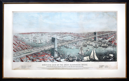
A. MAJOR. Bird’s-eye View of the Great Suspension Bridge connecting the cities of New York and Brooklyn. 1883
Regular price $ 7,500.00 USDRegular priceUnit price per -
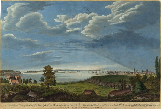
PIERRE CHARLES CANOT (1710-1777), after THOMAS HOWDELL A South West View of the City of New York in North America. 1768
Regular price $ 14,000.00 USDRegular priceUnit price per -
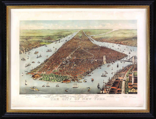
NATHANIEL CURRIER (1813 - 1888) JAMES MERRITT IVES (1824 - 1895). The City of New York
Regular price $ 24,000.00 USDRegular priceUnit price per -
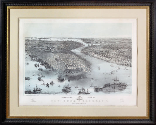
JOHN BACHMANN (1814–1896) Birds’ Eye View of New-York & Brooklyn. 1851
Regular price $ 13,000.00 USDRegular priceUnit price per -
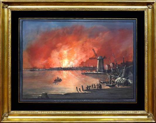
NICOLINO CALYO (1799-1884). View of New York City as It Appeared on the Eve of the Fire, 1835.
Regular price $ 175,000.00 USDRegular priceUnit price per -
PIERRE CHARLES CANOT (1710-1777), after THOMAS HOWDELL A South East View of the City of New York in North America. 1768
Regular price $ 14,000.00 USDRegular priceUnit price per -
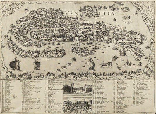
Ughi, Ludovico (fl. 1700-1740). [Venice] Iconografica rappresentazione della inclita citta di Venezia consacrata al reggio serenissimo domino veneto. Venice: 1703.
Regular price $ 58,000.00 USDRegular priceUnit price per -
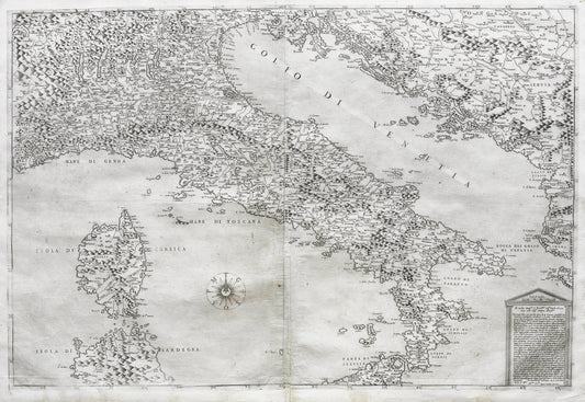
Forlani, Paolo (1560-1571) & Gastaldi, Giacomo (1500-1566). Italy. Venice: 1569
Regular price $ 28,000.00 USDRegular priceUnit price per -
Scolari, Stefano (c. 1612-1691). Venetia. Venice: ca. 1670
Regular price $ 16,000.00 USDRegular priceUnit price per -
Scolari, Stefano (c. 1612-1691) after Matteo Greuter (1564-1638). [Italy] Novissima ac Exactissima Totius Italia Descriptio Magna. Venice, 1657.
Regular price $ 145,000.00 USDRegular priceUnit price per -
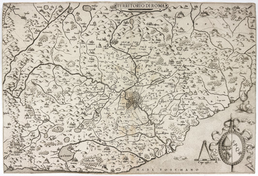
Camocio, Giovanni Francesco (1550-1575). Territoria di Roma. Venice, 1559
Regular price $ 4,500.00 USDRegular priceUnit price per -
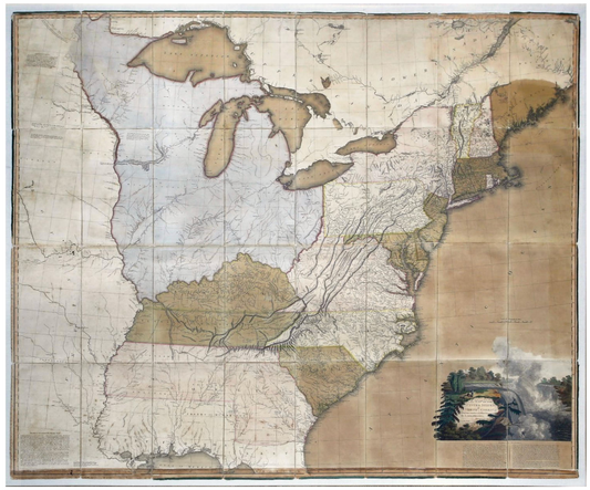
Aaron Arrowsmith. A Map of the United States of North America... 1796
Regular price $ 48,000.00 USDRegular priceUnit price per
![Jaillot, Alexis-Hubert. Le Golfe de Venise avec ses Principaux. Paris: 1692 [Italy]](http://aradernyc.com/cdn/shop/files/SSV0140.jpg?v=1691603692&width=533)
![LUIGI KASIMIR (1881-1962). View of [New York from] Governor’s Island. 1927](http://aradernyc.com/cdn/shop/files/Kasimir_ViewofGovernorsIsland_Framed.jpg?v=1759436625&width=533)
![Ughi, Ludovico (fl. 1700-1740). [Venice] Iconografica rappresentazione della inclita citta di Venezia consacrata al reggio serenissimo domino veneto. Venice: 1703.](http://aradernyc.com/cdn/shop/files/JLR0424_1.jpg?v=1754082357&width=533)
![Scolari, Stefano (c. 1612-1691) after Matteo Greuter (1564-1638). [Italy] Novissima ac Exactissima Totius Italia Descriptio Magna. Venice, 1657.](http://aradernyc.com/cdn/shop/files/ScolariGreuterItaly.jpg?v=1754081611&width=533)