from: June 2025 1
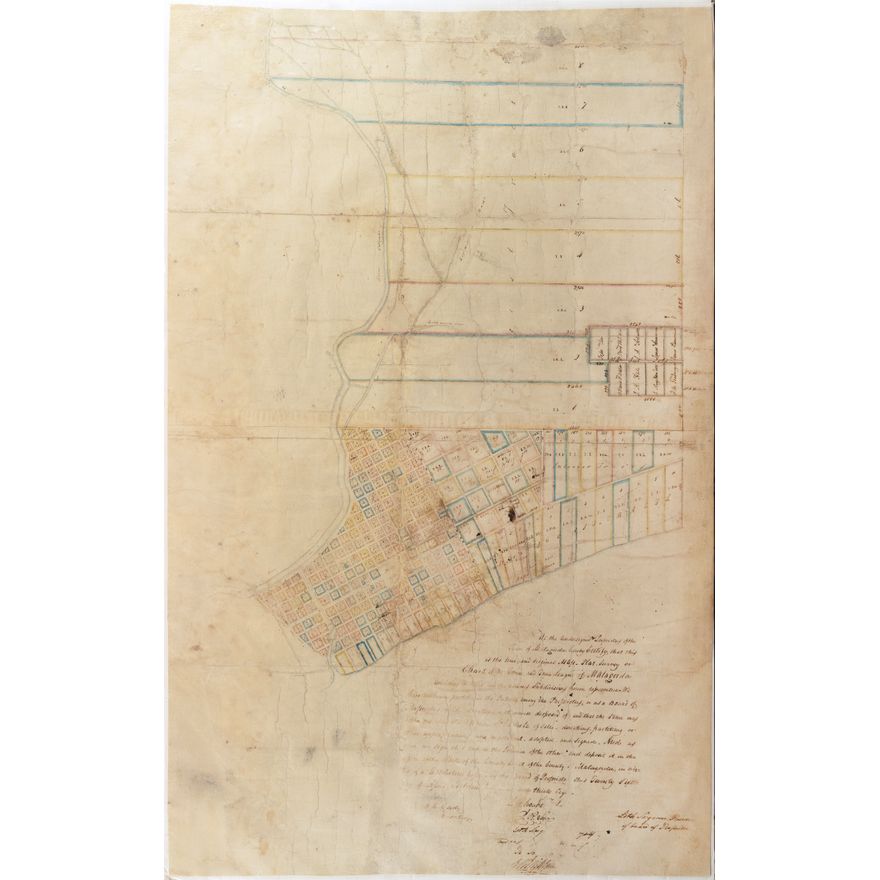
Manuscript Map Survey of the Town of Matagorda, Texas and Environs - Third oldest town in Texas
Manuscript Map Survey of the Town of Matagorda, Texas and Environs - Third oldest town in Texas
Couldn't load pickup availability
FISHER, Samuel Rhoads (1794-1839), after Elias Wightman.
Survey of the Town of Matagorda, Texas and Environs - Third oldest town in Texas.
Manuscript map in pen and ink with colors.
c. 1838.
38" x 24" sheet.
Original manuscript plans of American cities are of great rarity, especially for Texas. This speaks to the history of urban planning in the American Southwest.
An important original manuscript city plan of Matagorda, Texas made during the Republic, its most interesting historic period; almost certainly drawn by Elias Wightman, with certification in the hand of S. Rhodes Fisher.
The map provides significant detail, including streets, town lots, and public buildings and spaces. Lots are numbered, and color coded, with larger tracts identified by owner. The map includes a lengthy certification in the hand of S. Rhoads Fisher (based upon comparison to a similar plat map dated 1835 and offered at Dorothy Sloan in 2009. As with that example, this was most certainly drawn by Elias Wightman, a Surveyor whom Steven F. Austin had brought to Texas in 1827 and who had originally laid out the Town of Matagorda in 1828.
