|
Dear Collectors,
Since the dawn of cartography, maps have been far more than tools for navigation—they are primary records of power, discovery, and ambition. They chart not only landforms but the evolving priorities of nations and the worldviews of those who ruled them.
This June 2025 selection at Arader Galleries invites you to explore maps that span the Age of Discovery through the rise of the American republic. From monumental sea charts to boundary-defining surveys and early urban plans, each example reveals a pivotal moment in the shaping of our modern world.
They capture the shifting understanding of geography, the expansion of empires, and the emergence of new settlements and nations. These works stand alongside great manuscripts as essential artifacts of history—collected, studied, and preserved for their enduring significance.
I invite you to view this collection as both evidence of the past and a testament to the enduring value of cartographic art and science.
Warm regards,
Graham Arader
Arader Galleries
|
|
|
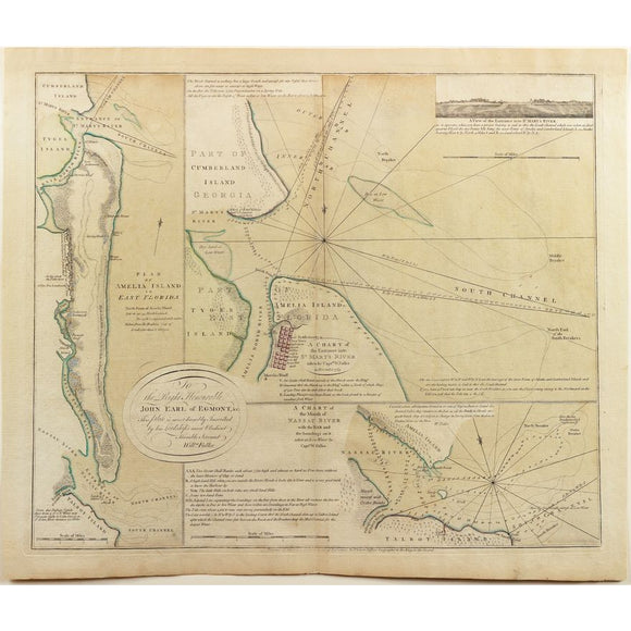
De Brahm's Plan of Amelia Island Florida
|
$ 3,800.00
|
Finest original color ever on this cornerstone, revolutionary war map of Amelia Island - one of America's finest resort islands. Rare 1770 British sea chart of Amelia Island and nearby rivers, offering the most accurate navigation of northeast Florida during early colonial expansion.
|
|
|
|
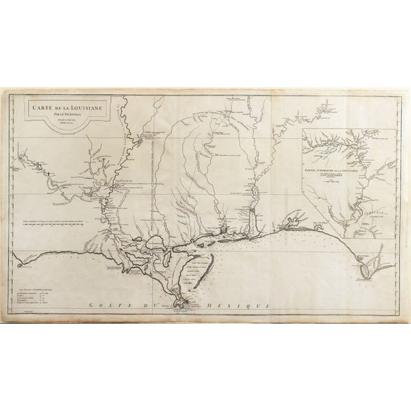
D'Anville's Carte de la Louisiane, 1732
|
$ 2,800.00
|
Foundational 18th-century map of Louisiana, charting French territorial claims and Indigenous nations during early exploration and imperial rivalry in North America.
|
|
|
|
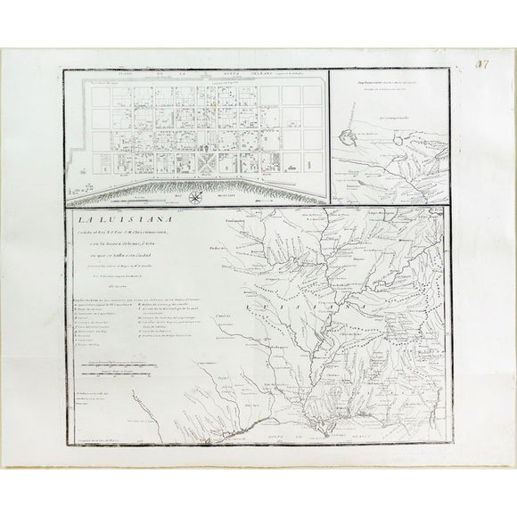
Lopez de Vargas Map of Louisiana showing New Orleans
|
$ 3,500.00
|
Scarce Spanish map of Louisiana marking France’s secret 1762 cession to Spain, with insets of New Orleans and the Mississippi—reflecting shifting imperial power post-Seven Years’ War.
|
|
|
|
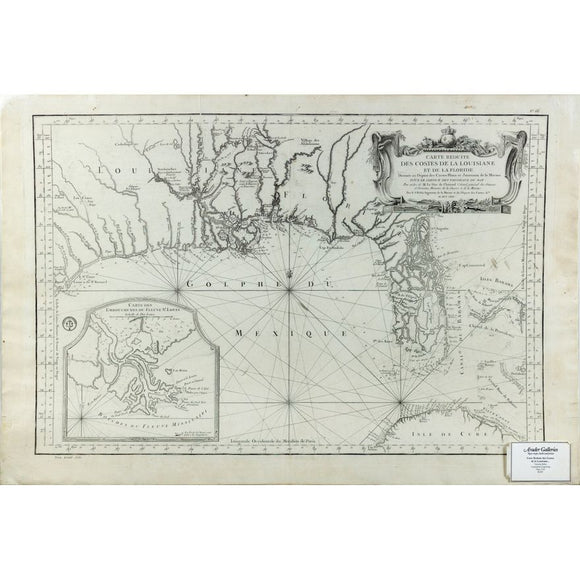
Bellin's Carte Reduite des costes de la Louisiane et de la Floride
|
$ 2,800.00
|
Last French map of the Gulf Coast issued during the French and Indian War, reflecting final French claims before territorial loss to Britain and Spain.
|
|
|
|
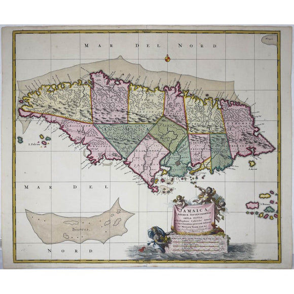
Visscher's Map of Jamaica - The Kislak Copy with Excellent Original Color
|
$ 1,800.00
|
Vivid early 18th-century map of Jamaica, reflecting its layered colonial past and English control post-Treaty of Madrid, with exceptional original color from the Kislak collection.
|
|
|
|
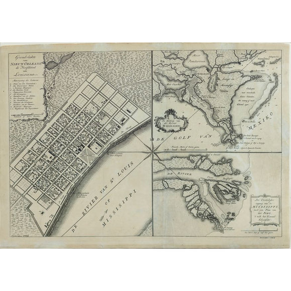
Isaak Tirion's Grondvlakte van Nieuw Orleans - One of the Earliest Obtainable Maps of Louisiana and the Lower Mississippi River
|
$ 1,800.00
|
One of the earliest obtainable 18th-century plans of New Orleans and the Mississippi Delta, detailing key buildings, fortifications, and French colonial infrastructure.
|
|
|
|
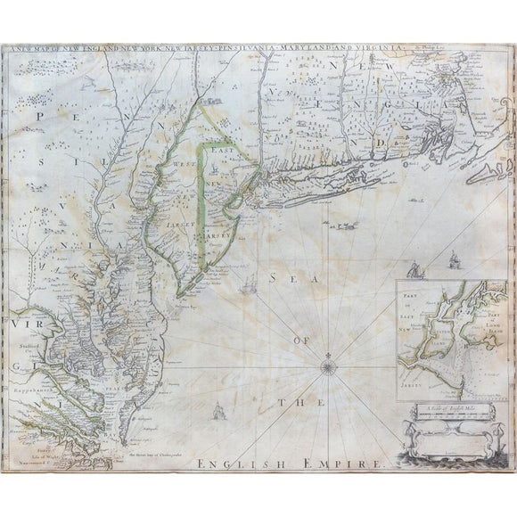
Philip Lea's New Map of New England, New York, New Jarsey, Pensilvania, Maryland and Virginia
|
$ 14,000.00
|
One of the earliest obtainable maps of England’s American colonies, showing detailed geography from Massachusetts to Virginia and the first printed chart of New York Harbor.
|
|
|
|
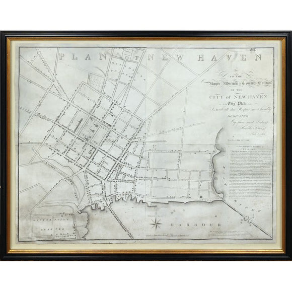
Amos Doolittle's Plan of New Haven
|
$ 9,000.00
|
Rare 1824 map of New Haven by Revolutionary War engraver Amos Doolittle, blending civic pride, Federal-era design, and Yale’s growing architectural footprint.
|
|
|
|
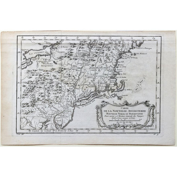
Bellin's Carte de la Nouvelle Angleterre Nouvelle Yorck et Pensilvanie
|
$ 300.00
|
First edition 1757 French map of New England, New York, and Pennsylvania, published during the French and Indian War to illustrate contested colonial territories
|
|
|
|
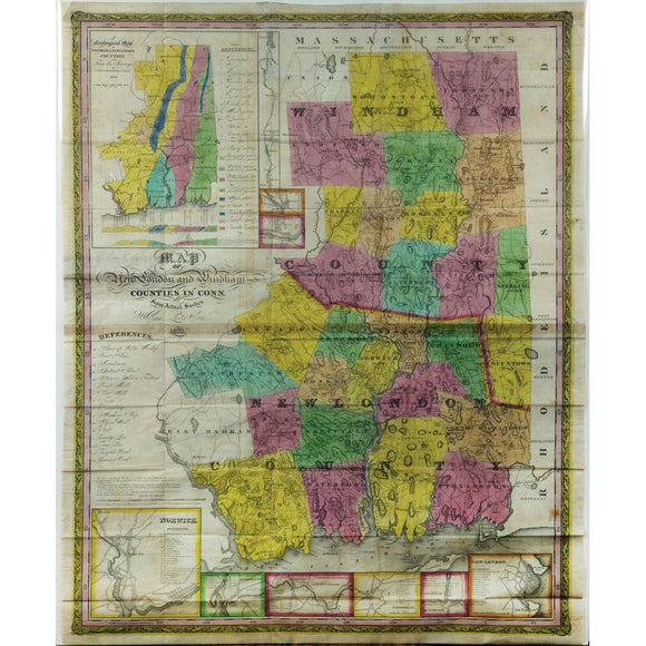
William Lester, Map of New London and Windham Counties in Conn. from Actual Survey
|
$ 900.00
|
Detailed 1833 map of New London and Windham Counties, Connecticut, based on actual surveys—reflecting early 19th-century land use, infrastructure, and township development.
|
|
|
|
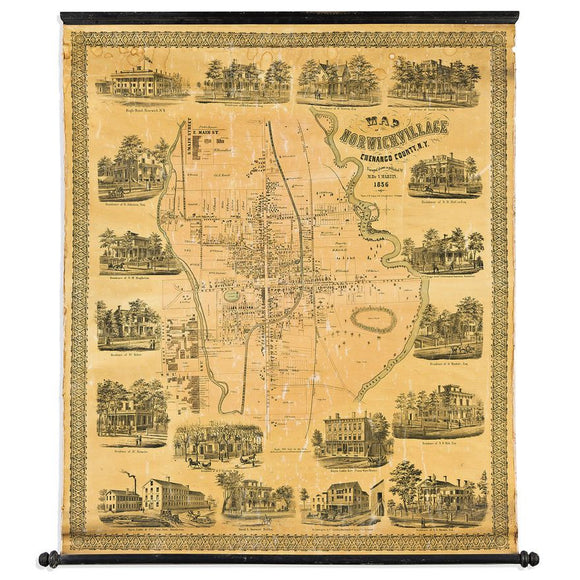
Martin's Map of Norwich Village Chenango County, N.Y
|
$ 900.00
|
Striking 1856 wall map of Norwich, New York, richly illustrated with vignettes of homes and businesses—an ornate visual record of a growing 19th-century village.
|
|
|
|
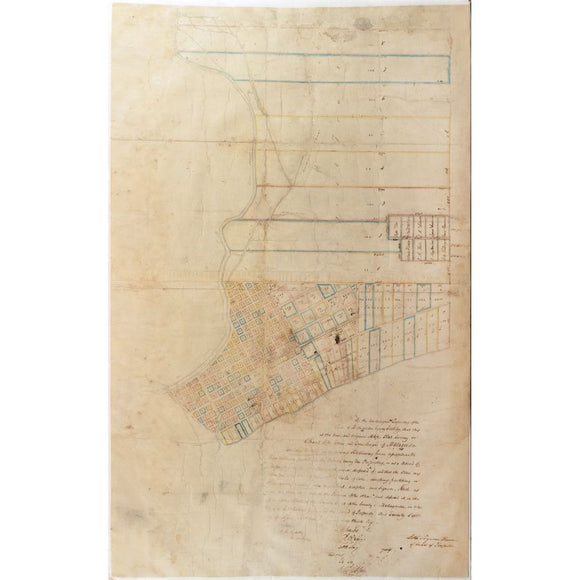
Manuscript Map Survey of the Town of Matagorda, Texas and Environs - Third oldest town in Texas
|
$ 24,000.00
|
Incredibly important for the urban history of Texas. Rare manuscript map from Texas’s Republic era, documenting early urban planning amid rising American settlement and independence.
|
|
|
|
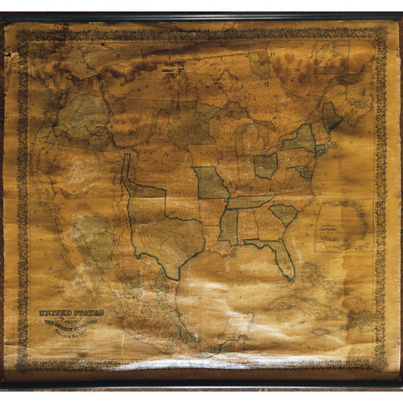
Joseph Colton's Map of the United States of America...1847
|
$ 1,800.00
|
Large 1847 wall map of the United States, showing Texas as an independent republic and California as New California—capturing U.S. expansion on the eve of war.
|
|
|
|
|


