from: June 2025 1
Isaak Tirion's Grondvlakte van Nieuw Orleans - One of the Earliest Obtainable Maps of Louisiana and the Lower Mississippi River
Isaak Tirion's Grondvlakte van Nieuw Orleans - One of the Earliest Obtainable Maps of Louisiana and the Lower Mississippi River
Regular price
$ 1,800.00 USD
Regular price
Sale price
$ 1,800.00 USD
Unit price
per
Couldn't load pickup availability
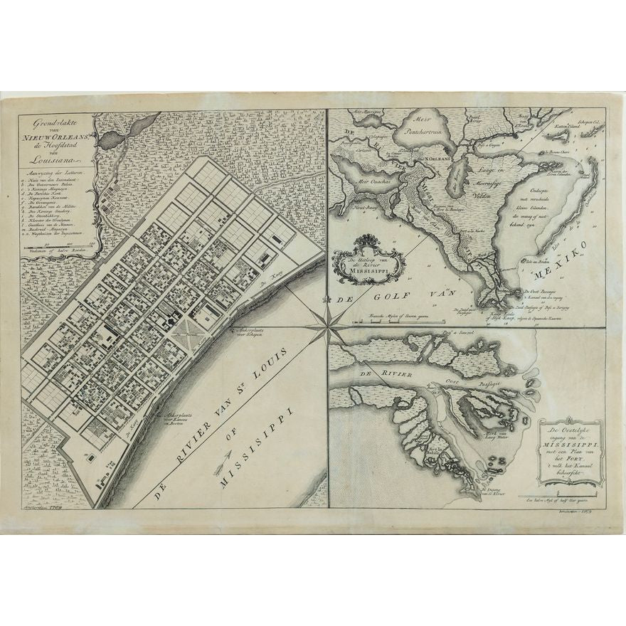
TIRION, Isaak (1705-1765).
Grondvlakte van Nieuw Orleans, de Hoofdstad van Louisiana [with] De Uitloop vande Rivier Missisippi [and] De Oostelyke ingang van de Missisippi met cen Plan van het Fort...
Engraved map.
Amsterdam, c. 1769.
14 3/8" x 18 5/8" sheet.
One of the Earliest Obtainable Maps of Louisiana and the Lower Mississippi River. The map identifies by letter the most important buildings in New Orleans, including government buildings, military facilities, and churches, along with the smith, brick kiln, and other details. Ft. Balise is shown on the River plan. One of the few obtainable plans of New Orleans from the 18th century.