-
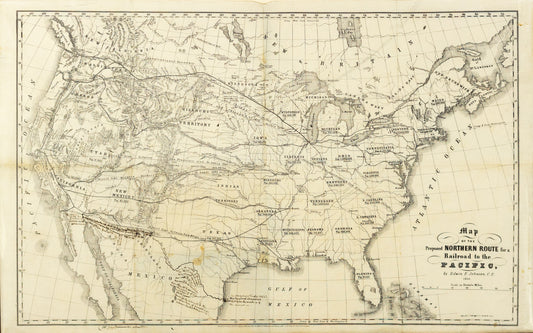
Johnson, Edwin F. Map of the Proposed Northern Route for a Railroad to the Pacific. Hartford, CT, 1853.
Regular price $ 700.00 USDRegular priceUnit price per -
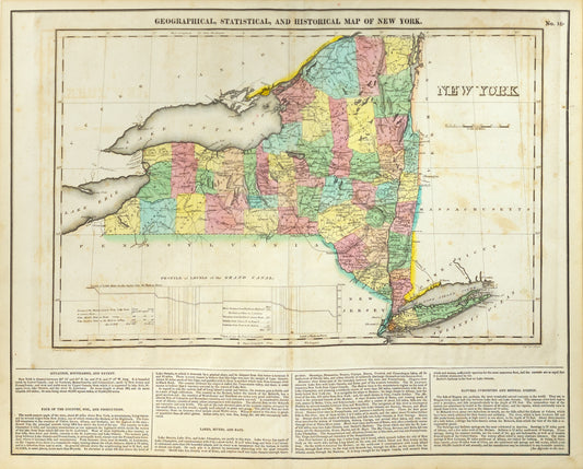
Carey, Henry Charles & Lea, Isaac. Geographical, Statistical, and Historical Map of New York. Philadelphia, 1822.
Regular price $ 220.00 USDRegular priceUnit price per -
J. W. C. Williams (1811-1893). New-York and Its Environs. (Paris & New York: L. Turgis, c. 1855)
Regular price $ 2,800.00 USDRegular priceUnit price per -
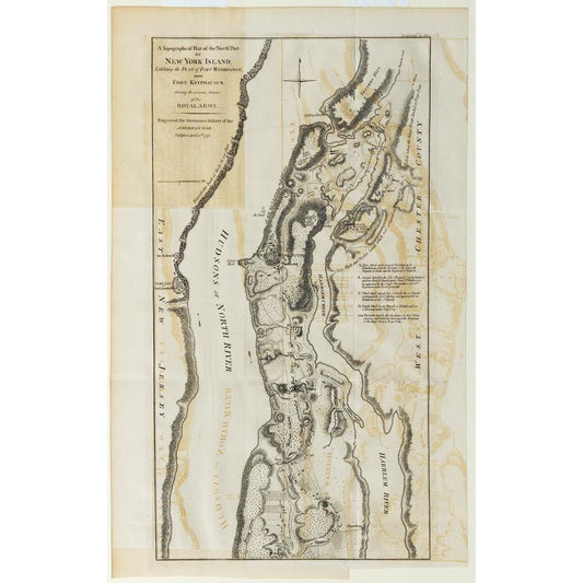
Faden, William (1749-1836). A Topographical Map of the North Part of New York Island. London, 1793.
Regular price $ 1,200.00 USDRegular priceUnit price per -
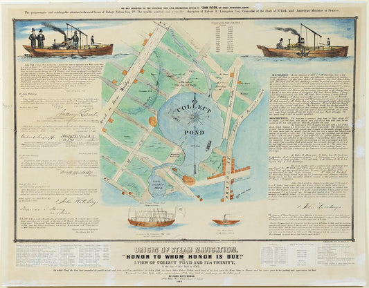
Hutchings, John. The Origins of Steam Navigation. 1846
Regular price $ 400.00 USDRegular priceUnit price per -
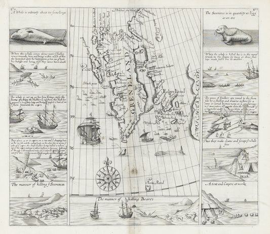
Purchas, Samuel. Greenland & Edges Island. London, 1625.
Regular price $ 2,800.00 USDRegular priceUnit price per -
Disturnell, John. Traveller’s Map of the Middle, Northern, Eastern States and Canada. New York, 1850.
Regular price $ 350.00 USDRegular priceUnit price per -
US Department of the Interior. Map Showing Progress of Allotment in the Creek Nation. 1899.
Regular price $ 900.00 USDRegular priceUnit price per -
US Department of the Interior. Map of Choctaw Nation Indian Territory. 1900.
Regular price $ 900.00 USDRegular priceUnit price per -
Mitchell, S. Augustus. Map of Massachusetts Connecticut and Rhode Island... Philadelphia, c. 1840
Regular price $ 2,100.00 USDRegular priceUnit price per -
Wells, John. G. Dinsmore's Complete Map of the Railroads and Canals in the United States of America & Canada. New York, 1856.
Regular price $ 1,200.00 USDRegular priceUnit price per -
Rowe, WM. H. Map Showing the Locations of the Indian Reservations within the Limits of the United States and Territories. Washington D.C. 1888
Regular price $ 900.00 USDRegular priceUnit price per -
Zatta, Antonio. Il Canada, Le Colonie Inglesi con La Luigiana, E Florida. Venice, 1778
Regular price $ 700.00 USDRegular priceUnit price per -
De l'Isle, Guillaume. L'Amerique Septentrionale. Amsterdam, 1700
Regular price $ 1,800.00 USDRegular priceUnit price per -
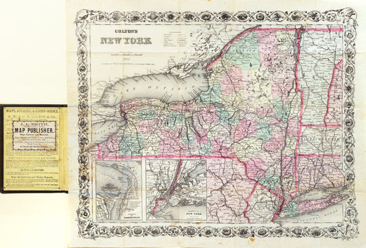
Colton, J.H. Colton's New York. 1874.
Regular price $ 400.00 USDRegular priceUnit price per -
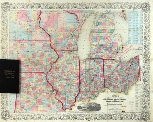
Smith, J. Calvin. Guide Through Ohio, Michigan, Indiana, Illinois, Missouri, Wisconsin & Iowa. New York, 1854.
Regular price $ 700.00 USDRegular priceUnit price per -
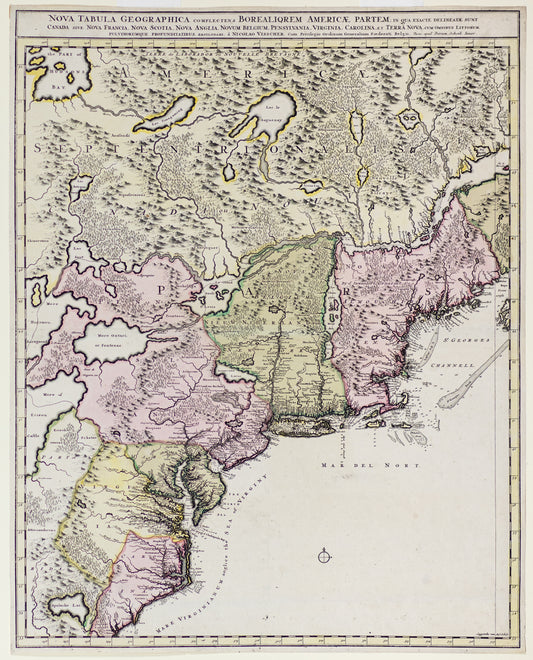
Visscher & Schenk Jr. Nova Tabula Geographica Complectens Borealigrem Americae Partem: Canada, Nova Francia... 1710.
Regular price $ 2,500.00 USDRegular priceUnit price per -
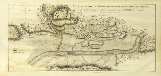
Stedman, Charles. after Faden, William. Plan of the Position which the Army Under Lt. Genl. Burgoine Took at Saratoga on the 10th September 1777. London, 1793
Regular price $ 1,400.00 USDRegular priceUnit price per -
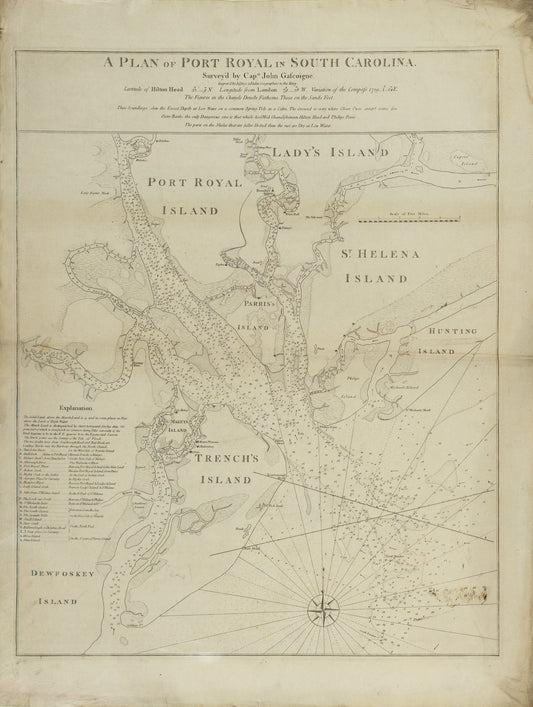
Jeffreys & Faden. A Plan of Port Royal in South Carolina. London, 1776.
Regular price $ 8,500.00 USDRegular priceUnit price per -
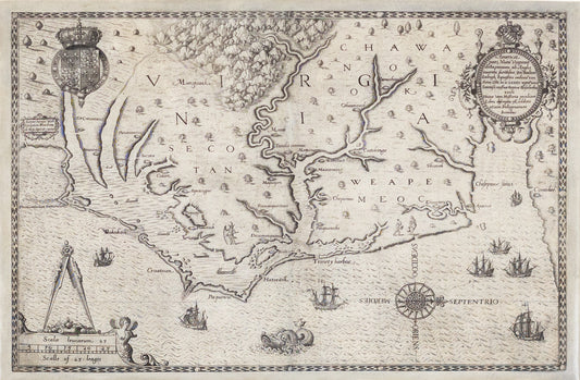
White, John. Americae pars, Nunc Virginia dicta, primum ab Anglis inuenta Dn Walten Raleigh... Frankfurt,1585
Regular price $ 14,000.00 USDRegular priceUnit price per