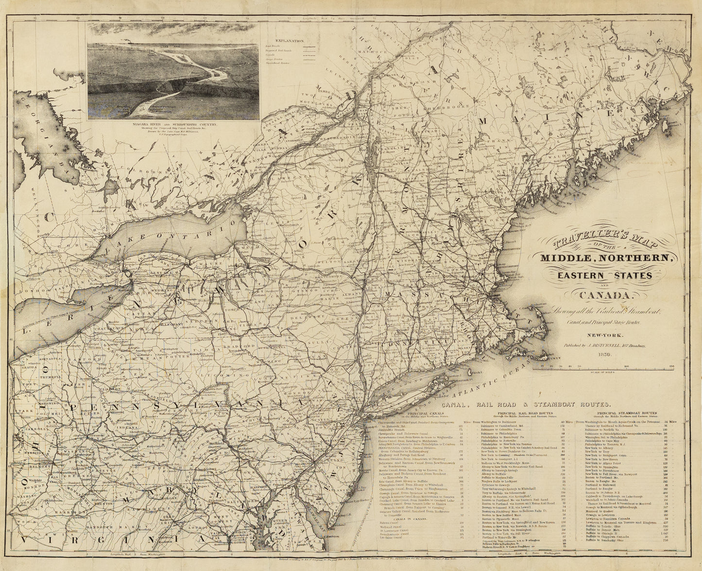
Disturnell, John. Traveller’s Map of the Middle, Northern, Eastern States and Canada. New York, 1850.
Disturnell, John. Traveller’s Map of the Middle, Northern, Eastern States and Canada. New York, 1850.
Couldn't load pickup availability
The "John Disturnell Traveller’s Map of the Middle, Northern, Eastern States and Canada," published in New York in 1850, is a detailed and expansive map measuring approximately 19 ½ by 23 ¾ inches. This map showcases the northeastern region of the United States and parts of Canada during a period of significant growth and expansion. The map is intricately detailed, highlighting major cities, towns, transportation routes such as railways and canals, and geographical features like rivers and mountains.
Historical Importance:
-
Manifest Destiny and Expansion: Created during a period of westward expansion and industrial growth in the United States, the map reflects the nation's drive toward Manifest Destiny. It illustrates the development of infrastructure, such as railroads and canals, that facilitated this expansion and the economic boom of the mid-19th century.
-
Transportation and Commerce: The map is an important artifact for understanding the transportation networks of the time. It provides insights into the early development of the American transportation system, crucial for the movement of people and goods across the growing nation.
-
Canadian-American Relations: The inclusion of Canada on the map is significant, highlighting the interconnectedness of the two regions in terms of trade and migration. This was a period when borders were more fluid, and the map reflects the economic and social ties between the United States and Canada.
-
Tourism and Travel: As a traveller's map, it catered to the increasing number of people traveling for leisure or business, marking it as a tool for tourism and exploration during a time when travel was becoming more accessible to the general public.
-
Historical Documentation: The map serves as a historical document that offers a snapshot of the geopolitical landscape of the time. It can be used to study changes in the landscape, city growth, and the development of transportation networks that shaped the modern-day United States and Canada.
Overall, John Disturnell's map is a valuable historical artifact that provides insight into the social, economic, and political dynamics of North America in the mid-19th century
John Disturnell (1801–1877) was a prominent American mapmaker, publisher, and bookseller in the 19th century. Born in the early years of the new republic, Disturnell became well-known for his detailed maps and travel guides that catered to the needs of a rapidly expanding United States. His work was particularly influential during the mid-19th century, a period marked by westward expansion and significant developments in transportation.
Disturnell's most notable contribution was his 1847 map of Mexico, which played a pivotal role in the negotiations of the Treaty of Guadalupe Hidalgo, ending the Mexican-American War. The map was used as a reference for drawing the new boundary lines between the United States and Mexico, underscoring its historical importance.
In addition to maps, Disturnell published a wide range of guidebooks and directories, including "The New York State Register" and "The Traveler's Guide to the Hudson River." These publications provided invaluable information for travelers and were highly regarded for their accuracy and comprehensiveness.
Throughout his career, Disturnell's work reflected the dynamic changes in the United States, from the growth of railroads to the expansion into new territories. His maps and guides not only helped people navigate the physical landscape but also offered insights into the economic and social developments of the time.
John Disturnell's legacy as a mapmaker is marked by his meticulous attention to detail and his contributions to American cartography during a transformative period in the nation's history. His work remains a valuable resource for historians and collectors alike, offering a window into the 19th-century American experience.

-
Example product title
Regular price $ 350.00 USDRegular priceUnit price per -
Example product title
Regular price $ 350.00 USDRegular priceUnit price per -
Example product title
Regular price $ 350.00 USDRegular priceUnit price per -
Example product title
Regular price $ 350.00 USDRegular priceUnit price per

