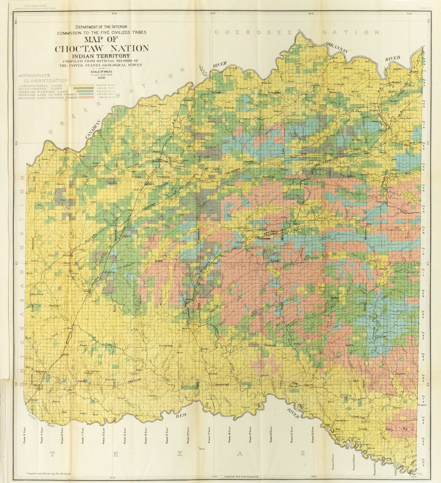
US Department of the Interior. Map of Choctaw Nation Indian Territory. 1900.
US Department of the Interior. Map of Choctaw Nation Indian Territory. 1900.
Couldn't load pickup availability
The **Map of Choctaw Nation Indian Territory**, compiled by the US Department of the Interior and the United States Geological Survey in 1900, serves as a crucial historical document that reflects the complex relationship between Indigenous nations and the United States government. This map not only delineates the geographic boundaries of the Choctaw Nation but also captures the socio-political landscape of the time, illustrating how Indigenous territories were impacted by policies of displacement and assimilation.
#### Historical Context
In the late 19th and early 20th centuries, the Choctaw Nation was navigating the aftermath of the Indian Removal Act and subsequent treaties that reshaped their lands. The 1900 map is a testament to this tumultuous history, representing both the resilience of the Choctaw people and the ongoing struggle for sovereignty.
#### Significance of the Map
1. **Cultural Heritage**: The map is a vital resource for understanding the geographical and cultural identity of the Choctaw Nation, showcasing their ancestral lands and historical boundaries.
2. **Political Implications**: It provides insight into the administrative divisions and political landscape of the time, reflecting the governance structures within the Indian Territory and their interactions with federal authorities.
3. **Resource Management**: Compiled from official records, the map highlights natural resources and land use, which are critical for studying the economic foundations of the Choctaw Nation.
4. **Legacy and Education**: Today, this map is an invaluable educational tool for scholars, students, and community members, fostering awareness of Indigenous history and contemporary issues related to land rights and sovereignty.
#### Conclusion
The 1900 Map of Choctaw Nation Indian Territory stands as a powerful symbol of Indigenous identity and resilience. It serves as a vital record of a community's history, illustrating the ongoing importance of land and heritage in the pursuit of justice and recognition for Indigenous peoples in the United States.

-
Example product title
Regular price $ 900.00 USDRegular priceUnit price per -
Example product title
Regular price $ 900.00 USDRegular priceUnit price per -
Example product title
Regular price $ 900.00 USDRegular priceUnit price per -
Example product title
Regular price $ 900.00 USDRegular priceUnit price per

