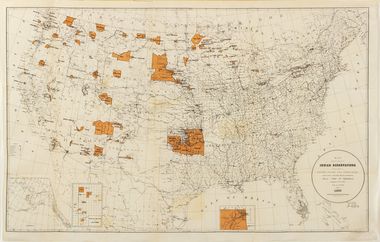
Rowe, WM. H. Map Showing the Locations of the Indian Reservations within the Limits of the United States and Territories. Washington D.C. 1888
Rowe, WM. H. Map Showing the Locations of the Indian Reservations within the Limits of the United States and Territories. Washington D.C. 1888
Couldn't load pickup availability
WM.H. Rowe's map, "Map Showing the Locations of the Indian Reservations within the Limits of the United States and Territories," created in 1888, serves as a vital historical document that illuminates the complex relationship between the U.S. government and Native American tribes during a pivotal era in American history.
### Historical Context
The late 19th century was marked by significant changes for Indigenous peoples, as the U.S. government increasingly sought to manage and control Native lands through policies that often marginalized tribes. This map emerged during a time when many reservations were being established and altered due to westward expansion and federal policies aimed at assimilation.
### Significance of the Map
1. **Geographical Insight**: Rowe’s map provides a comprehensive overview of the locations of various Indian reservations across the United States and its territories. This geographical representation is crucial for understanding the spatial dynamics of Native American life and the effects of colonization.
2. **Policy Reflection**: The map reflects the prevailing policies of the time, highlighting how the U.S. government delineated Indigenous territories in a way that often disregarded traditional tribal boundaries. It serves as a visual representation of the government's attempts to regulate and confine Native populations.
3. **Resource for Research**: For historians, anthropologists, and researchers, Rowe's map is an essential resource for studying the historical and cultural landscapes of Native American tribes. It provides a foundational understanding for examining treaties, conflicts, and the socio-political environment of the era.
4. **Cultural Legacy**: By mapping these reservations, Rowe’s work contributes to a broader understanding of Indigenous history and the ongoing impact of reservation systems on contemporary Native communities. It invites discussions about sovereignty, identity, and the enduring effects of displacement.
### Conclusion
WM.H. Rowe's 1888 map stands as a crucial artifact that encapsulates a significant moment in U.S. history, highlighting the complexities of Native American relations with the federal government. Its value extends beyond mere cartography, serving as a powerful reminder of the historical challenges faced by Indigenous peoples and the need for continued dialogue about land, rights, and recognition.

-
Example product title
Regular price $ 900.00 USDRegular priceUnit price per -
Example product title
Regular price $ 900.00 USDRegular priceUnit price per -
Example product title
Regular price $ 900.00 USDRegular priceUnit price per -
Example product title
Regular price $ 900.00 USDRegular priceUnit price per

