from: June 2025 1
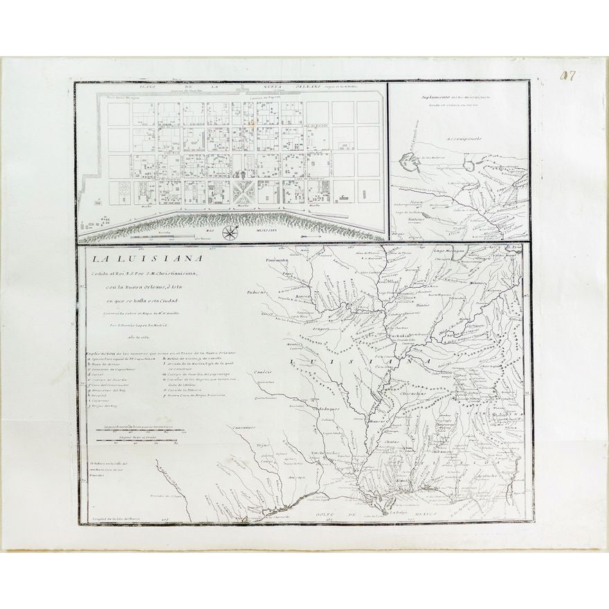
Lopez de Vargas Map of Louisiana showing New Orleans
Lopez de Vargas Map of Louisiana showing New Orleans
Couldn't load pickup availability
LOPEZ DE VARGAS MACHUCA, Tomas (1730-1802).
La Luisiana cedida al Rei N. S. por S. M.. Christianisima, con la Nueva Orleans, e isla en que se halla esta ciudad.
Engraved map.
Madrid, 1762.
17 1/4" x 20 5/8" sheet, 29" x 32" framed.
A Spanish Imprint of the Mississippi Valley. A scarce and significant Spanish map of Louisiana, probably produced to commemorate the secret cession of the area from France to Spain in the Treaty of Fontainebleau at the end of the Seven Years' War. Lopez credits the work of Jean Baptiste Bourguignon d'Anville as the basis of his map. Inset maps of "Plano de la Nuevo Orleans" after Bellin and "Suplemento del Rio Misissipi" after Delisle.
Condition: Some staining and repair at lower right margin, a few other small stains and closed marginal tears. Handsomely framed with UVIII Plexiglass.
REFERENCES: Charting Louisiana 34; Lowery 467; Streeter sale, 6:3913.
