from: June 2025 1
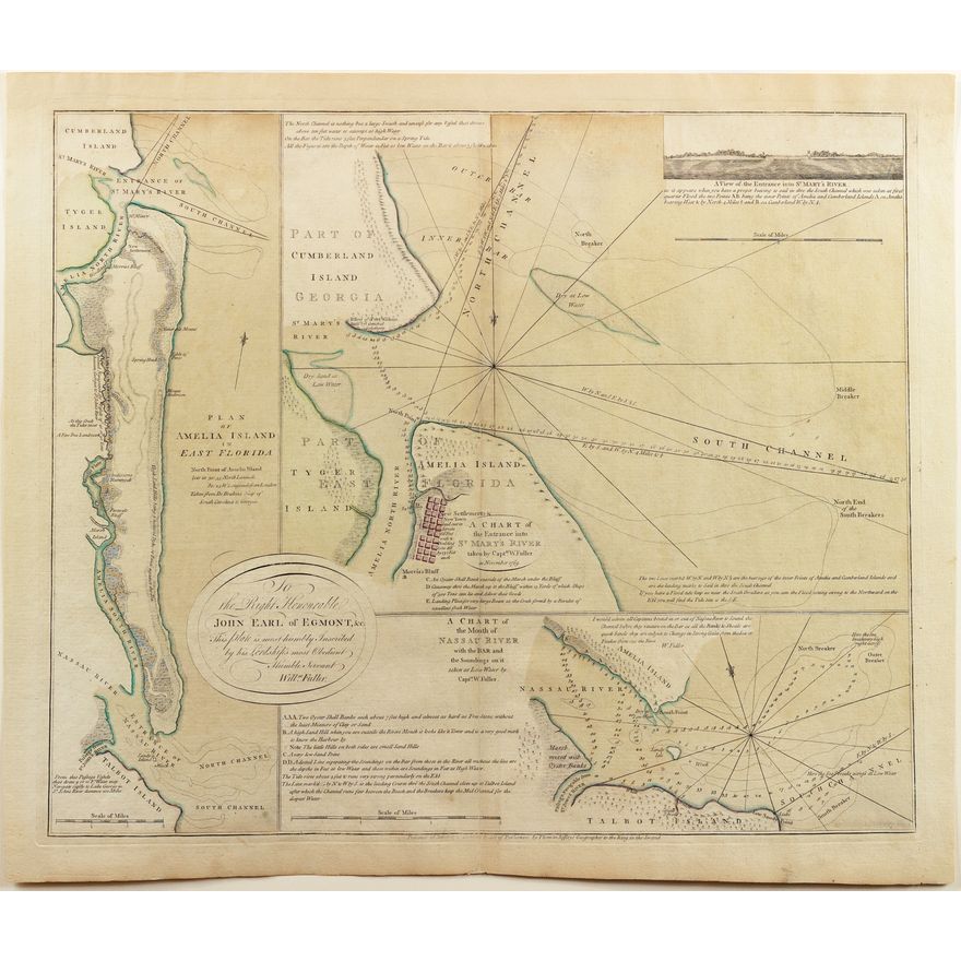
De Brahm's Plan of Amelia Island Florida
De Brahm's Plan of Amelia Island Florida
Couldn't load pickup availability
JEFFERYS, Thomas (1719-1771) & FULLER, William, and William Gerard DE BRAHM (1717-1799).
A Plan of Amelia island in East Florida [and] A chart of the Entrance into St. Mary's River taken by Capt. W. fuller in November 1769 [and] A Chart of the Mouth of Nassau River and the Soundings on it taken at Low Water by Captn. W. Fuller.
Engraved map with original hand color.
London: Jefferys, March 26, 1770.
22" x 26 1/2" sheet.
A rare and extremely fine 18th-century set of sea charts of Amelia island, presented on one sheet, produced by the British royal cartographer. This superb map sheet contains three maps of Amelia Island, in northeastern Florida and vicinity, and was at the time the most accurate sea chart of the area ever produced.