from: 1016 Map Inventory
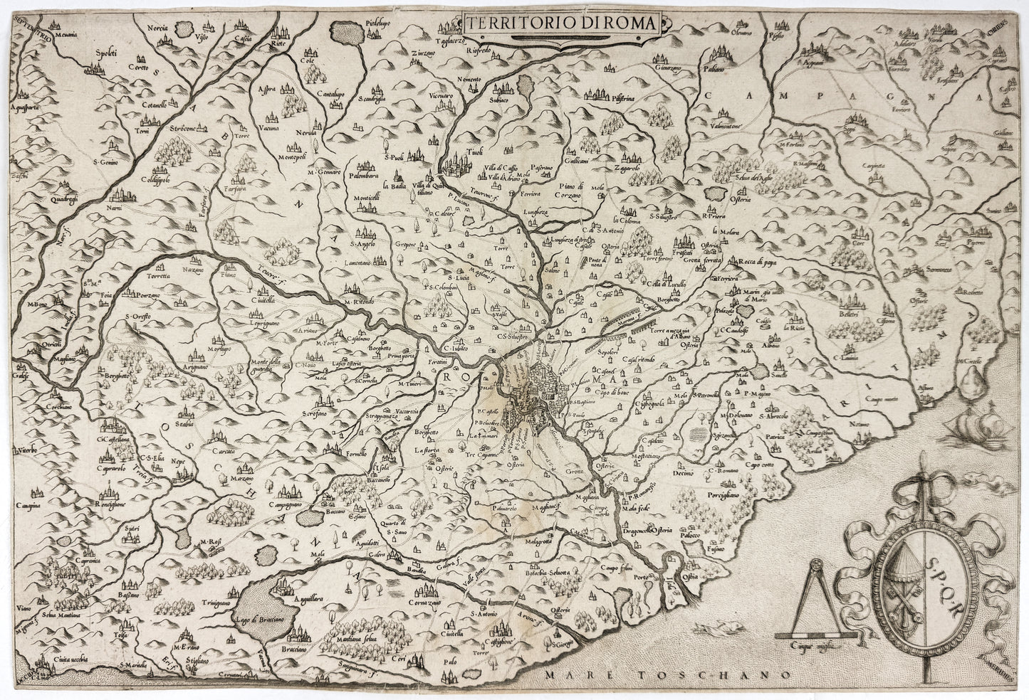
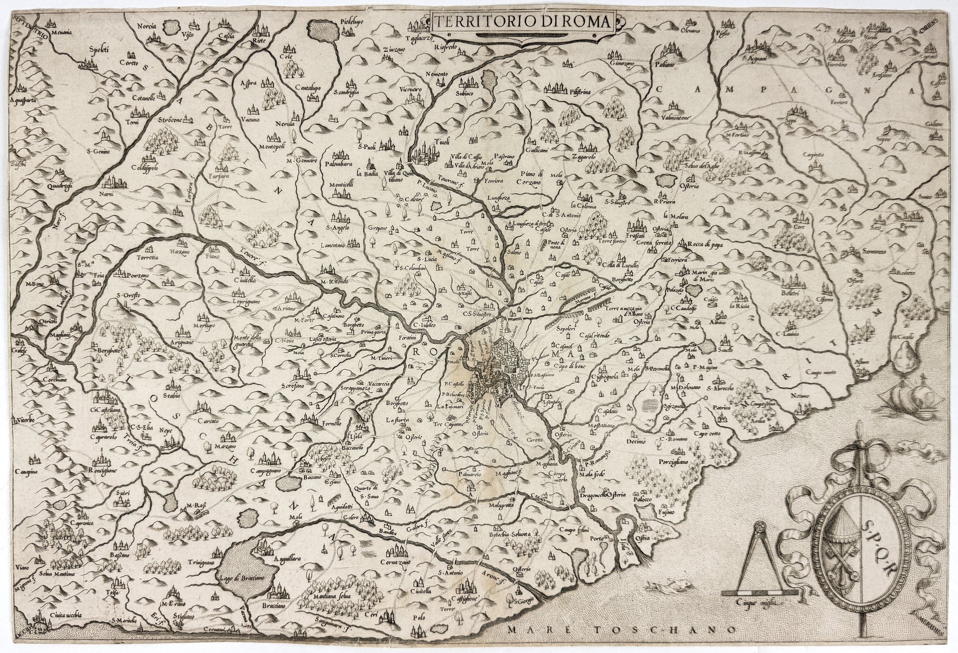
Camocio, Giovanni Francesco (1550-1575). Territoria di Roma. Venice, 1559
Camocio, Giovanni Francesco (1550-1575). Territoria di Roma. Venice, 1559
Couldn't load pickup availability
Giovanni Francesco Camocio (1550-1575)
Territorio di Roma
Engraved map
Venice: 1559
18 15/16" x 12 13/16" sheet
Giovanni Francesco Camocio (active from the 1550's through the 1570's) was one of a group of Italian cartographer-booksellers known, a little artificially, as the "Lafreri school." His name has come to be associated with the present map because it was added in later states, this being the first of Bifolco-Ronca's four; the point is the absence of an address below the scale. Camocio appears to have cut a near-replica of an anonymous map dated 1557, which is itself based upon a 1556 map attributed to Vincenzo Luchini, all deriving ultimately from a 1547 map of Eufrosino della Volpaia. These maps all depict Lazio (the territory immediately surrounding Rome) with North at the upper-left corner (i.e., NE at the top). Visible within the city of Rome are the Castel Sant'Angelo, Pantheon and Colosseum.
In the cartouche at bottom left are the impaled arms of the Camera Apostolica (the papal treasury; the crossed keys below the umbraculum in lieu of the papal tiara) and those of the city of Rome (S.P.Q.R., Senatus Populusque Romanus, "Roman Senate and People"). When the Catholic church is sede vacante -- between the death of a pope and the election of his successor -- the Chamberlain as president of the Camera Apostolica is its temporal leader. Bifolco-Ronca locate this period sede vacante as that between the death of Paul IV 18 August 1559 and the election of Pius IV on Christmas day that year, the longest such period of the XVIc.