-
van Wytfliet, Cornelis. Hispania Nova. Louvain, 1597. [Mexico]
Regular price $ 1,200.00 USDRegular priceUnit price per -
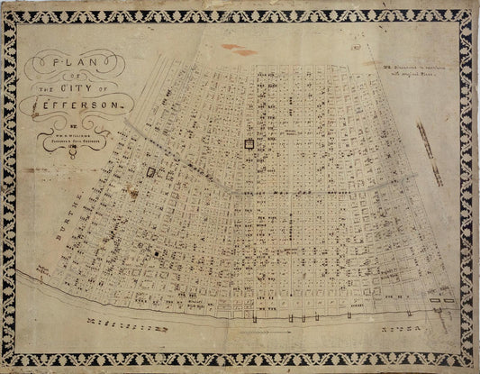
Williams, Wm. H. Plan of the City of Jefferson, LA. c. 1860
Regular price $ 18,000.00 USDRegular priceUnit price per -
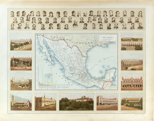
Garcia Cubas, Antonio. Carta Politica. Mexico, 1885.
Regular price $ 700.00 USDRegular priceUnit price per -
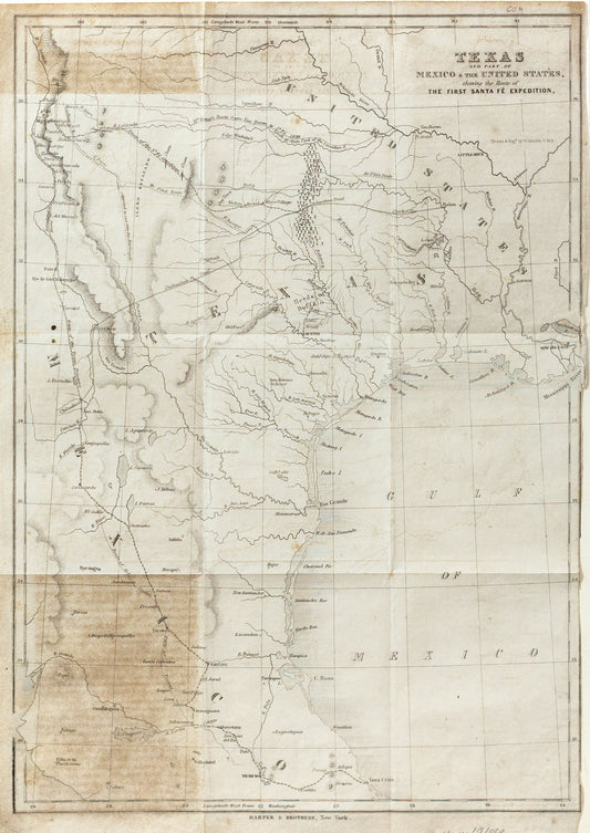
Kemble, W. Texas and part of Mexico & the United States, showing the route of the first Sante Fe expedition. New York, 1844.
Regular price $ 800.00 USDRegular priceUnit price per -
Ortelius, Abraham. The Gulf of Mexico from Florida to Texas to Tampico. Antwerp: 1592.
Regular price $ 3,500.00 USDRegular priceUnit price per -
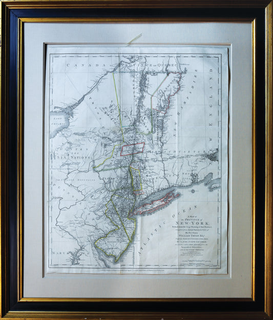
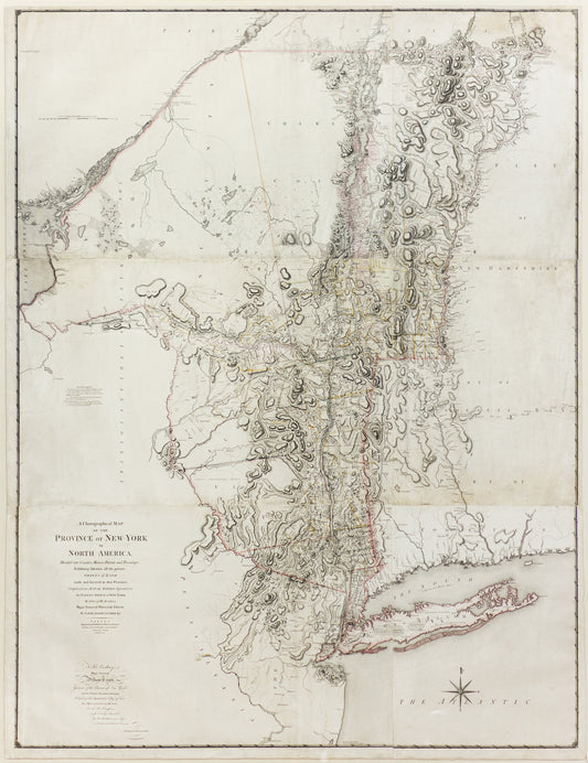
Claude Joseph Suathier. A Chorographical Map of the Province of New-York...1779.
Regular price $ 28,000.00 USDRegular priceUnit price per -
LA HARPE, Jean-Baptiste Benard de (1683-1775) Carte nouvelle de la partie de l'Ouest de la Louisanne faitte sur les observations, recherches, et decouvertes de ...1722
Regular price $ 1,200,000.00 USDRegular priceUnit price per -
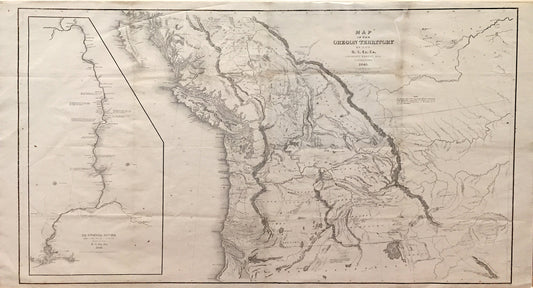
CHARLES WILKES, Map of the Oregon Territory, 1841.
Regular price $ 3,800.00 USDRegular priceUnit price per -
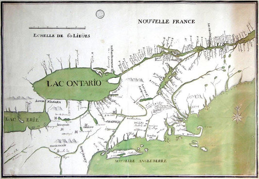
COUAGNE, Jean-Baptiste de (1687-1740). Nouvelle France. Canada: 1711.
Regular price $ 750,000.00 USDRegular priceUnit price per -
JOHNSTON, Thomas. Quebec, the Capital of New-France, a Bishoprick, and Seat of the Soverain Court. [Boston, 1759].
Regular price $ 80,000.00 USDRegular priceUnit price per -
C.J. Sauthier & B. Ratzer A Map of the Province of New-York, . . . London, 1776
Regular price $ 8,500.00 USDRegular priceUnit price per -
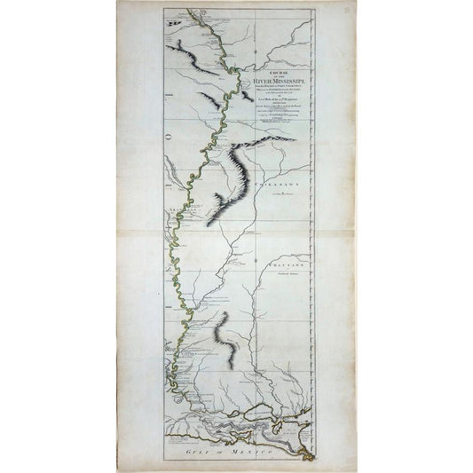
John Ross. Course of the River Mississippi. 1775.
Regular price $ 25,000.00 USDRegular priceUnit price per
![van Wytfliet, Cornelis. Hispania Nova. Louvain, 1597. [Mexico] - Arader Galleries](http://aradernyc.com/cdn/shop/files/MB0231.jpg?v=1723128787&width=533)

![JOHNSTON, Thomas. Quebec, the Capital of New-France, a Bishoprick, and Seat of the Soverain Court. [Boston, 1759]. - Arader Galleries](http://aradernyc.com/cdn/shop/products/JOHNSTON_20Thomas._20Quebec_20the_20Capital_20of_20New-France_20a_20Bishoprick_20and_20Seat_20of_2803d65a-a790-45dd-93d3-4fe352bf6c8c.jpg?v=1585166288&width=533)