from: 1016 Map Inventory
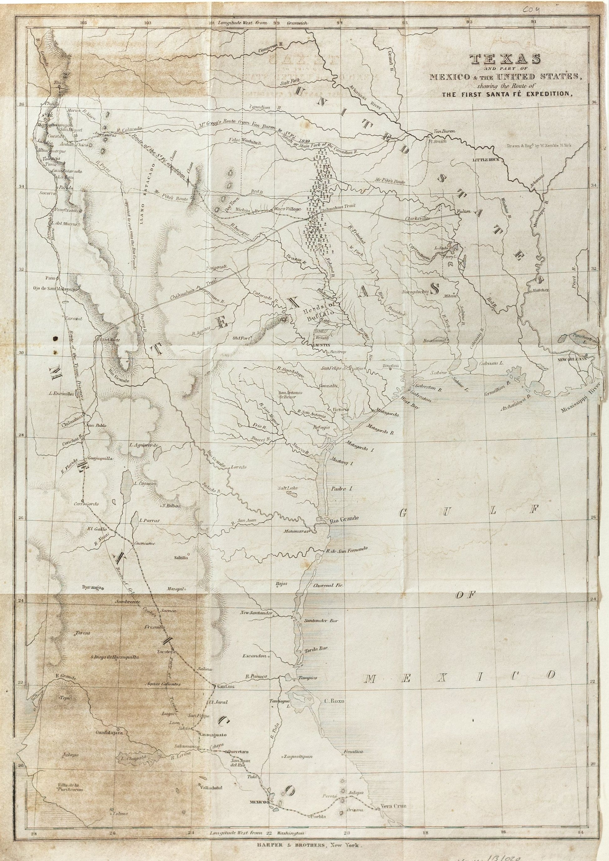
Kemble, W. Texas and part of Mexico & the United States, showing the route of the first Sante Fe expedition. New York, 1844.
Kemble, W. Texas and part of Mexico & the United States, showing the route of the first Sante Fe expedition. New York, 1844.
Couldn't load pickup availability
W. Kemble
Texas and part of Mexico & the United States, showing the route of the first Sante Fe expedition
New York, 1844
17 x 12 inches
Map of the Republic of Texas, which appeared in Kendall's Narrative Of The Texan Santa Fe Expedition ....
This map shows efforts of the Republic of Texas, under President Mirabeau Lamar, seeking to take control over Santa Fe and develop trade links between Texas and New Mexico.
The expedition was undertaken because the Texas leadership believed New Mexico would be interested in forging and alliance with the Republic. However, the expeditionary force was met in Santa Fe by 1,500 Mexican troops and forced to march the 2,000 mile route to Mexico City before diplomatic measures guaranteed their release a year later.
The map also locates Josiah Gregg’s route from Van Buren, Pike’s route from Ft. Smith, and the Chihuahua Trail. Published in George Kendall's Narrative of the Texan Santa Fe Expedition.
