


from: Americas
Henry Popple. Map of the British Empire in America. 1740.
Henry Popple. Map of the British Empire in America. 1740.
Couldn't load pickup availability
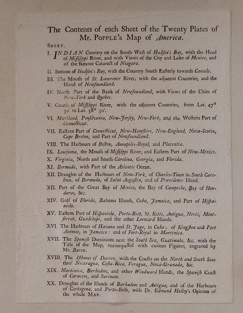
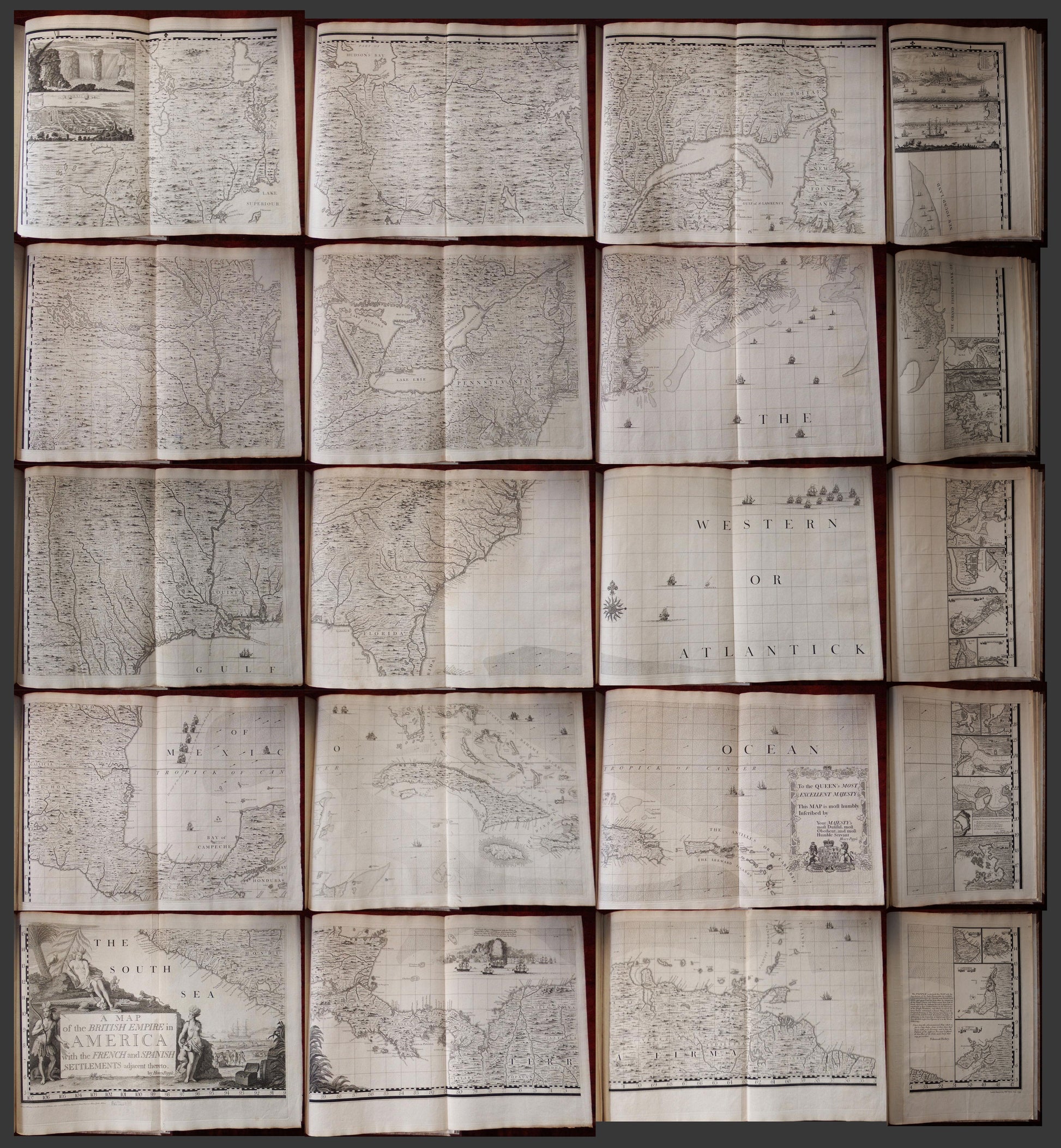
POPPLE, Henry (d. 1743). Map of the British Empire in America with the French and Spanish Settlements adjacent Thereto. London: sold by S. Harding and W.H. Toms, 1733 [but 1739-1740].
Folio (21 4/8 x 15 4/8 inches). Original RARE letterpress contents leaf (Brabinski State 1, with incorrect enumeration of sheet 13 as XII) laid-down on the front paste-down. Fine engraved folding "key" map with original hand-colour in full (to neat line: 19 6/8 x 19 1/8 inches; Brabinski State 3), 15 exceptionally fine engraved double page and 5 single page sheet maps by William Henry Toms. Expertly bound to style in 18th-century diced half Russia over contemporary marbled paper-covered boards, the spine in seven compartments with raised bands, red morocco lettering-piece in one; modern black morocco backed cloth clamshell box.
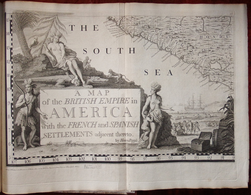
A FINE COPY OF THE FIRST LARGE-SCALE PRINTED MAP OF COLONIAL NORTH AMERICA, THE FIRST PRINTED MAP TO SHOW THE THIRTEEN COLONIES AND A MONUMENT OF NORTH AMERICAN CARTOGRAPHY.
Babinski's State 7, after August 1739, when Toms and Samuel Harding took over publishing the map from Popple. This is the first issue to be published by them, and differs only from the previous issue by the addition of their imprint on sheet 17, and the price: Popple had sold his issues at 4 Guineas (4 pounds, 4 shillings), Toms and Harding reduced it to a more affordable 1 pound, 16 shillings and 6 Pennies.
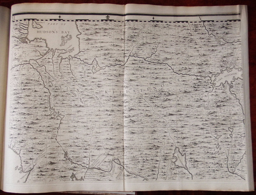
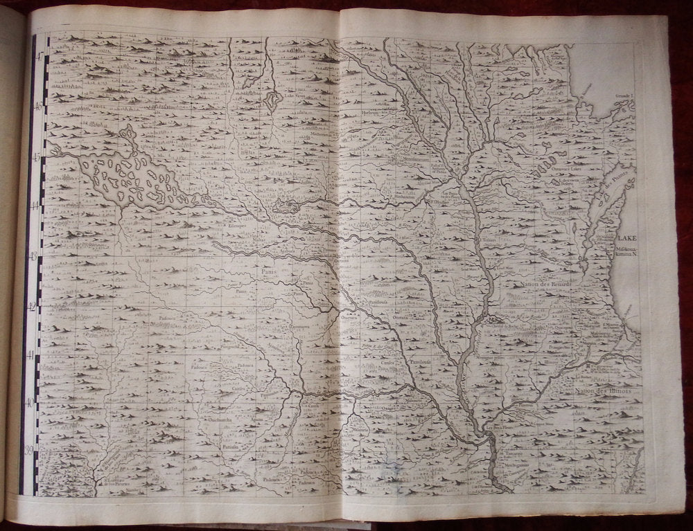
Henry Popple's Map of the British Empire in America marks the beginning of a new epoch in the mapping of America, and was the first in a series of maps published up to the 1760s that would catapult England to the forefront in the study of the geography of the continent.
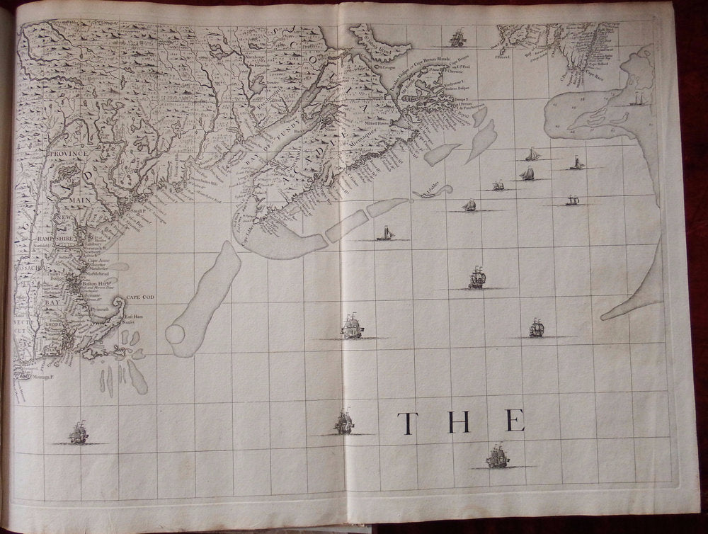
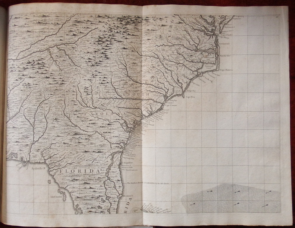
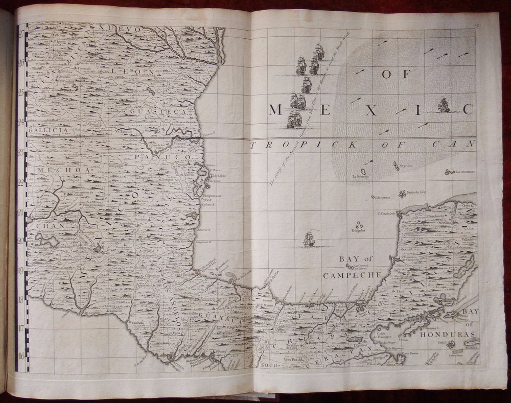
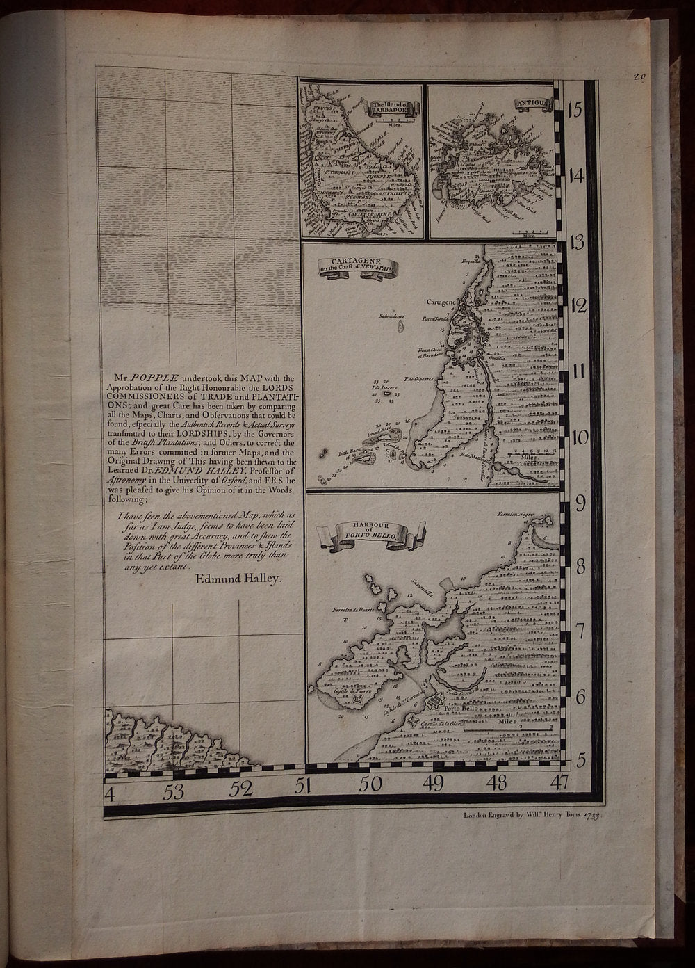
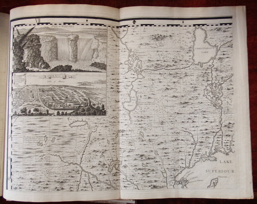
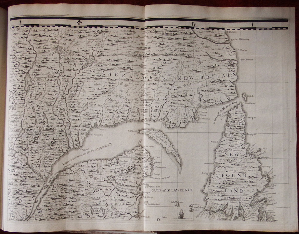
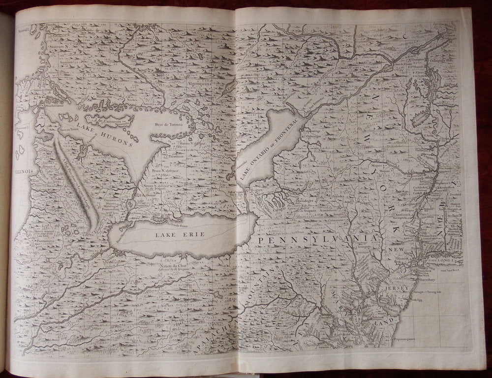
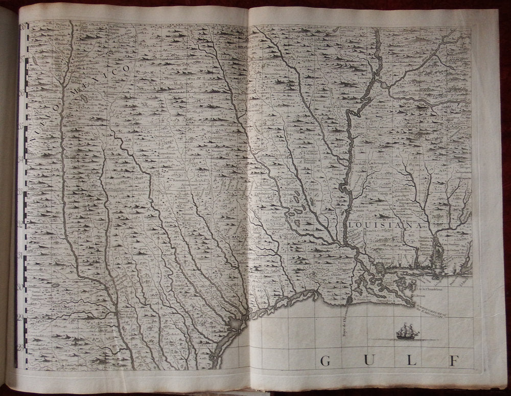
Commissioned by the Lord Commissioner of Trade and Plantation, it was intended as a tool for mediating disputes arising from the competing claims of English, French and Spanish colonists. In the years when this map was made, territorial disputes demanded current and precise geographical knowledge, and copies of Popple's map were sent to the governors of each English colony for official use. The map illustrates the growth of knowledge about the interior of the American Northeast, and there is much information regarding settlements and natives in the areas of the Great Lakes. Popple's map is a compilation of French and English sources, primarily Guillaume Delisle's "Carte du Canada" 1703 and "Carte de la Louisiana et Cours du Mississippi" 1718; , as well as the maps of Herman Moll. The most valuable contribution is in the area of the American Southeast, where the map incorporates information from the highly important survey by Colonel John Barnwell, circa 1722, which was the first detailed English map of the southern frontier. Information for the printed map was compiled at least as early as 1727, a date that appears on a signed manuscript draft by Popple now in the British Museum, although the actual draftsman of the final map was Clement Lempriere, an English military cartographer who worked in the Corps of Engineers.
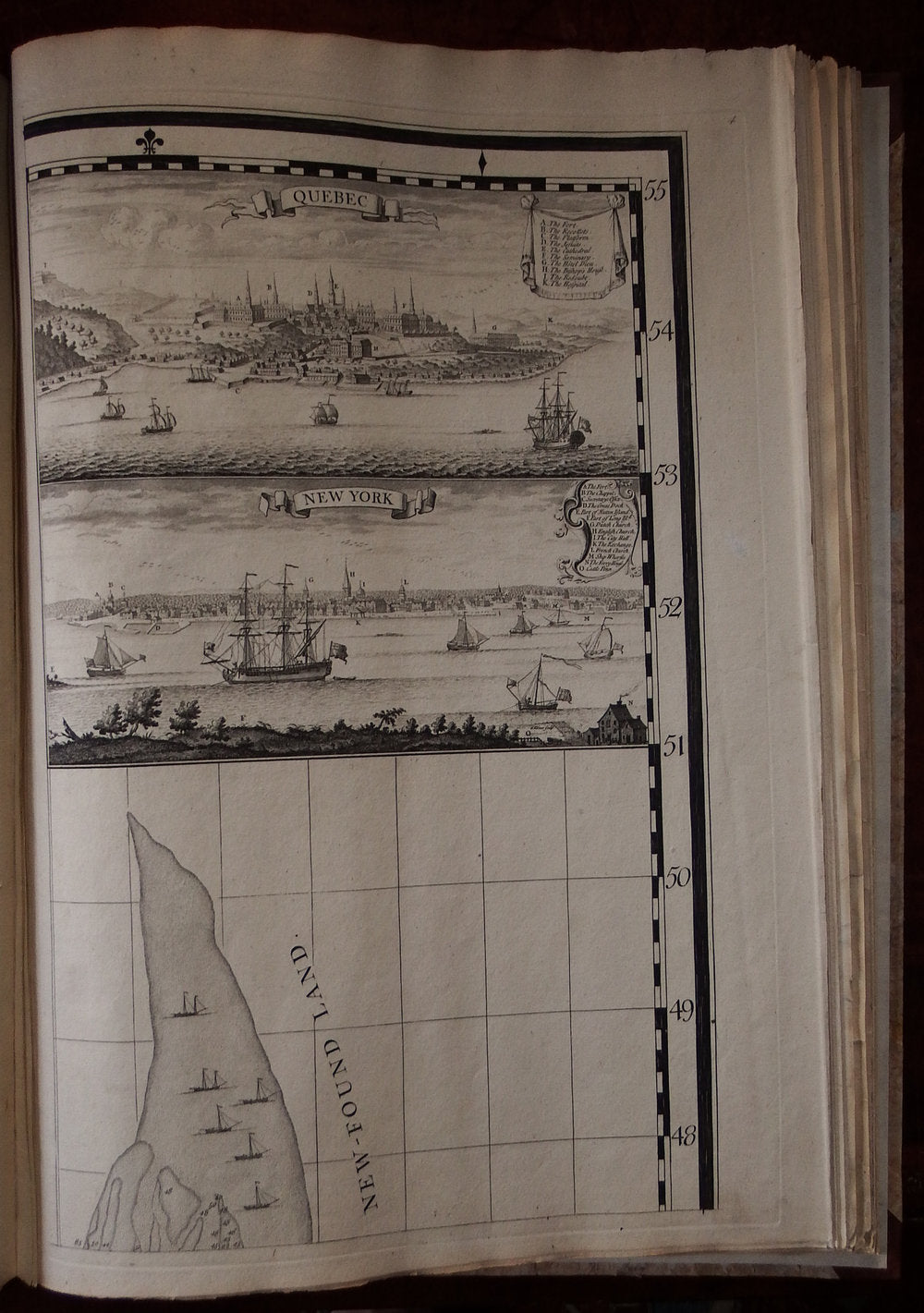
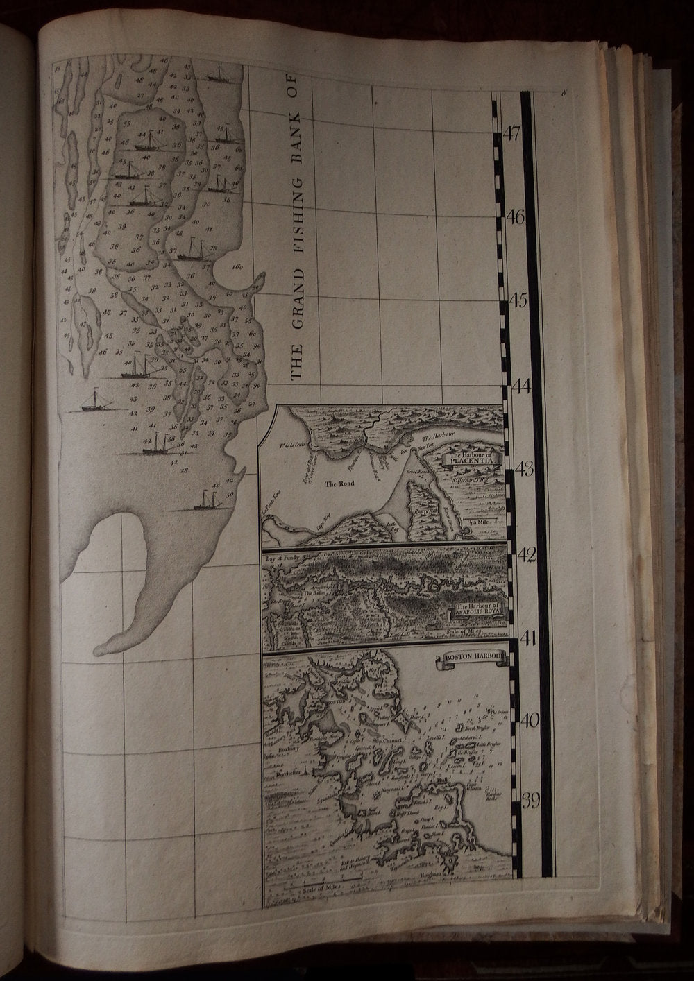
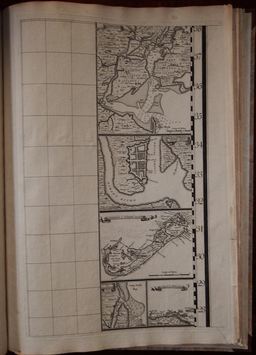
Of the four inset views, two are of special note. The first, of New York City, is an early copy of William Burgis's "South Prospect of the Flourishing City of New York," circa 1720. A second perspective view, of Quebec, is based on the manuscripts of Franquelin Joliet, which were previously published in French maps by De Fer and Châtelain.
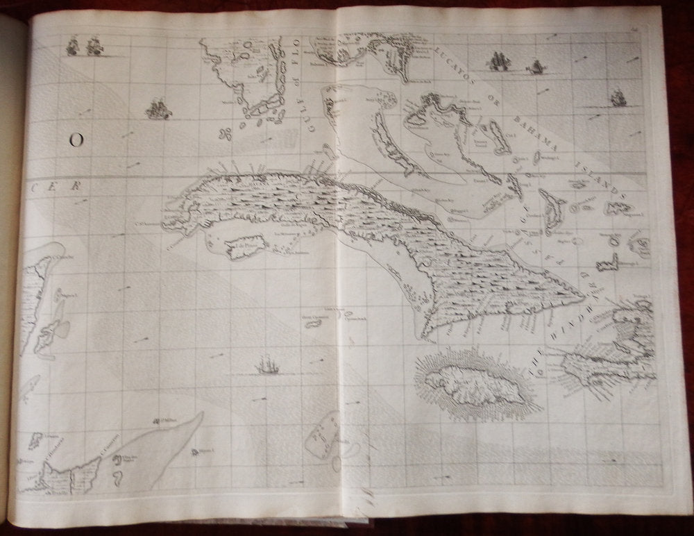
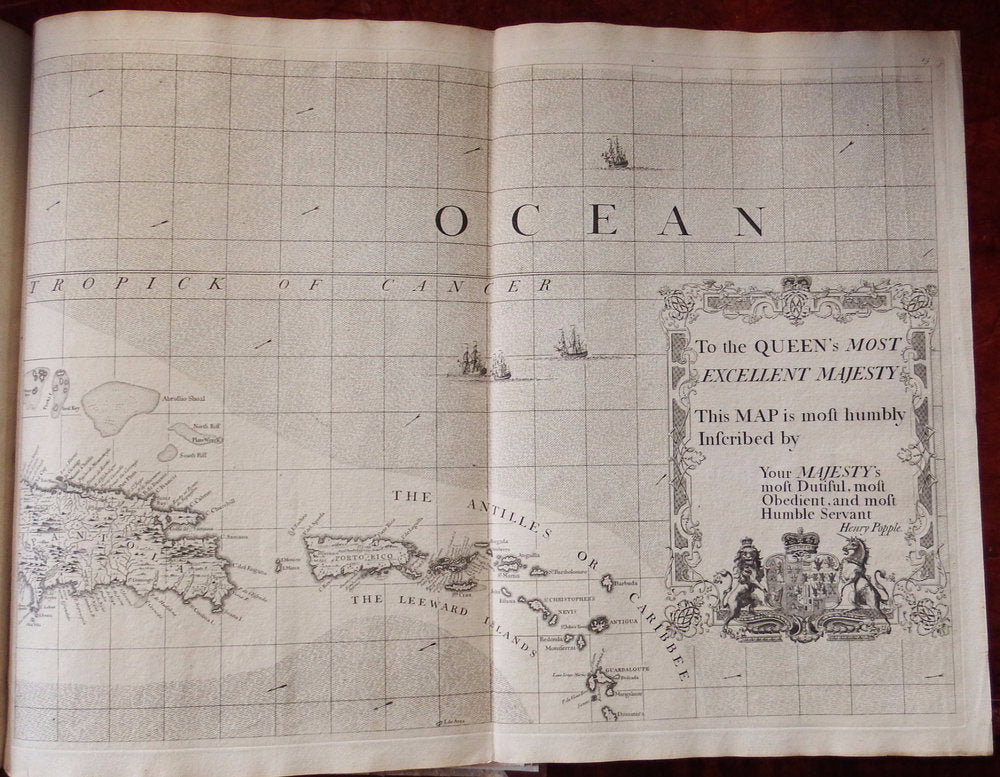
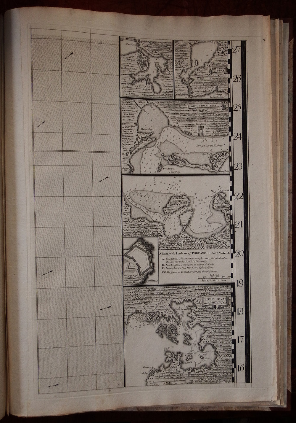
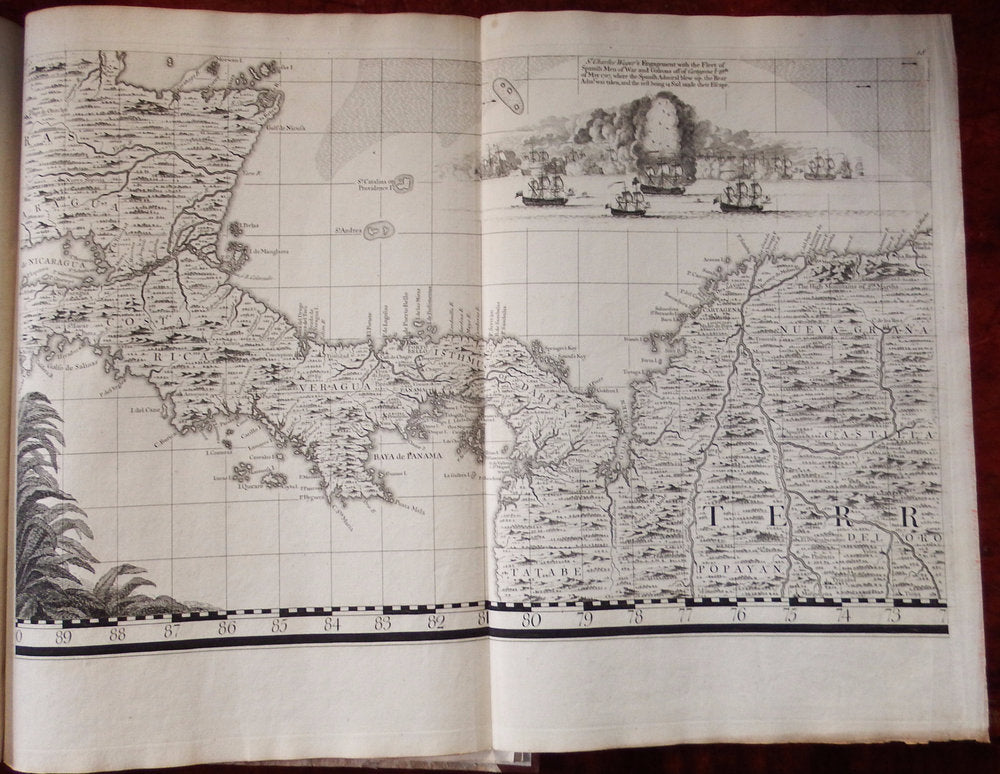
Seventeen detailed charts depict major islands and ports on the American coast and in the Caribbean. Boston, New York and Charleston are included, the latter based on the important inset to Edward Crisp's map of 1711. Numerous legends note historical and topographical features, including the route of Spanish fleet through the Bahama Channel and a vignette depicting the engagement of Sir Charles Wagner against the Spanish off Cartagena.
Brabinski's State 3 of the "key" map was published circa 1740 and probably printed for only a few months before being replaced by State 4 in which the track of Spanish Galleons has been added. It is the rarest of the Popple "key" maps with the exception of the ones published by Steel during the American Revolution (in which the dedication has been changed from Queen to King). This State 3 "key" map has an interesting history and was probably published as the result of and a response to sarcastic comments in London papers by George Foster, who published a competing "Seat of War in the West Indies" map in 1740. Foster compared his map with Brabinski's State 2 of what he called Popple's "Miniature Map" in an advertisments published in the February 22, 1740 issue of "The Daily Post" - disparaging the "key" map for not showing "Cumana, the Caraccas, Coro, Rio de la Hecha, Sancta Martha, Cartago, the Logwood Creeks," etc which appeared on Foster's smaller map. As a result Toms added a number of new place-names on this Branbinski's State 3 map. References: Seymour I. Schwartz & Ralph E. Ehrenberg, The Mapping of America (New York, 1980), 151-152; Mark Babinski, Henry Popple's 1733 Map of The British Empire in North America (Garwood, NJ, 1998); M.B. Pritchard and H.M. Taliaferro, Degrees of Latitude: Mapping Colonial America (Williamsburg, 2002), 134-41. Catalogued by Kate Hunter