from: Maps
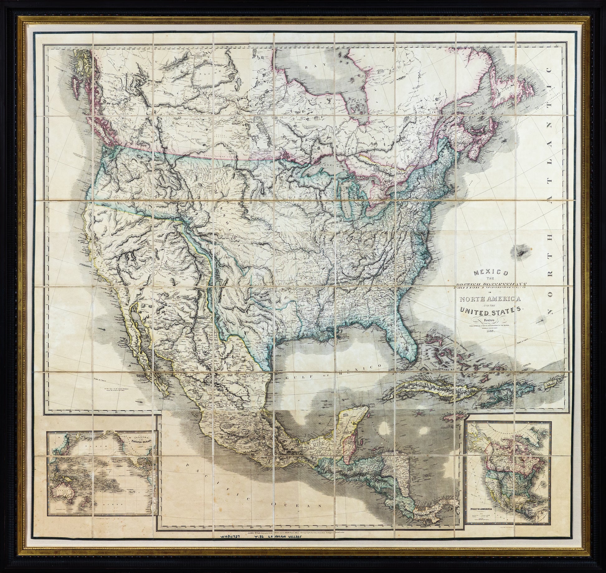
WYLD, James Sr. (1790-1836). Mexico the British Possessions in North America and the United States … 1846.
WYLD, James Sr. (1790-1836). Mexico the British Possessions in North America and the United States … 1846.
Couldn't load pickup availability
WYLD, James Sr. (1790-1836).
Mexico the British Possessions in North America and the United States … 1846.
Engraved case map; printed on two sheets, dissected into 36 sections and mounted on linen, edged in green silk, contemporary outline hand coloring.
London: 1846.
56 ⅞” x 53” sheet, 60” x 64” framed.
A superbly detailed large scale English map of North America at the onset of the Mexican American war. England’s position favored Mexico, in part because it was an ally but mostly because English mills needed Texan cotton to compete with American supplies.
View the roots of texas collection
Wyld's 1846 Map of the Mexico and the United States is one of the rarest and most fascinating maps of the region from the period.
Wyld's map of Mexico and the United States was specifically prepared for the London market at the outset of the Mexican-American War, capitalizing on British interests in the region, including Britain's own aspirations for possession of Texas and part of the disputed regions in Oregon Territory, which were resolved in this time period.
The map is a fascinating amalgam of information dating from Lewis & Clark to the early 1840s. The detail of the map is truly extraordinary, both in terms of content and as a snapshot of American history. The earliest information provided by the map includes a number of boundary lines and other details set in the years prior to Lewis & Clark. Lewis & Clarks' route to the Pacific and back is tracked, and the map includes several notes on the observations of the exploring party. An offshoot route from main route shows Colter's route in 1807.
John Wyld was one of the most prolific publishers of separately issued maps during the 19th Century. His 6 (and later 7) sheet map of North America is a testament to Wyld's publishing accumen. First published in 1823, the map was periodically updated to incorporate new discoveries. However, Wyld had the curious habit of frequently leaving older information on the map, making for a very curious mix of geographical details.
