from: Maps
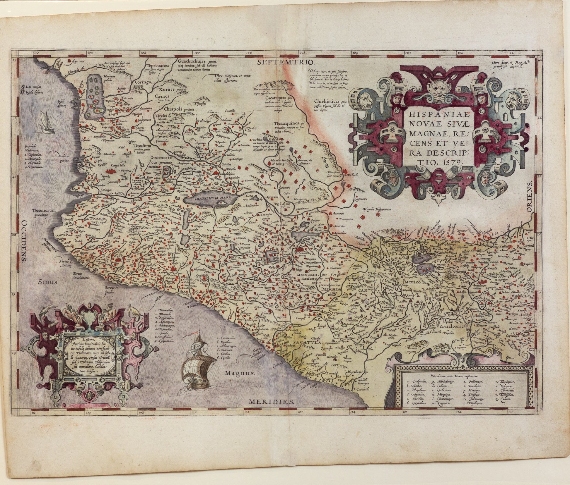
Ortelius, Abraham. Hispaniae Novae Sivae Magnae Recens Et Vera Descriptio. Antwerp, 1579
Ortelius, Abraham. Hispaniae Novae Sivae Magnae Recens Et Vera Descriptio. Antwerp, 1579
Couldn't load pickup availability
Abraham Ortelius
Hispaniae Novae Sivae Magnae Recens Et Vera Descriptio
Antwerp, 1579
Approx. 13 1/2 x 19 3/4 inches
Nice example of Ortelius' map of western New Spain, showing the recently-created Spanish settlements, many rivers, and large lakes, including Lake Chapala and a mythical sea with islands in the northwest. The map is heavily decorated, with a huge title cartouche dominating the upper right corner. The cartouche depicts interwoven pieces and is adorned with the fierce heads of creatures, somber faces, and a devil's leering visage in the top center. It surrounds the title, which translates to, "A recent and true representation of new or large Spain 1579." Another cartouche in the lower left corner translates to, "To the reader; the beginning of the longitude on this map we have not, in the Ptolemaic fashion taken from the Canary Islands towards the East, but from the Spanish meridian in Toledo towards the West." Ortelius' atlas, the first of its kind, was also part of a new cartography that deviated from the Ptolemaic system, or rather that had to augment the Ptolemaic grid that only contained Africa, Asia, and Europe.
The map is heavily decorated, with a huge title cartouche dominating the upper right corner. The cartouche depicts interwoven pieces and is adorned with the fierce heads of creatures, somber faces, and a devil's leering visage in the top center. It surrounds the title, which translates to, "A recent and true representation of new or large Spain 1579." Another cartouche in the lower left corner translates to, "To the reader; the beginning of the longitude on this map we have not, in the Ptolemaic fashion taken from the Canary Islands towards the East, but from the Spanish meridian in Toledo towards the West." Ortelius' atlas, the first of its kind, was also part of a new cartography that deviated from the Ptolemaic system, or rather that had to augment the Ptolemaic grid that only contained Africa, Asia, and Europe.
