from: June 2025 2
Jan Jansz Dou's Map of the Netherlands / Friesland
Jan Jansz Dou's Map of the Netherlands / Friesland
Regular price
$ 12,000.00 USD
Regular price
Sale price
$ 12,000.00 USD
Unit price
per
Couldn't load pickup availability
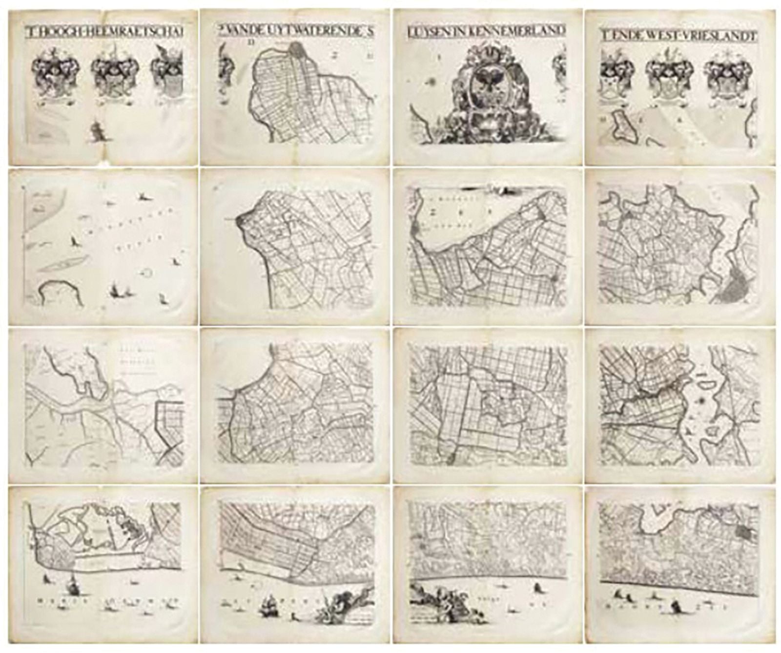
DOU, Jan Jansz (1615-1682).
[NETHERLANDS - FRIESLAND]. T Hoogh-Heemraetschap vande Uytwaterende Sluysen in Kennemerlandt ende West-Vrieslandt.
16 double-page engraved maps.
Amsterdam: Jan Karelsz, 1680.
22" x 26 1/2" sheet, each.
A magnificent large uncoloured map of north Holland by Coenraedt Decker (1651-1685) and Abraham Deur (died 1717) after Dou, the title within a broad ruled banner across the top of the map, with the large and elaborate allegorical arms of the waterboard top centre, with three smaller arms either side of the commissioners, the imprint within another elaborate cartouche lower centre, the sea decorated with ships and compass rose (each map sheet with old central vertical fold and one of two small marginal tears with loss).
First edition, re-issued many times over the next 50 years. The commissioners of the water corporation for this historical region of West Friesland, including the islands are shown as Aris vander Mieden (Chairman), Floris Wil, Gysbert Ramp, Gerrit Warmenhuysen, Gerard Fannus, and Johan Baert (also secretary). A decorative, detailed and proud map showing the islands, bays, hills, rivers, canals and towns and hamlets of West Friesland. The Dutch Water Boards are amongst the earliest forms of local government in the Netherlands, some of them dating back to the 13th-century when Friesland was divided as the dunes north of the Zuiderzee succumbed to the sea, and management of the fragile relationship between land and sea became increasingly important for the safety and livelihood of the Dutch people. These individual water corporations in turn influenced the development of a decentralized political system in the Netherlands dependent on communal cooperation, and so the rise of the Dutch Republic.
Donkersloot, Topografische kaarten van Nederland voor 1750, nr. 751; Kaartboek uitwaterende sluizen in Kennemerland en West-Friesland / inl. J.G. Schulting.
