|
Dear Collectors,
This week, we are pleased to present a selection of historically important maps that chart the evolution of geography, power, and scientific understanding from the 16th through the 19th centuries. Among the highlights are Cornelis Wytfliet’s rare depiction of early North America with the mythical city of Norumbega; a German manuscript map detailing the 1711 Battle of Wismar; a spectacular wall map of Pomerania by Eilhard Lubben; and Griffith’s geological survey of Ireland that informed early railway planning. From sea charts by Johannes van Keulen and Herman Moll’s political mapping of Central Europe, to the sacred lands of Pierre Duval’s Terra Sancta, each work offers not only visual appeal but deep insight into the worldview of its time. These maps reflect the ambitions of empire, the advance of science, and the artistry of cartographic design—inviting collectors and historians alike to explore their rich narratives.
Graham Arader
|
|
|
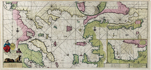
Johannes Van Keulen, Paskaart Van de Archipelagusche Eylanden - Sea Chart of the Northern Aegean Islands
|
$ 1,800.00
|
The very highest level of original color. Striking Dutch sea chart of the Northern Aegean, reflecting the height of maritime trade and navigation in the early 18th-century Mediterranean.
|
|
|
|
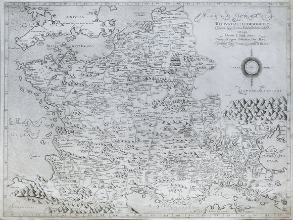
Oronce FINE (1494-1555), after. Totius Galliae descriptio...1561
|
$ 12,000.00
|
An extremely rare Lafreri School map of France originally by the Great French Mathematician Oronce Fine
|
|
|
|
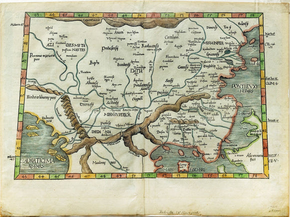
Laurent Fries Map of the Balkan Peninsula
|
$ 200.00
|
Early 16th-century map of Europe’s Balkans and surrounding regions, based on classical geography and reflecting Renaissance interest in ancient world knowledge.
|
|
|
|
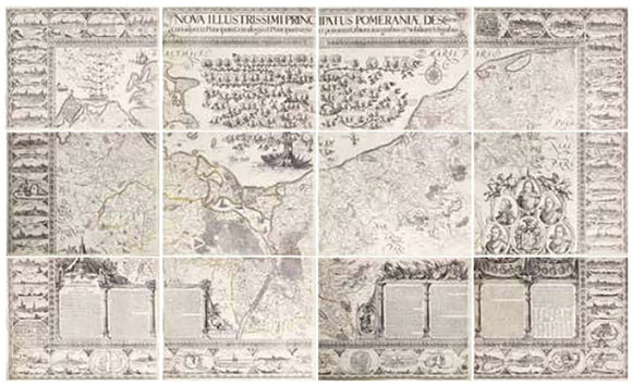
Eilhard Lubben's Map of Pomeraniae
|
$ 14,000.00
|
Monumental wall map of Pomerania, combining pioneering fieldwork and noble patronage—defining the region’s geography for over a century and influencing all later maps.
|
|
|
|
Von Rappholt's Map of Gotaland, Sweden - Showing Gothenburg, home of the SOIC
|
$ 600.00
|
Elegant 1743 manuscript map of southwestern Sweden, highlighting Gothenburg’s strategic role in trade and the Swedish East India Company’s global reach..
|
|
|
|
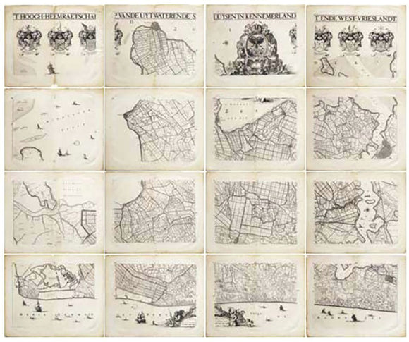
Jan Jansz Dou's Map of the Netherlands / Friesland
|
$ 12,000.00
|
Impressive 1680 atlas of North Holland’s water system, reflecting early Dutch water management, local governance, and the foundations of the Dutch Republic’s decentralized power.
|
|
|
|
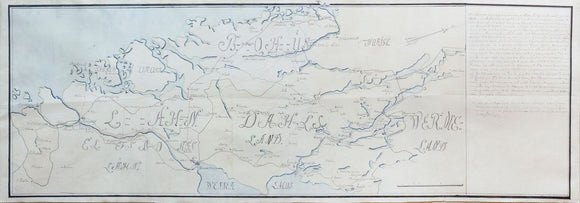
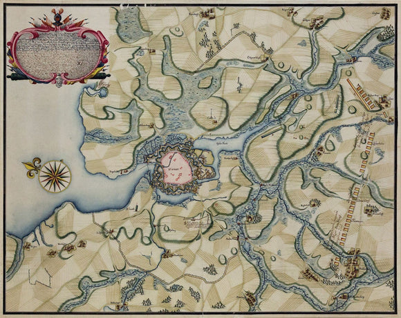
German Manuscript Map of the Battle of Wismar, 1711
|
$ 4,500.00
|
Striking manuscript map of Wismar’s siege, detailing Swedish and Danish positions during the Great Northern War’s pivotal struggle for control in northern Germany.
|
|
|
|
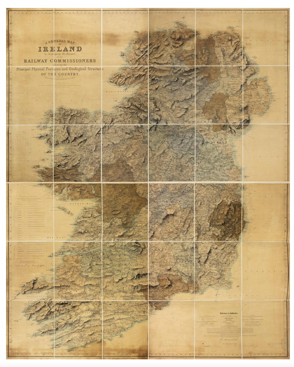
Griffith's Geological Map of Ireland to Accompany the Report of the Railway Comissioners of 1837
|
$ 3,500.00
|
Vibrant geological map of Ireland, foundational to railway planning and land valuation—Griffith’s landmark fusion of science, governance, and national infrastructure in 1830s Ireland.
|
|
|
|
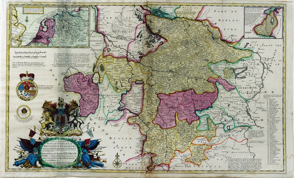
Herman Moll, A New and Exact Map of the Electorate of Brunswick-Lunenburg. 1722
|
$ 300.00
|
A richly detailed map illustrating the British crown’s German dominions, emphasizing political power, territorial control, and dynastic influence.
|
|
|
|
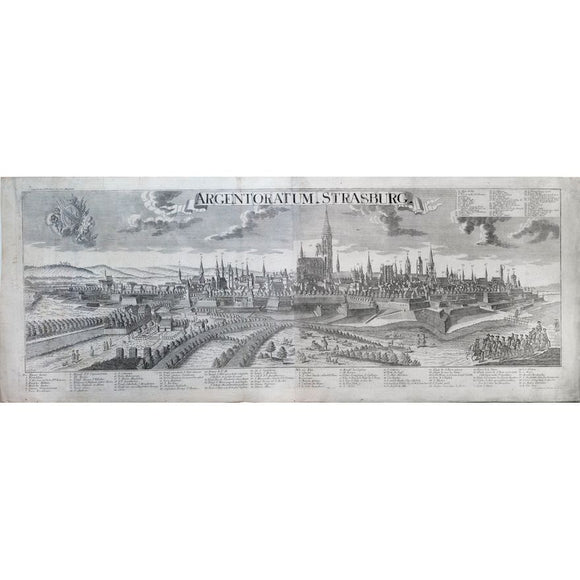
Georg Balthasar Probst. Strasburg. 1780
|
$ 800.00
|
Strasbourg's soaring cathedral anchors this Enlightenment-era panorama, reflecting the city's vital role as a Franco-German cultural and political crossroads.
|
|
|
|
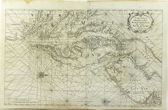
Mount & Page's Map of Virginia, Maryland, Pennsilvania, East & West New Jersey
|
$ 3,200.00
|
Important 18th-century sea chart of the Chesapeake Bay, guiding colonial navigation and trade, based on early surveys by Hermann and Thornton.
|
|
|
|
|


