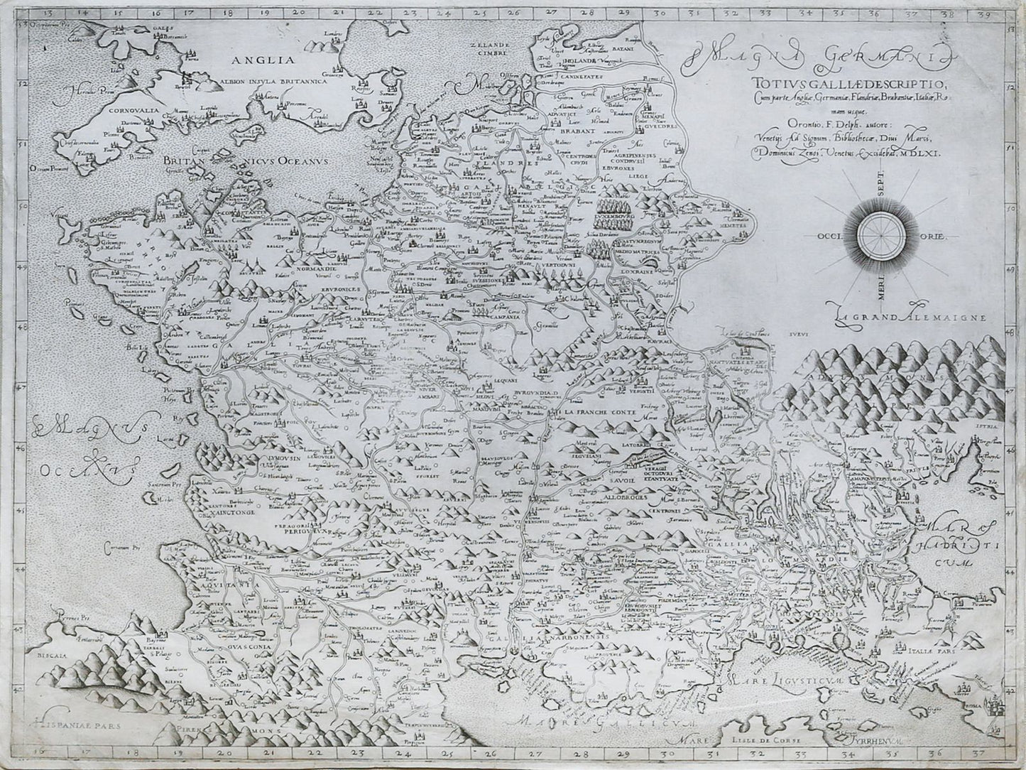
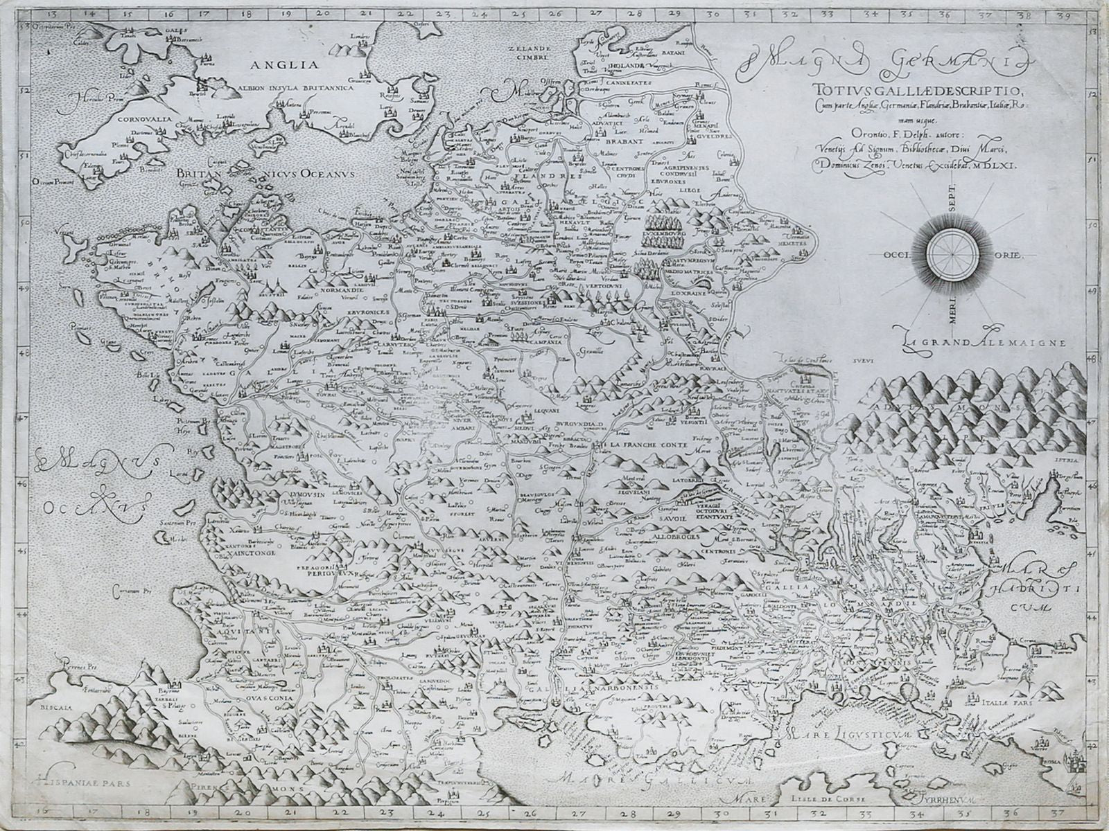
from: July Map Offering
VAN KEULEN, Johannes (1654-1713). Paskaart Van de Archipelagusche Eylanden. 1708.
Regular price
$ 28,000.00 USD
Regular price
Sale price
$ 28,000.00 USD
Unit price
per
Couldn't load pickup availability
VAN KEULEN, Johannes (1654-1713).
Paskaart Van de Archipelagusche Eylanden.
Engraved map with original hand color.
Amsterdam, 1708.
20 3/4" x 44 1/4" sheet.
Paskaart Van de Archipelagusche Eylanden.
Engraved map with original hand color.
Amsterdam, 1708.
20 3/4" x 44 1/4" sheet.
An extremely rare Lafreri School map of France originally by the Great French Mathematician Oronce Fine
This sea chart represents the Northern Aegean Islands. It contains an enlarged inset map of the eastern coast of the Chios island as well as one of the gulf of Smyrna, in Turkey.From van Keulen's "De Nieuwe Groote Lichtende Zee-Fackel, part III.3.3. The atlas was published by Johannes van Keulen (1654-1715) and his son Gerard with the cooperation of the mathematician and surveyor, Claes Jansz. Voogt. The chart is an altered state with a scale with Italian miles added. Koeman calls the Van Keulen maps of paramount importance in the development of marine cartography.The chart is beautifully engraved with a large decorative cartouche, compass roses and rhumb lines.
