from: June 2025 2
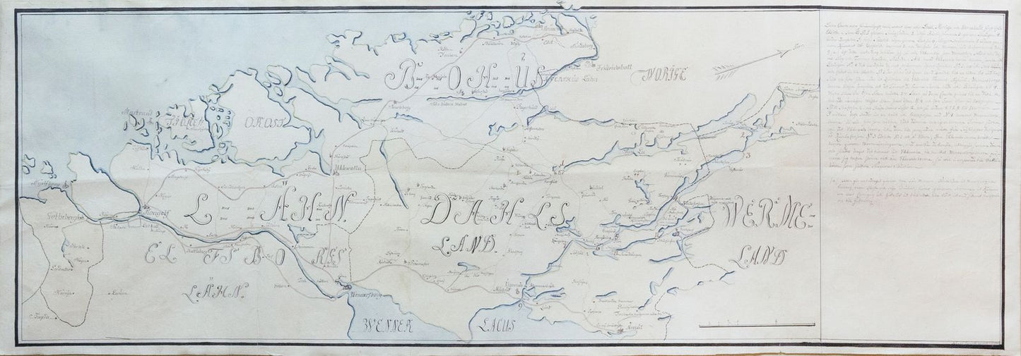
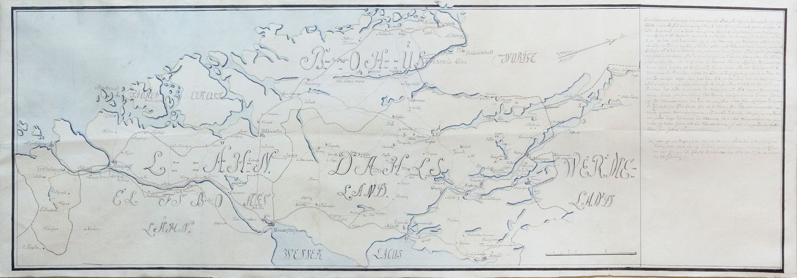
Von Rappholt's Map of Gotaland, Sweden - Showing Gothenburg, home of the SOIC
Von Rappholt's Map of Gotaland, Sweden - Showing Gothenburg, home of the SOIC
Couldn't load pickup availability
VON RAPPHOLT, Bengt Gustav (1717-1762).
Southwestern Sweden (Part of Gotaland).
Manuscript map with original hand color in full.
Wenersborg, 1743.
12 3/4" x 38 1/4" sheet, 22" x 48" framed.
A Rare and Elegant 18th-century Map of Southwestern Sweden. This elegant map, with its delicate watercolor wash denoting the North Sea and flawless calligraphy, focuses primarily on the Gotaland provinces of Bohuslan and Dalsland, which appears at center.
The map shows the trading center of Gothenburg in the lower corner. The town was considered ideal for Sweden's international trade since most of the goods were transported on ships and this was the only major Swedish port accessible without having to pass the Danish customs at Øresund. It was one of the largest ports for the The Swedish East India Company (Swedish: Svenska Ostindiska Companiet; SOIC).