from: June 2025 2
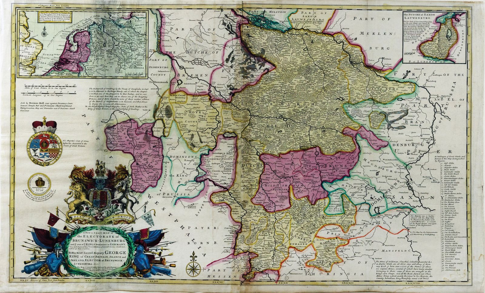
Herman Moll, A New and Exact Map of the Electorate of Brunswick-Lunenburg. 1722
Herman Moll, A New and Exact Map of the Electorate of Brunswick-Lunenburg. 1722
Couldn't load pickup availability
MOLL, Herman (1654-1732).
A New and Exact Map of the Electorate of Brunswick-Lunenburg and ye rest of ye Kings Dominions in Germany...
Engraved map with original hand color.
London, 1722.
25 1/4" x 41 1/2" sheet.
A striking and finely detailed map by Herman Moll, charting the Electorate of Brunswick-Lüneburg—better known as Hanover—and the surrounding dominions of the British monarch on the continent. Published during the reign of George I, who inherited the British throne as Elector of Hanover, this map underscores the dynastic and political links between Britain and the German states. Moll’s engraving reflects the precision and decorative flourishes for which his cartography is celebrated, complete with regional boundaries, towns, rivers, and elaborate title cartouche.
A fine example of 18th-century political cartography, this map offers both artistic appeal and historical insight into the Hanoverian succession and Britain’s continental interests. Ideal for collectors of European or royal cartography.
