from: Maps
Georges Le Rouge. Amerique Septentrionale. 1756
Georges Le Rouge. Amerique Septentrionale. 1756
Couldn't load pickup availability
George Louis LE ROUGE (1707-c. 1790), after John
Mitchell (1711-1768)
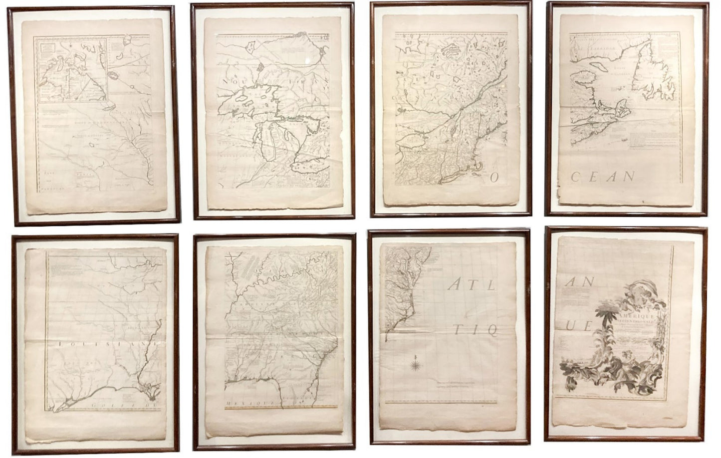
Amerique Septentrionale avec les routes distances en miles
villages et establissments francois et anglais...
Engraved map on eight sheets, each approximately 31 x 23 inches
Ristow’s Second Edition, First Impression
Paris, 1756 [1762]
A French copy of Mitchell’s map guided France’s North American policy through two wars.
John Mitchell’s 1755 Map of the British and French Dominions in North America has been called “…the most important map in American history” because of its role in
treaties ending two wars: the French and Indian War and the American Revolution. Ironically, a French copy by a German émigré played a key role in Paris during both conflicts.
During the 1750’s commerce continued between England and France despite the political tensions between them. George Louis le Rouge’s business was a perfect example. Le Rouge was a German born engraver and publisher active in Paris. Despite his location he was a staunch Anglophile and specialized in adapting English maps and books for the European market.
Upon publication of the Mitchell map, Le Rouge engraved an accurate, full-scale copy for the French and German markets. The map included French translations of the numerous
historical and physical notations in the original map, but the cartography was an exact copy of Mitchell’s. The map was used by the French civilian and military leaders throughout the French and Indian War and in negotiating the peace in 1763.
Le Rouge continued to update his map as Mitchell did between 1756 and 1777. This is the first impression of the second edition of the map, published after 1762 when the
German title was added.
The mapmaker befriended Benjamin Franklin in Paris, so it is likely his map aided the Americans during their revolution against the English. The map also played a direct role at the end of the conflict. While the 1783 Treaty of Paris was principally between Great Britain and the United States, Spain and France had also joined the conflict and had claims to assert.
Spain had entered the war allied with France on the promise of recovering Gibraltar from the British. That did not come to fruition, but Spain did participate in the negotiations to
gain what advantage it could in North America. Meeting in Paris, John Jay on the American side asserted that any interest Spain might have north of n Florida was west of the Mississippi River. Spain’s ambassador, Count d’Acada, made a much more expansive verbal claim to lands in the east, which Jay insisted he show on a map. The Count drew a line on Le Rouge’s map far to the east of the Mississippi, near the Flint River in Georgia, then north to the Ohio River and around the western shores of Lake Erie and Lake Huron. This “extravagant” claim did not hold, but by making the Spanish ambassador identify the claim on the map Jay aided his side greatly in the negotiations.