from: Americas
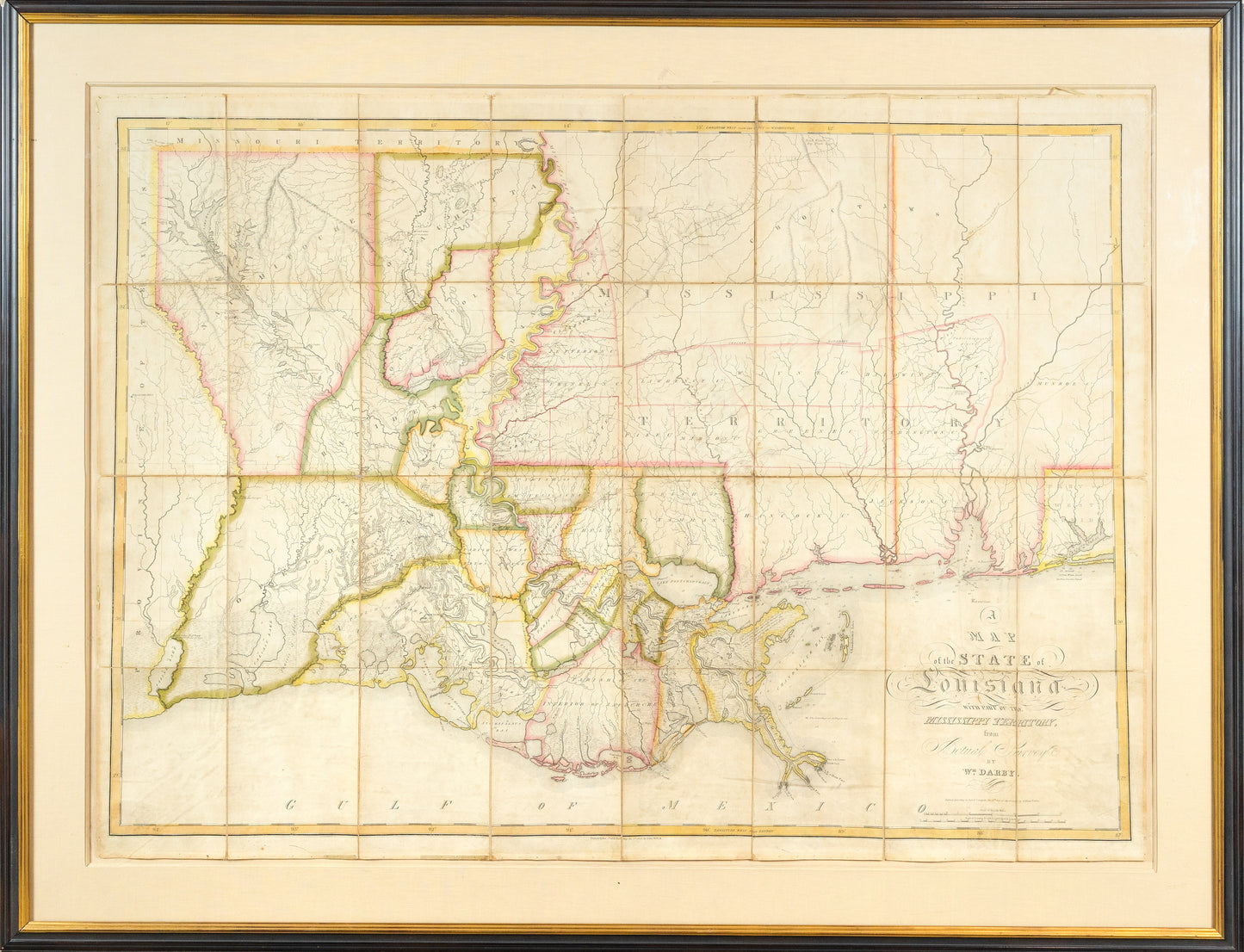
Darby, William (b.1775) A Map of the State of Louisiana with Part of Mississippi Territory from Actual Survey. 1816.
Darby, William (b.1775) A Map of the State of Louisiana with Part of Mississippi Territory from Actual Survey. 1816.
Couldn't load pickup availability
William DARBY (b. 1775)
A Map of the State of Louisiana with Part of the Mississippi Territory from Actual Survey
Engraved map with original hand outline color
Philadelphia: John Melish, 1816 (State 2)
Darby's map was the first and best map to depict the State of Louisiana, the 18th state admitted to the Union. La Fon's map was the first to accurately depict Eastern Louisiana and the region to the east, but his map omitted the southwestern border. This may have been because of the delicate political situation, or merely because data was not available to him. In any event, an obvious need existed for a map of the region.
Interest in such a map increased in 1810 when the citizens of the "Florida Parishes" rebelled against Spain's rule and declared themselves an independent republic. This was a short lived venture, and less than three months later the United States annexed that part of West Florida and added it to the Orleans Territory. At the same time, there was political pressure to admit the new territory as a state.
William Darby was a deputy surveyor for the Federal Land Office for western Louisiana. He decided that his familiarity with the region made him the right person to finally map it, which he did as a private citizen between 1811 and 1814. One of his major contributions came late in 1812, with the first accurate survey of the Sabine River, from its mouth to 32 degrees north latitude, or the original line established by the Adams Onis Treaty. As Darby completed his survey, Louisiana was admitted to be the 18th State in the Union..
Darby completed his map in 1814, but the war with England interrupted his publication plans. He volunteered to serve with Andrew Jackson as a topographer in and around New Orleans. He gave Jackson a copy of his manuscript map, which the General used in the famous defense of the city. Jackson wrote a strong recommendation to Darby for his work.
In 1815 Darby met with the Philadelphia mapmaker and publisher John Melish. Melish agreed to publish Darby's map and a book to go with it. One condition was that Melish be allowed to use Darby's map in Melish's own map of the United States. Melish had published such a map in 1813, but his 1816 map was a major upgrade, and went on to become one of the most important maps in American history. The portion of the map that depicts Louisiana is based almost entirely on Darby's work, although Melish apparently saw no need to credit Darby for his contribution. Darby's own map went through four editions, and was issued in London by John Arrow smith. As such, it was the seminal map of Louisiana on its admission into the United States.