-
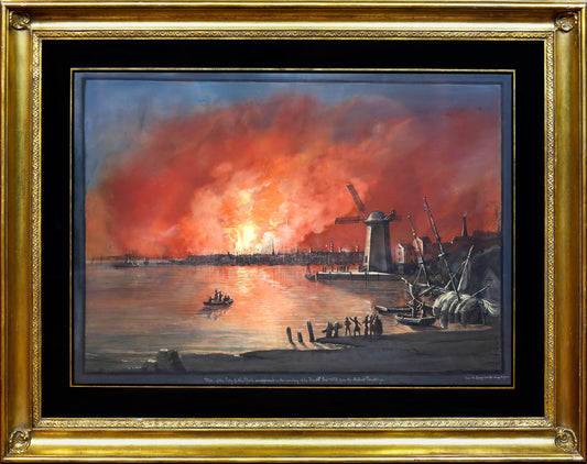
AMERICAN SCHOOL (19TH CENTURY). View of New York taken from Brooklyn on the Hudson (?) Fire...December..1835
Regular price $ 65,000.00 USDRegular priceUnit price per -
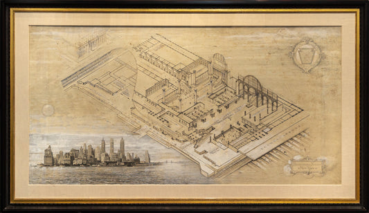
ANGELO MAGNANTI (1879-1969) Pennsylvania Station New York. 1946; HAWLEY HUGHSON (1850-1936), after Pennsylvania Station, New York City Seventh Avenue and Thirty-Second Street. 1910
Regular price $ 125,000.00 USDRegular priceUnit price per -
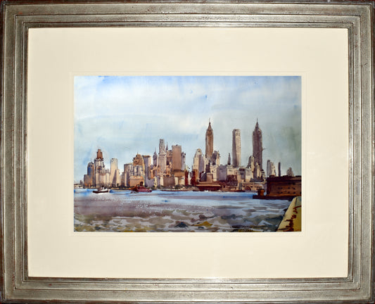
REGINALD MARSH (1898-1954) New York Skyline
Regular price $ 36,000.00 USDRegular priceUnit price per -
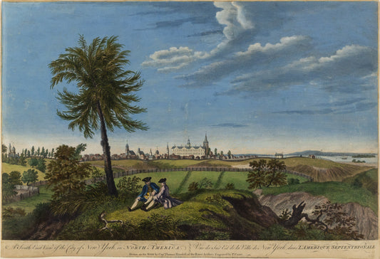
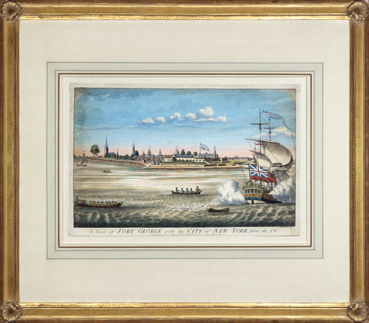
JOHN CARWITHAM (1723-1741). A View of Fort George with the City of New York from the SW. 1764
Regular price $ 12,000.00 USDRegular priceUnit price per -
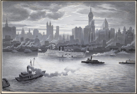
RUDOLF DANIEL LUDWIG CRONAU (1855 - 1939) Lower Manhattan Island in 1894
Regular price $ 15,000.00 USDRegular priceUnit price per -
LUIGI KASIMIR (1881-1962). View of [New York from] Governor’s Island. 1927
Regular price $ 8,500.00 USDRegular priceUnit price per -
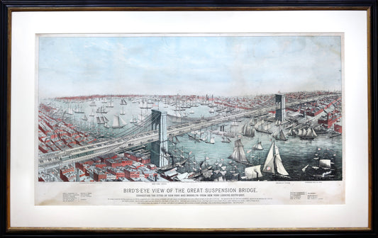
A. MAJOR. Bird’s-eye View of the Great Suspension Bridge connecting the cities of New York and Brooklyn. 1883
Regular price $ 7,500.00 USDRegular priceUnit price per -
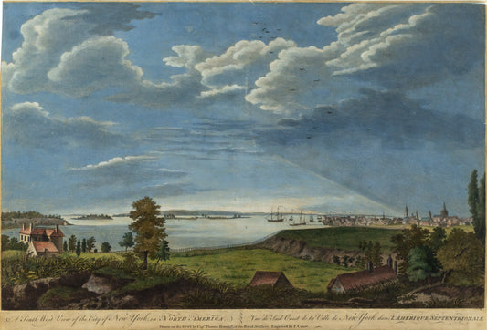
PIERRE CHARLES CANOT (1710-1777), after THOMAS HOWDELL A South West View of the City of New York in North America. 1768
Regular price $ 14,000.00 USDRegular priceUnit price per -
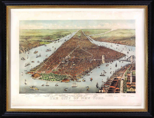
NATHANIEL CURRIER (1813 - 1888) JAMES MERRITT IVES (1824 - 1895). The City of New York
Regular price $ 24,000.00 USDRegular priceUnit price per -
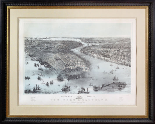
JOHN BACHMANN (1814–1896) Birds’ Eye View of New-York & Brooklyn. 1851
Regular price $ 13,000.00 USDRegular priceUnit price per -
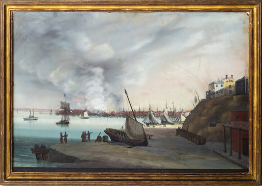
NICOLINO CALYO (1799-1884). View of New York City as It Appeared on the Eve of the Fire, 1835.
Regular price $ 175,000.00 USDRegular priceUnit price per -
PIERRE CHARLES CANOT (1710-1777), after THOMAS HOWDELL A South East View of the City of New York in North America. 1768
Regular price $ 14,000.00 USDRegular priceUnit price per
![LUIGI KASIMIR (1881-1962). View of [New York from] Governor’s Island. 1927](http://aradernyc.com/cdn/shop/files/Kasimir_ViewofGovernorsIsland_Framed.jpg?v=1759436625&width=533)