from: 05_09_23
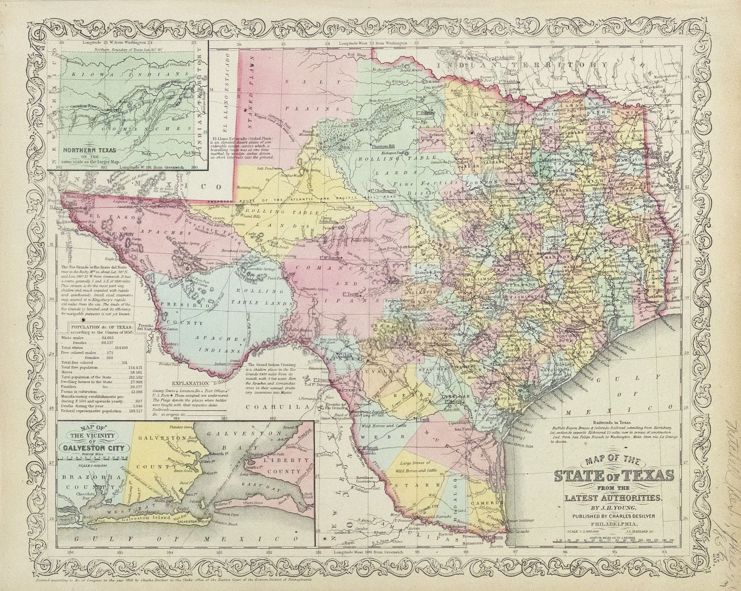
Young, J.H.. Map of the State of Texas from The Latest Authorities. Philadelphia: Charles Desilver, 1856.
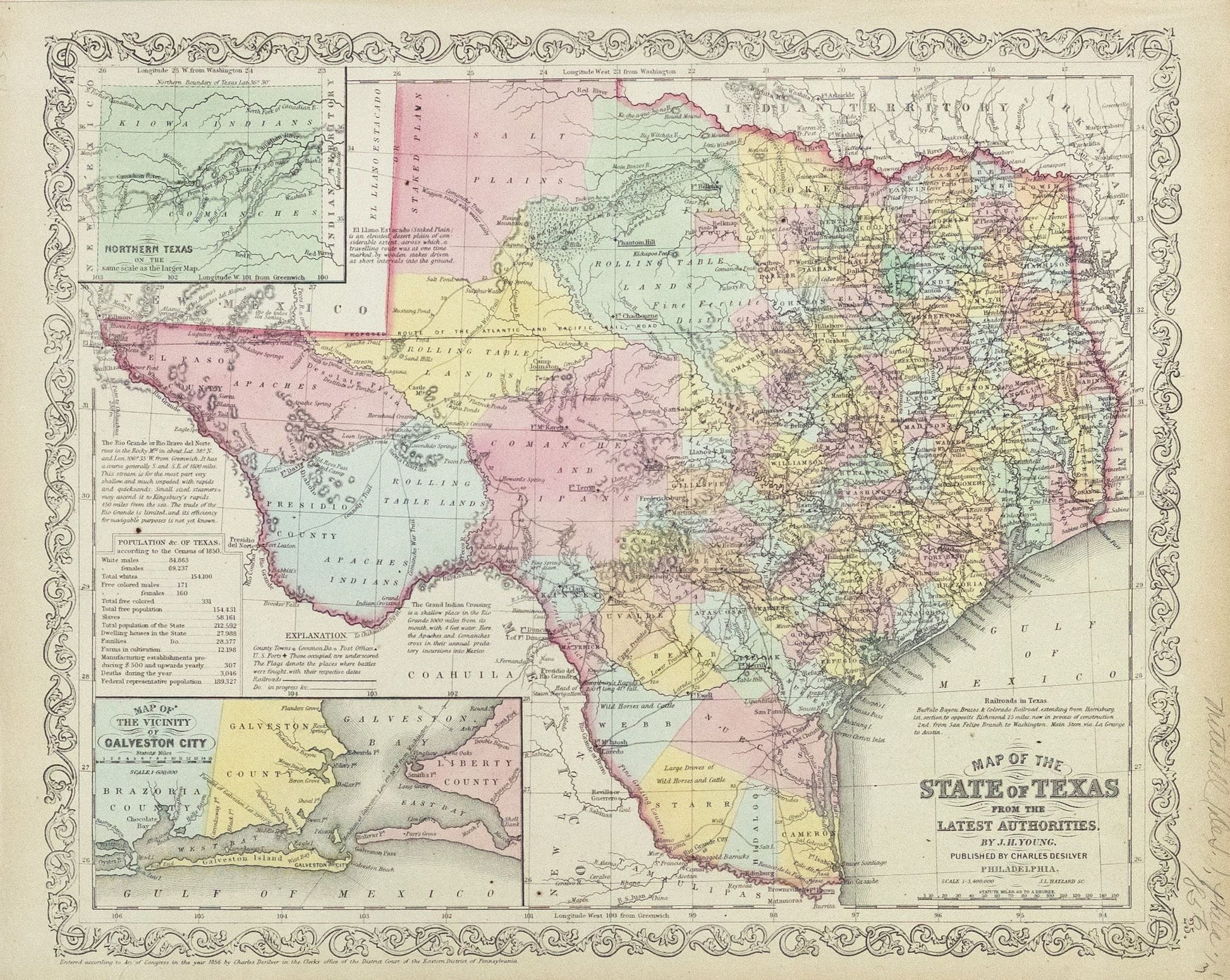
Young, J.H.. Map of the State of Texas from The Latest Authorities. Philadelphia: Charles Desilver, 1856.
Couldn't load pickup availability
Young, J.H.
Map of the State of Texas from The Latest Authorities
Philadelphia: Charles Desilver, 1856
13 1/2 x 17 1/2 inches
The most influential atlas map of the period and the first to widely disseminate Texas' new state boundaries, as a result of the Compromise.
The map depicts the newly resolved boundary of northern Texas at latitude 36°, which marked the end of Texas' claim to the upper Rio Grande and eastern New Mexico. The map richly details the county towns, post offices, and railroads (existing and in progress). An American flag identifies and dates the places where battles were fought during the Mexican-American War. The map is also richly annotated with notes describing the railroads, Staked Plain, Rio Grande, Grand Indian Crossing, and the population from the 1850 Census.
The map represents a significant work in the early history of Texas, having also been issued separately as part of several guidebooks. The progress made in land development is reflected by the contrast between the dense concentration of counties in the eastern half of the state and the open expanses of proposed counties and empressario colonies in the western part of Texas. The western edge of the frontier includes a line of U. S. forts whose names are underscored on the map. Charged in 1849 with defending the frontier against Indian attacks, the US Army was required to quickly establish forts in this region to keep up with the rapid westward expansion.
The Compromise of 1850
The Mexican War (1846-48) brought Texas into serious conflict with the United States Federal government over Texas's claim to a large portion of New Mexico. The claim dated to 1836, when the Republic of Texas sought to expand its boundaries to the Rio Grande.
In the early months of the Mexican War, the U. S. troops under General Stephen W. Kearny, occupied New Mexico. Kearny quickly established a temporary civil government. Under the Treaty of Guadalupe Hidalgo, Mexico relinquished all claim to territory north and east of the Rio Grande, but did not resolve the Texas claim to that portion of New Mexico lying east of the river.
Following annexation, New Mexico became part of the slavery controversy. Southern leaders insisted that all of the new territory be opened to slaveholders and their human property, a position contested by Northerners. Texas attempted to further its claim by organizing Santa Fe County in 1848, with boundaries including most of New Mexico, east of the Rio Grande. In New Mexico, military and civilian leaders petitioned the federal government to organize their area into a federal territory. Texas governor George T. Wood, responded by asking the legislature to give him the power and means to assert the claim of Texas to New Mexico "with the whole power and resources of the State." Soon afterward his successor, Peter H. Bell, made a more moderate request, asking only for authority to send a military force sufficient to maintain the state's authority in that area. Bell then sent Robert S. Neighbors west to organize four counties in the disputed area.
Publication of the report of Neighbors's mission in June of 1850, led to a public outcry in Texas. Some persons advocated the use of military force; others urged secession. Bell reacted by calling a special session of the legislature to deal with the issue. Before the session began, the crisis deepened. New Mexicans ratified a constitution for a proposed state, specifying boundaries that included the territory claimed by Texas. Also, President Millard Fillmore reinforced the army contingent stationed in New Mexico and asserted publicly, that should Texas militiamen enter the disputed area, he would order federal troops to resist them. Southern political leaders responded by sending Governor Bell offers of moral and even military support.
On January 16, 1850, Senator Thomas Hart Benton, of Missouri, introduced a bill that would have had Texas cede all land west of 102° longitude and north of the Red River to the United States for $15 million. The bill would also divide Texas into two states. Soon afterward, Senator John Bell, of Tennessee, offered a resolution that would have divided Texas into three states. Then a Senate committee, chaired by Henry Clay of Kentucky, reported a bill that would have given Texas an unspecified sum in exchange for ceding all lands northwest of a straight line from the El Paso area to that point on the 100th meridian that intersects the Red River. None of these efforts proved successful.
Finally, Senator James A. Pierce of Maryland introduced a bill that offered Texas $10 million in exchange for ceding to the national government all land north and west of a boundary beginning at the 100th meridian where it intersects the parallel of 36°30', then running west along that parallel to the 103d meridian, south to the 32d parallel, and from that point west to the Rio Grande. The bill had the support of the Texas delegation and of moderate leaders in both the North and South. Holders of bonds representing the debt of the Republic of Texas lobbied hard for the bill, for it specified that part of the financial settlement be used to pay those obligations. The measure passed both houses of Congress in the late summer of 1850, and was signed by President Fillmore.
Texas voters approved the measure and Governor Bell signed off on November 25, 1850. The boundary act and four additional bills passed at about the same time, all dealing with controversial sectional issues, came to be known collectively as the Compromise of 1850.


