from: 05_09_23
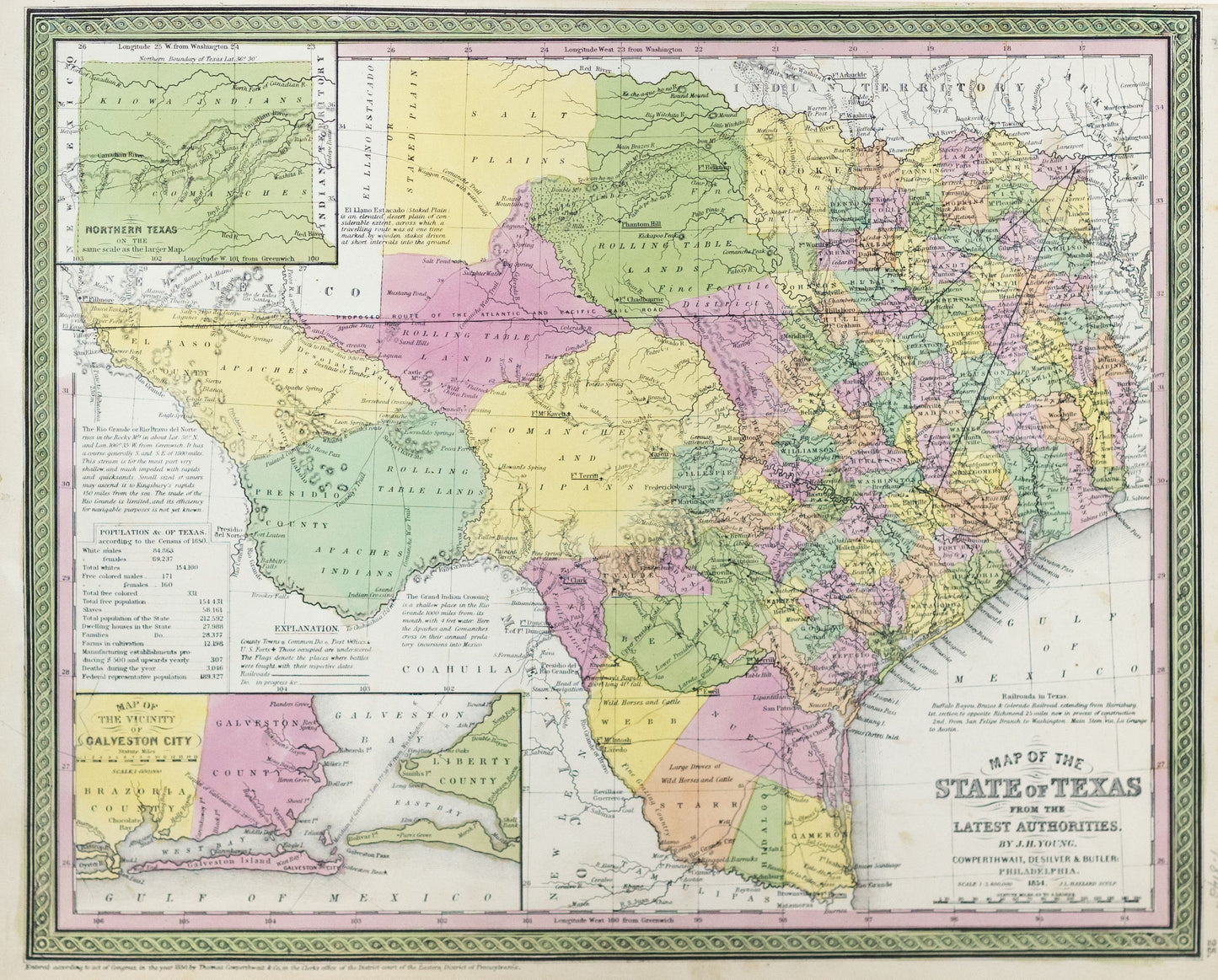
Young, J.H.. Map of the State of Texas from The Latest Authorities. Philadelphia: Charles Desilver, 1854.
Young, J.H.. Map of the State of Texas from The Latest Authorities. Philadelphia: Charles Desilver, 1854.
Couldn't load pickup availability
Young, J.H.
Map of the State of Texas from The Latest Authorities
Philadelphia: Charles Desilver, 1854
14 1/2 x 17 inches
The most influential atlas map of the period and the first to widely disseminate Texas' new state boundaries, as a result of the Compromise.
The map depicts the newly resolved boundary of northern Texas at latitude 36°, which marked the end of Texas' claim to the upper Rio Grande and eastern New Mexico. The map richly details the county towns, post offices, and railroads (existing and in progress). An American flag identifies and dates the places where battles were fought during the Mexican-American War. The map is also richly annotated with notes describing the railroads, Staked Plain, Rio Grande, Grand Indian Crossing, and the population from the 1850 Census.
The map represents a significant work in the early history of Texas, having also been issued separately as part of several guidebooks. The progress made in land development is reflected by the contrast between the dense concentration of counties in the eastern half of the state and the open expanses of proposed counties and empressario colonies in the western part of Texas. The western edge of the frontier includes a line of U. S. forts whose names are underscored on the map. Charged in 1849 with defending the frontier against Indian attacks, the US Army was required to quickly establish forts in this region to keep up with the rapid westward expansion.