from: 1016 Map Inventory
Vaugondy, Robert. Les Indes Orientales, ou sount distingues les Empires et Royaumes. Paris, 1755.
Vaugondy, Robert. Les Indes Orientales, ou sount distingues les Empires et Royaumes. Paris, 1755.
Couldn't load pickup availability
Robert Vaugondy
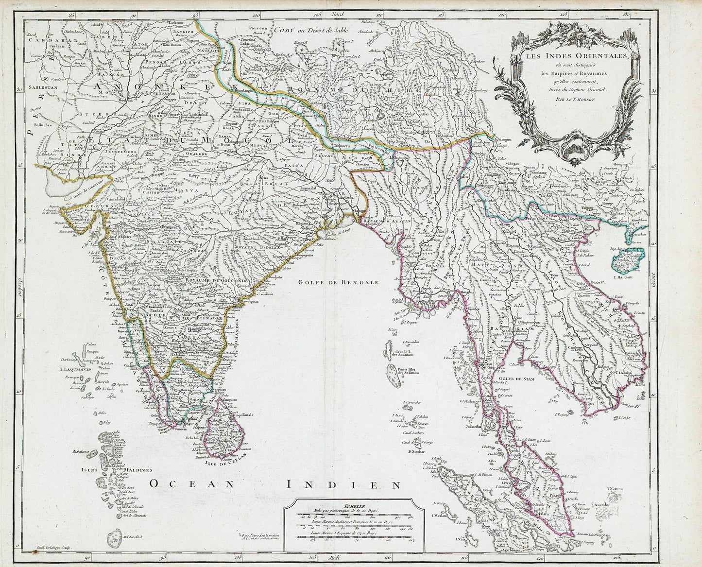
Les Indes Orientales, ou sount distingues les Empires et Royaumes
Paris, 1755
20 x 26 inches
A richly detailed and meticulously crafted representation of the East Indies, a term historically used to describe Southeast Asia and parts of India. The map highlights various empires and kingdoms, with distinct boundaries and color-coded regions. The geographic scope includes parts of modern-day India, Indonesia, Malaysia, Thailand, and the Philippines. Vaugondy's map reflects the European interest in the region during the Age of Exploration and colonial expansion, with particular attention to maritime routes and the strategic significance of various islands and coastal cities.
Robert de Vaugondy (1723-1786), also known as Gilles Robert de Vaugondy, was a renowned French cartographer and geographer of the 18th century. He was the son of the famous cartographer Didier Robert de Vaugondy, from whom he inherited a deep passion for geography and mapmaking. Together with his father, Robert de Vaugondy produced some of the most detailed and scientifically accurate maps of their time. Their work was characterized by precision, clarity, and artistic elegance, often incorporating the latest geographical knowledge obtained from explorers and travelers. In 1757, Robert de Vaugondy was appointed the official geographer to Louis XV, a testament to his expertise and the high regard in which his work was held. His maps, including the "Les Indes Orientales," remain significant historical documents, offering insights into the geographical understanding and colonial ambitions of 18th-century Europe.