from: 1016 Map Inventory
Van Meurs, Jacob. Nova Mexico. Amsterdam, 1673.
Van Meurs, Jacob. Nova Mexico. Amsterdam, 1673.
Couldn't load pickup availability
Jacob Van Meurs
Nova Mexico
Amsterdam, 1673
approx. 12 x 23 inches sheet
[Mexico]
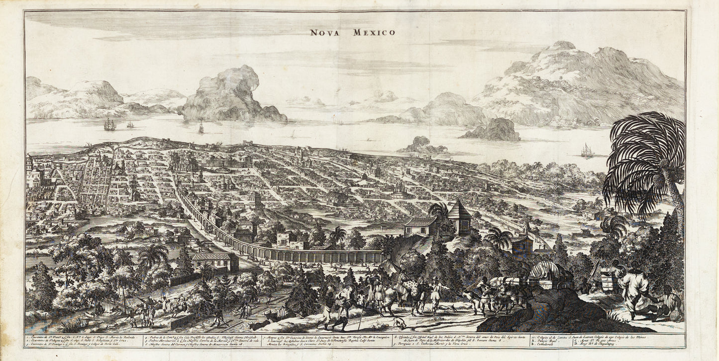
**Jacob Van Meurs, "Nova Mexico," Amsterdam, 1673**
Jacob Van Meurs was a prominent Dutch engraver and map publisher in the 17th century. His 1673 view, titled "Nova Mexico," is a fascinating representation of Mexico City during the late 17th century. The map was part of a broader European interest in documenting and understanding the newly explored and colonized lands of the Americas.
Jacob Van Meurs's "Nova Mexico," published in 1673, provides a historically significant glimpse into the colonial era's vision of Mexico City, a vital center of the Spanish Empire in the Americas. This engraving is not merely a map but a detailed portrayal that reflects the city's importance in the 17th century, both as a hub of colonial administration and as a symbol of European dominance in the New World.
In the foreground, the scene is alive with colonial activity. A group of travelers, likely representing Spanish settlers or indigenous laborers under colonial rule, are depicted with pack animals, emphasizing the role of trade and transportation in the economic life of the colony. The lush vegetation and presence of palm trees signify the fertility of the land and its exploitation by the colonial powers for agricultural purposes. This area illustrates the controlled expansion of European settlements into the surrounding natural landscape, which was often cultivated or repurposed for colonial use.
The city itself, meticulously laid out in a grid pattern, highlights the imposition of European urban planning on the indigenous landscape. The prominent buildings, particularly the churches and government structures, stand as symbols of Spanish authority and the Catholic Church's role in the colonization process. These buildings not only dominated the physical landscape but also represented the ideological control exerted by the Spanish over the native populations.
The background, featuring Lake Texcoco and the surrounding mountains, underscores the geographical and strategic importance of Mexico City. The lake, once central to the Aztec capital of Tenochtitlan, is now shown as part of a transformed landscape under Spanish control. The mountains frame the city, serving as a reminder of the natural barriers that both protected and isolated this colonial outpost.
The ships visible on the lake indicate Mexico City's connection to broader trade networks, both within the Spanish Empire and beyond. These vessels symbolize the flow of goods, people, and ideas between the Old World and the New, and the city's role as a key node in these exchanges.
In this view, Meurs captures more than just the physical layout of Mexico City; he encapsulates the historical significance of the city as a focal point of Spanish colonial power. The detailed depiction of the city's architecture, infrastructure, and surrounding landscape serves as a testament to the transformative impact of European colonization on the Americas, making "Nova Mexico" a valuable historical document that reflects the complex interplay of power, culture, and geography in the 17th century.