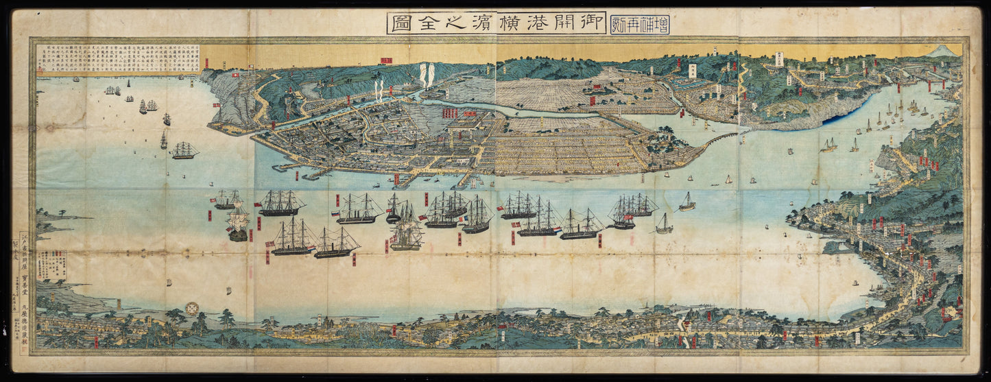
UTAGAWA Sadahide (1807-1873 ) Gokaiko Yokohama no Zenzu (trans. A complete panoramic view of Yokohama port)
UTAGAWA Sadahide (1807-1873 ) Gokaiko Yokohama no Zenzu (trans. A complete panoramic view of Yokohama port)
Couldn't load pickup availability
UTAGAWA Sadahide (1807-1873)
Gokaiko Yokohama no Zenzu (trans. A complete panoramic view of Yokohama
port)
Tokyo: Maruya Tokuzō, 1865-1866
Multi-sheet woodblock print
28” x 72 3⁄4” sheet; 29” x 74” framed
Map of the imperial capital city under the reign of Alexander I, showing the
Neva River and surrounding countryside. The city is drawn with its traditional
regular street layout and eleven districts, providing excellent detail of the public
buildings, docks and shipyards, fortifications, palaces, churches, hospitals, and
universities. At the bottom are two numbered keys in both Latin and German.
In the top corners are two decorative cartouches, one naming the place mapped
within an architectural surround, the other filled with beautifully engraved images of the martial prowess of Russia, including cannon, forts, a warship and
globes surmounted by the crest of the Russian Empire.
Seutter’s map is believed to be directly copied from the first Russian plan of the
city, drawn by George Wolffgang Krafft for the Akademiya Nauk and published
in 1737. In Seutter’s edition, the only significant modification is the replacement
of Cyrillic Russian by Latin text.