from: 1016 Map Inventory
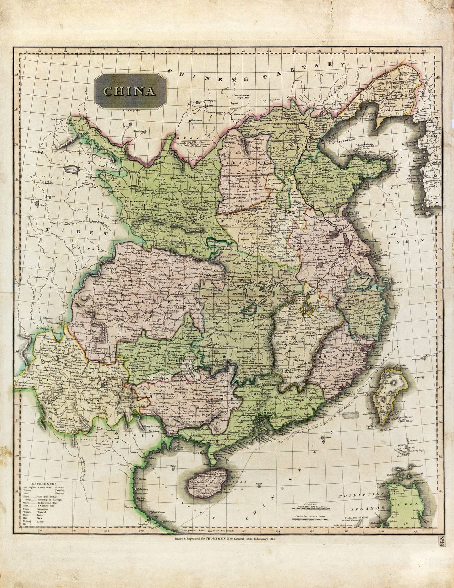
Thomson, John. China, New General Atlas. Edinburgh, 1815.
Thomson, John. China, New General Atlas. Edinburgh, 1815.
Couldn't load pickup availability
John Thomson
China, New General Atlas
Edinburgh, 1815
29 x 21 inches sheet
John Thomson's "China" map, published in 1815 as part of his *New General Atlas,* is a significant historical artifact that reflects early 19th-century Western perspectives on East Asia. Thomson was a prominent Scottish cartographer known for his detailed and carefully crafted maps. This particular map of China provides insight into the geographical knowledge and imperial interests of the time.
Created during an era when European powers were expanding their influence in Asia, the map offers a Western interpretation of China's vast and complex territory. It delineates China's provincial boundaries with remarkable precision, considering the limited information available to Western cartographers of that period. The map also includes parts of neighboring regions, such as Tibet, Mongolia, and Korea, highlighting China's influence over these areas.
Thomson’s work is emblematic of the period's cartographic advancements and the growing European curiosity about distant lands, driven by both scientific interest and colonial ambitions. The map captures a moment in history when China, though still a powerful empire, was beginning to face increasing pressure from European powers, which would eventually lead to significant geopolitical changes in the region.
This map is not only a representation of geographic knowledge but also a reflection of the cultural and political dynamics of the early 19th century, showcasing how Western nations viewed and engaged with China during this pivotal period.