from: 05_09_23
Jeckyll, Thomas. Map of the United States and their Territories between the Mississippi River and the Pacific Ocean. Washington DC, 1857-8.
Jeckyll, Thomas. Map of the United States and their Territories between the Mississippi River and the Pacific Ocean. Washington DC, 1857-8.
Couldn't load pickup availability
Thomas Jeckyll
Map of the United States and their Territories between the Mississippi River and the Pacific Ocean
Washington DC, 1857-8
22 1/2 x 25 inches
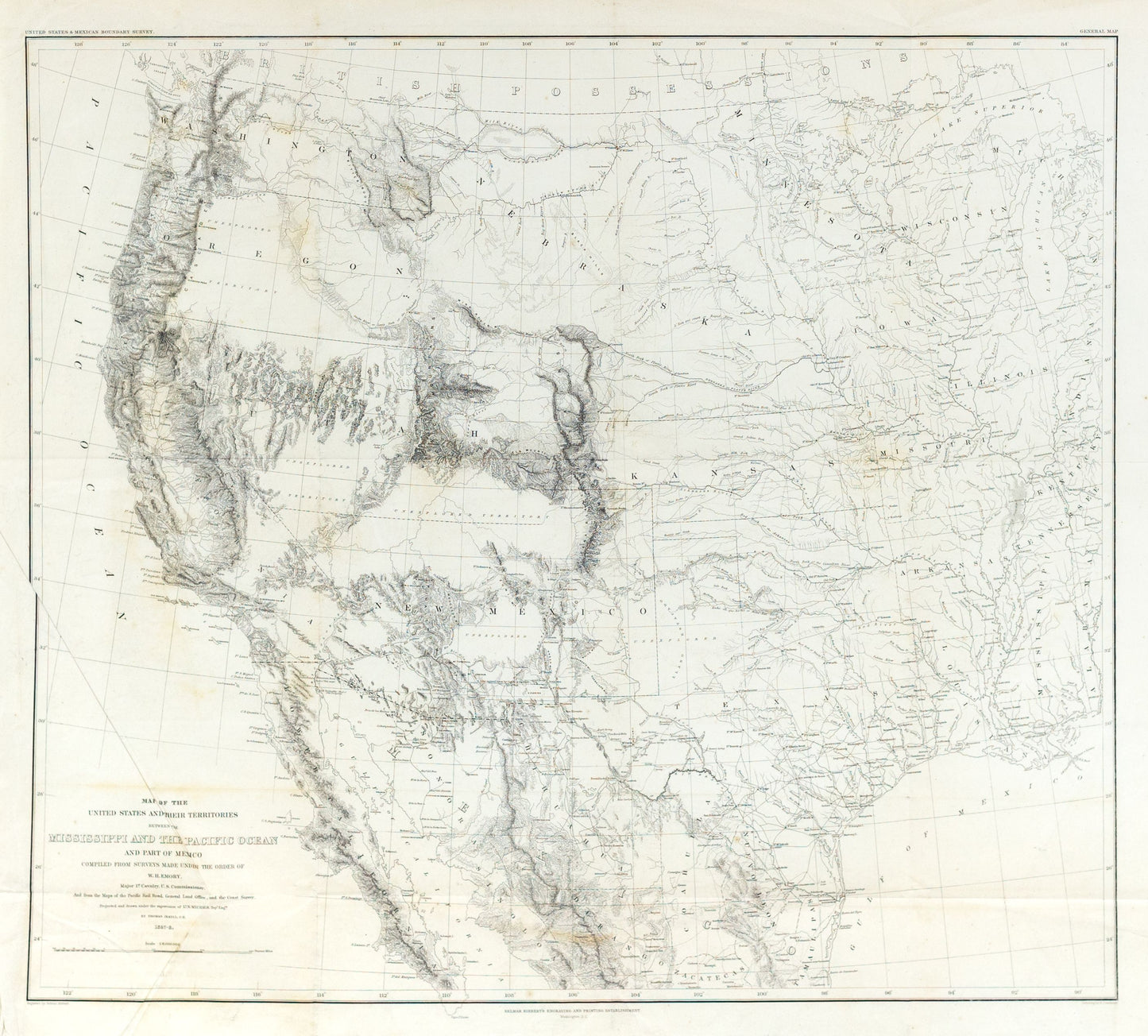
This impressive map of the United States west of the Mississippi River reflects the latest surveys performed along the newly established Mexican-American border by a party led by William H. Emory, an officer in the U.S. Army Corps of Topographical Engineers. Shortly after the Gadsden Purchase of 1854, Emory was assigned to lead the American boundary commission established to determine the exact line of demarcation and spent nearly two years performing the requisite surveys.
The results, seen here, are among the most detailed cartographic representations of the West until after the Civil War. Delicately engraved topography and geographic features dominate much of the image, but important transportation routes, settlements, and fortifications are also named throughout. Vast swathes of unexplored territory are labeled across the Southwest and Pacific Northwest, east of the Cascades and Sierra Nevada. Both the pre and post-Gadsden purchase boundaries are outlined, with accompanying annotations and dates providing additional context on the convoluted process of mapping the border.
The map was drawn by Thomas Jekyll under the authority of Lieutenant N. Michler. Engraved by Selmar Siebert and published in Washington, D.C. in 1857 by Cornelius Wendell as part of Emory’s Report on the United States and Mexican Boundary Survey, Made Under The Direction of the Secretary of the Interior.
Sources: Wheat 916; Rumsey 026.001