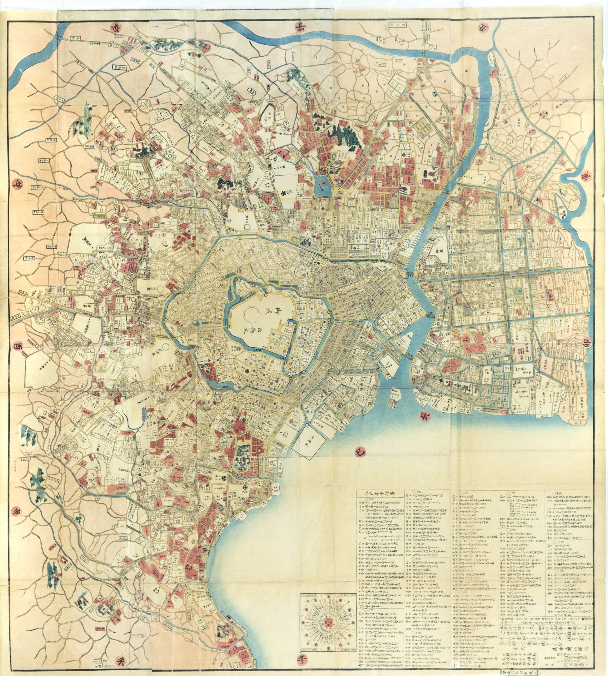
TAKAI RANZAN, Ansei kaisei no Edo oezu, Tokyo 1859. [Map of Tokyo, Japan].
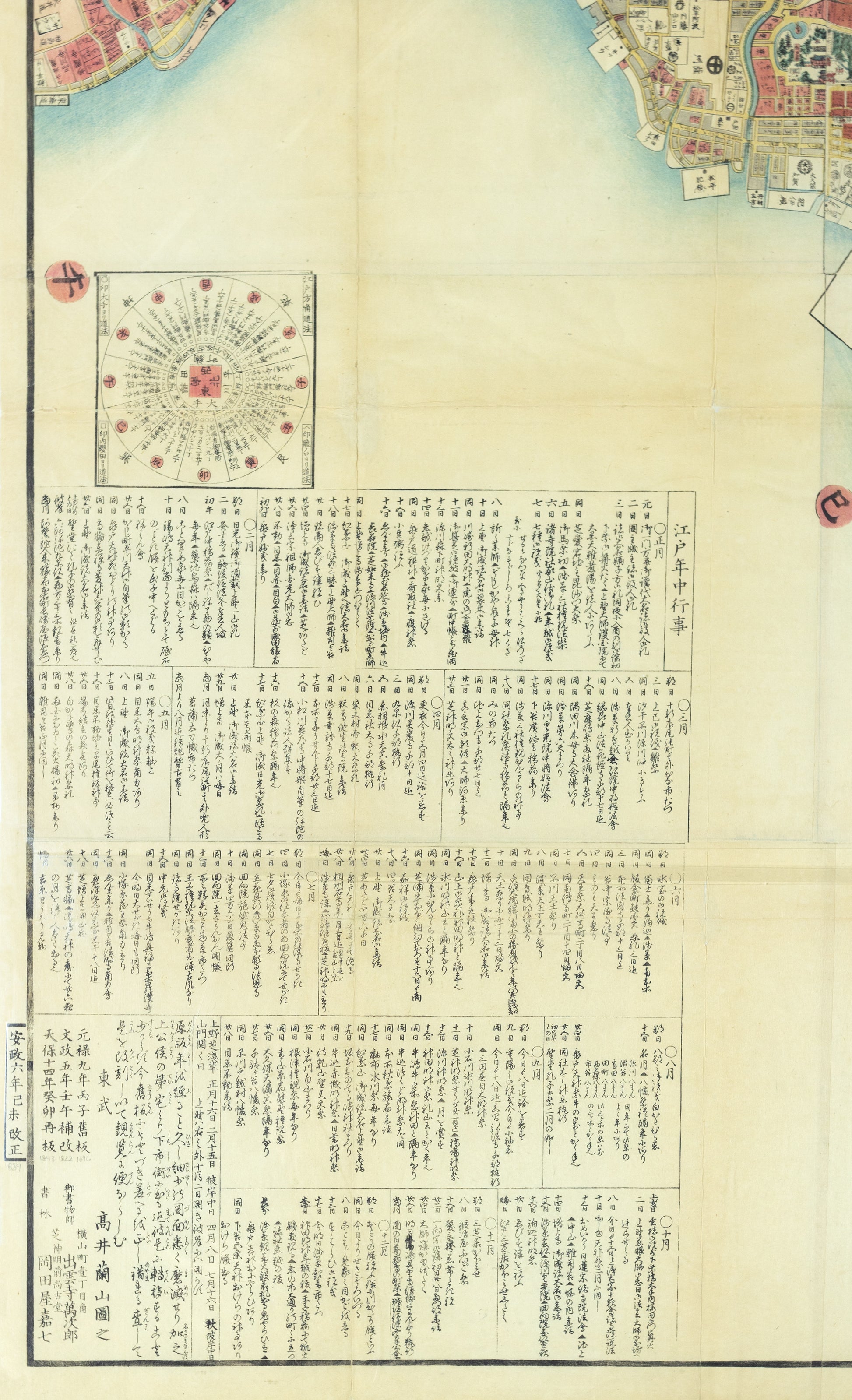
TAKAI RANZAN, Ansei kaisei no Edo oezu, Tokyo 1859. [Map of Tokyo, Japan].
Couldn't load pickup availability
TAKAI Ranzan (1762-1838)
Ansei kaisei no Edo oezu (trans. Illustrated Map of Great Edo Revised in the Ansei Period)
Tokyo: 1859 (Ansei 6)
Large multi-sheet color block printed folding map; folds into the original covers with paper title label
52 1/2" x 47 1/2" sheet
A grand, highly-detailed map of Edo with an extensive legend at bottom left listing all important events taking place throughout the year within the capital city. At center sits Edo Castle, enclosed in a large protective moat, surrounded by residences of the Shogun's most loyal supporters (Hatamoto). Corresponding family crests (mon) are illustrated throughout the map. Radiating out from the center, all residents and family businesses are named, as well as waterways, lakes, streets, temples, and shrines. Rather than the western convention of cardinal directions, directions are split into 12 parts based on the Chinese zodiac. A directional distance chart from Edo to 46 provincial areas, shown in Japanese miles, is printed next to the list of annual events. This map was first printed in the 1820s and revised once again in 1843 (Tenpo 14) and 1859 (Ansei 6).
![TAKAI RANZAN, Ansei kaisei no Edo oezu, Tokyo 1859. [Map of Tokyo, Japan].](http://aradernyc.com/cdn/shop/products/Ranzan_EdoMap_1.jpg?v=1678228434&width=1445)
![TAKAI RANZAN, Ansei kaisei no Edo oezu, Tokyo 1859. [Map of Tokyo, Japan].](http://aradernyc.com/cdn/shop/products/Ranzan_EdoMap_2.jpg?v=1678228434&width=1445)