from: 05_09_23
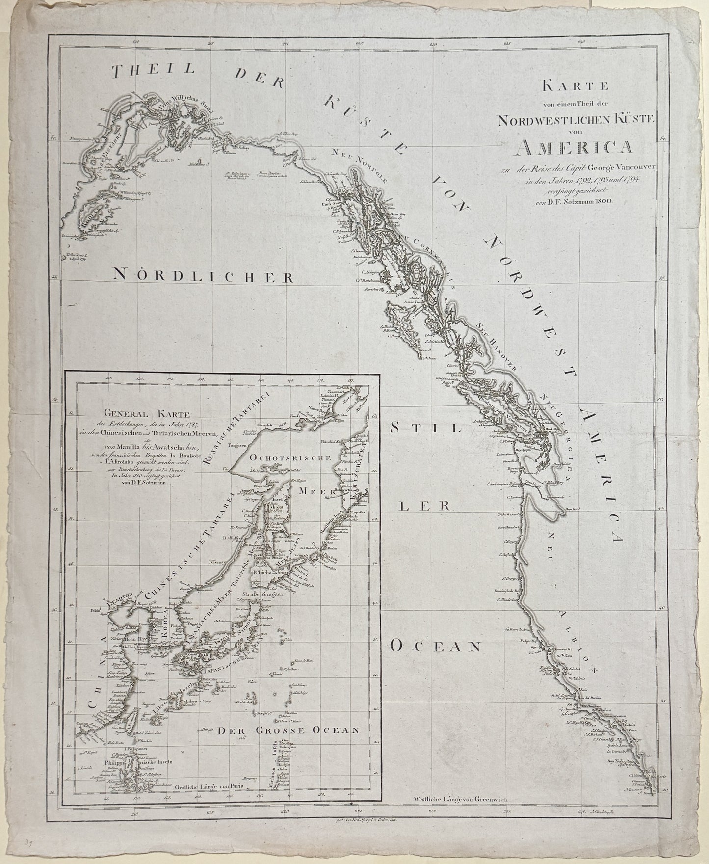
Daniel Friedrich Sotzmann. Karte von einem Theil de Nordwestlichen Küste von America of 1800
Daniel Friedrich Sotzmann. Karte von einem Theil de Nordwestlichen Küste von America of 1800
Couldn't load pickup availability
Daniel Friedrich Sotzmann.
Karte von einem Theil de Nordwestlichen Küste von America of 1800
Map of a Part of the Northwest Coast of America; about the captain's journey. George Vancouver rejuvenated in 1792, 1793 and 1794 drawn by D.F. Sotzmann 1800
Berlin / 1800
16 x 20 inches
Copperplate engraving, uncolored
Finely engraved map of the West Coast of North America, stretching from Kodiak Island in the north to San Diego.
The map appeared in Magazin von merkwurdigen neuen Reisebeschreibungen : aus fremden Sprachen ubersetzt und mit erlauternden Anmerkungen begleitet, accompanied by a short article announcing the discoveries of Vancouver along the Northwest coast of America.
The map is based upon the discoveries of the English, French, Spanish and Russian explorations in the region up to 1800, and including the discoveries of George Vancouver.
Vancouver is alternatively named for both Vancouver and Quadra.
Large inset of Korea, China, Japan, and the Russian Coastline to the North.