from: 1016 Map Inventory
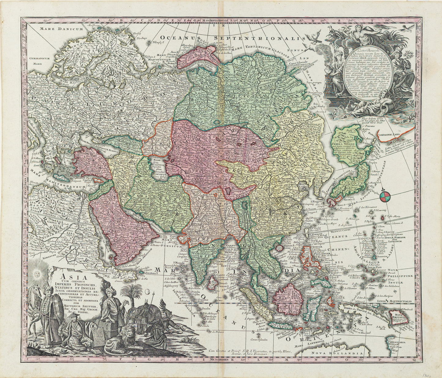
Seutter, Matthäus. Asia cum omnibus Imperiis Provinciis Statibus et insulis... Augsburg, 1697
Seutter, Matthäus. Asia cum omnibus Imperiis Provinciis Statibus et insulis... Augsburg, 1697
Couldn't load pickup availability
Matthäus Seutter (German, 1678-1757)
Asia cum omnibus Imperiis Provinciis Statibus et insulis...
Augsburg, 1697
Engraved map with original hand color
21 1/4 x 25 inches
This impressive map of Asia by Matthäus Seutter reflects Europe's growing geographic knowledge and imperial ambitions during the late 17th century. Covering the vast continent from the Middle East to the islands of Southeast Asia and Japan, the map highlights major political divisions, cities, rivers, and trade routes that were central to European exploration and commerce.
Seutter’s work captures both the geographic and economic importance of Asia at a time when European powers were expanding their influence through trade networks, particularly in regions like India, China, and the Spice Islands. The map is richly decorated with allegorical cartouches, sailing ships, and depictions of Asian figures and animals, reflecting Europe’s fascination with the wealth and diversity of the continent.
As a product of Augsburg’s celebrated mapmaking tradition, Asia cum omnibus Imperiis combines artistic elegance with cartographic precision, serving as both a practical reference and a representation of Europe’s perception of Asia during the early modern period.