
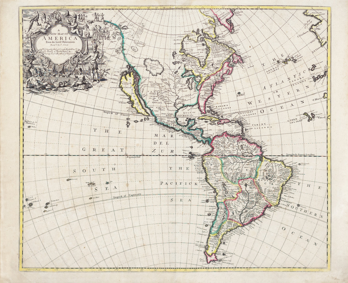
Senex, John. A New Map of America from the latest observations. London, 1719.
Senex, John. A New Map of America from the latest observations. London, 1719.
Couldn't load pickup availability
John Senex
A New Map of America from the latest observations
London, 1719
20 3/4" x 25 1/4"
This detailed map of the Americas by John Senex, a leading English cartographer, offers a fascinating glimpse into early 18th-century geographic knowledge and misconceptions. One of its most notable features is the depiction of California as an island, a persistent cartographic error that originated in the 17th century and was perpetuated by European mapmakers, including the English, as a symbol of their rivalry with Spanish claims to the region.
The map highlights key political divisions, major rivers, and coastal settlements in North and South America, reflecting the growing importance of the continents in European colonial ambitions. Features such as the Mississippi River, the Great Lakes, and South America’s extensive waterways underscore the economic significance of the New World, particularly for trade in natural resources.
Senex's map, published in London, reflects both the scientific advancements of the Enlightenment and lingering geographic uncertainties, such as California’s insular depiction. This choice may have been politically motivated, as English cartographers sought to challenge Spanish dominance in the Americas and assert their own claims to knowledge and influence over these contested territories. The ornate title cartouche and precise engraving further emphasize the map’s value as both a practical tool and an artistic achievement.
-
Example product title
Regular price $ 800.00 USDRegular priceUnit price per -
Example product title
Regular price $ 800.00 USDRegular priceUnit price per -
Example product title
Regular price $ 800.00 USDRegular priceUnit price per -
Example product title
Regular price $ 800.00 USDRegular priceUnit price per