from: 1016 Map Inventory
Sanson, Nicolas & Mortier, Pierre. L'Etat de la Republique de Venice. Paris: ca. 1700
Sanson, Nicolas & Mortier, Pierre. L'Etat de la Republique de Venice. Paris: ca. 1700
Couldn't load pickup availability
Nicolas Sanson & Pierre Mortier
L'Etat de la Republique de Venice
Paris: ca. 1700
Approx. 24 1/2 x 38 in.
Nicolas Sanson (1600-1667), a renowned French cartographer often referred to as the "father of French cartography," played a crucial role in the development of mapmaking in the 17th century. His meticulous work and scientific approach set new standards in the field, moving away from the decorative styles of his predecessors. Sanson's maps were highly valued for their accuracy and attention to detail.
Pierre Mortier (1661-1711) was a prominent Dutch publisher and bookseller based in Amsterdam. He is well known for his high-quality maps and atlases, often collaborating with leading cartographers of the time. Mortier's work was instrumental in disseminating advanced cartographic knowledge throughout Europe.
Map Description:
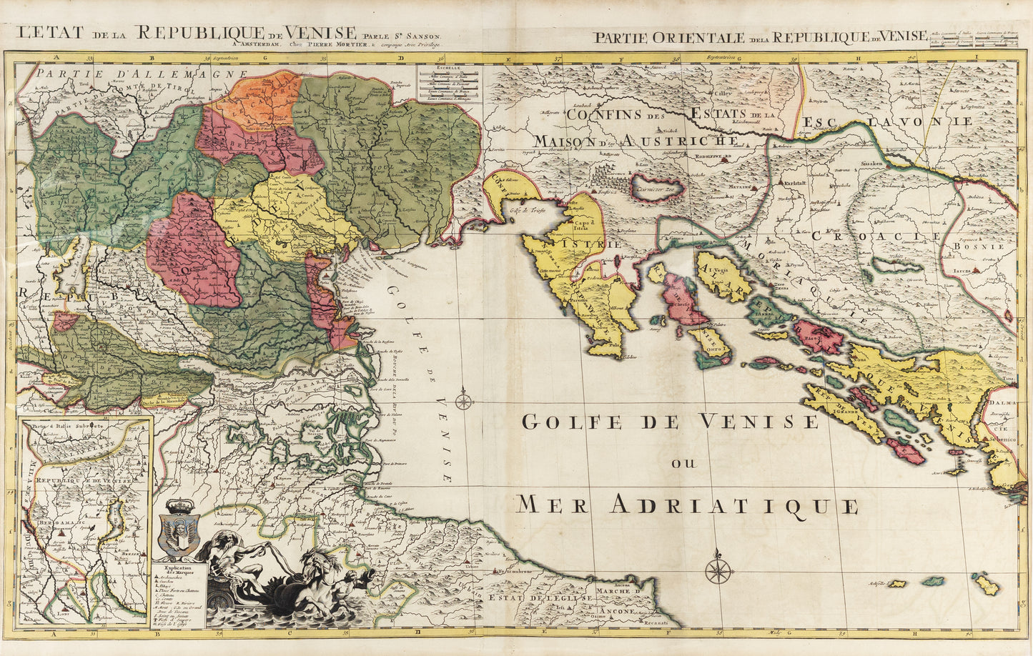
"L'Etat de la Republique de Venice" (The State of the Republic of Venice) is a map created around 1700 by Nicolas Sanson and published by Pierre Mortier. This map represents the Venetian Republic at a time when it was a significant maritime and commercial power in the Mediterranean region.
Importance of the Map
1. **Historical Context:**
The map provides valuable insights into the geopolitical landscape of the late 17th and early 18th centuries. The Venetian Republic was a major player in European politics, commerce, and culture. Understanding its territorial extent helps historians and scholars contextualize the period's socio-economic and political dynamics.
2. **Cartographic Innovation:**
The collaboration between Sanson and Mortier brought together French precision and Dutch craftsmanship. This map exemplifies the advancements in cartographic techniques of the time, showcasing improved accuracy, clarity, and artistic quality.
3. **Economic and Maritime Significance:**
The map highlights the extensive trade networks and maritime routes controlled by Venice. It illustrates the city's strategic ports, trade hubs, and naval dominance, which were crucial for the flow of goods, ideas, and culture across Europe and the Mediterranean.
4. **Cultural Representation:**
Venice was not only a commercial center but also a cultural beacon during the Renaissance and Baroque periods. This map captures the essence of Venetian influence, including its architecture, urban planning, and artistic heritage, contributing to our understanding of the cultural landscape of the era.
5. **Educational Value:**
For contemporary scholars, historians, and enthusiasts of cartography, this map serves as a critical educational tool. It provides a snapshot of historical geography, helping to visualize the territorial and political realities of the past.
6. **Aesthetic and Artistic Merit:**
Beyond its practical use, the map is a work of art. The collaboration between Sanson and Mortier resulted in a visually stunning piece, reflecting the high aesthetic standards of the period. It remains a collector's item and a testament to the artistry of early modern mapmaking.
Legacy
The map "L'Etat de la Republique de Venice" stands as a significant artifact from the early 18th century, embodying the collaboration between two of the era's most important figures in cartography. It continues to be studied and admired for its historical, geographical, and artistic contributions, preserving the legacy of the Venetian Republic and the advancements in mapmaking during a pivotal time in European history.