from: 05_09_23
Mitchell, S. Augustus. A New Map of Texas Oregon and California. Philadelphia, 1846.
Mitchell, S. Augustus. A New Map of Texas Oregon and California. Philadelphia, 1846.
Couldn't load pickup availability
S. Augustus
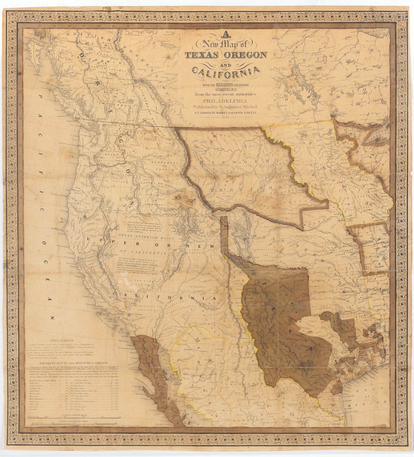
A New Map of Texas Oregon and California
Philadelphia, 1846
22 x 21 ½ inches
Nice example of Mitchell's seminal map of Texas, Oregon, Upper California, Missouri Territory and a massive Indian Territory (covering most of Kansas and Colorado).
The region covered by the map was of particular interest in 1846 because of two recent and related events. In 1845, Texas was admitted into the Union, which prompted Mexico to invade Texas in 1846, thus precipitating the U.S.-Mexican war. General curiosity about the new State of Texas and interest in the war with Mexico led to Mitchell's timely map becoming quite popular. Mitchell used the latest and best sources for the map, including Arrowsmith's 1841 map of Texas, Fremont's and Emory's maps of their explorations in the region, data from the Lewis & Clark expedition, Nicollet's map of the region between the Mississippi River and the Missouri River, and Wilkes map of Oregon.
Among other significant uses of the map, Brigham Young ordered 6 copies of the map. An example in the BYU collection includes an annotation placing the Mormons in Utah, pre-dating Fremont's map of 1848, which is the first printed map noting the presence of the Mormon's in the Great Basin.
The map shows Texas claims to the Upper Rio Grande in present-day New Mexico. These claims were eventually given up as part of the Great Compromise of 1850, in exchange for the U.S. Federal Government's assumption of Texas' public debt.
One of the most influential maps in Western American History.