from: 1016 Map Inventory
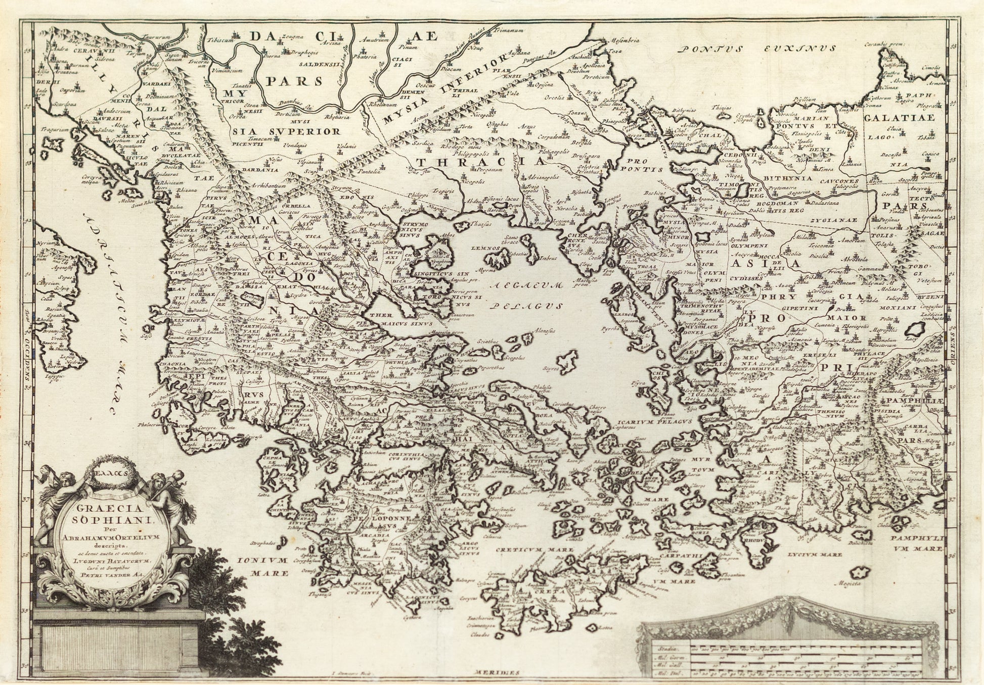
Ortelius, Abraham. Graecia Sophiani. Antwerp, 1624.
Ortelius, Abraham. Graecia Sophiani. Antwerp, 1624.
Couldn't load pickup availability
Abraham Ortelius (1527–1598)
Graecia Sophiani
Antwerp, 1624
Copperplate engraving
Sheet size: 14 3/4 x 20 1/2 inches
This exquisite map of ancient Greece, published in 1624 by the great Flemish cartographer Abraham Ortelius, is based on the cartographic work of Nikolaos Sophianos, a 16th-century Greek scholar and geographer. Titled Graecia Sophiani, it reconstructs the classical world of Hellenic civilization, presenting not just modern geography but an idealized version of Greece as it was understood in antiquity.
The map encompasses the entire Greek world—from Macedonia and Thrace in the north, to the Peloponnese and Crete in the south, and extending eastward across the Aegean to Asia Minor (modern-day Turkey). Cities and regions central to classical history, mythology, and literature—Athens, Sparta, Troy, Lydia, Ionia—are rendered with precision and reverence. Many of the labels follow ancient names and regional divisions, evoking the era of Homer, Herodotus, and Thucydides.
Ortelius, the creator of the first modern atlas (Theatrum Orbis Terrarum, 1570), was instrumental in transforming maps from navigational tools into cultural and scholarly artifacts. This map exemplifies that vision, uniting the humanist fascination with antiquity and the emerging rigor of Renaissance cartography. The decorative title cartouche, flanked by classical figures, reinforces the grandeur and scholarly authority of the map, while the finely engraved detail affirms Ortelius’s commitment to clarity and beauty.
Graecia Sophiani is more than a map—it is a historical reconstruction, an intellectual homage to classical civilization, and a statement of early modern Europe’s deep admiration for the ancient world.
Biography of the Mapmaker:
Abraham Ortelius (1527-1598) was a Flemish cartographer and geographer, widely recognized as the creator of the first modern atlas, Theatrum Orbis Terrarum (Theatre of the World), published in 1570. Born in Antwerp, which was then a hub of commerce and culture, Ortelius began his career as a map engraver and a dealer in maps and books. His work was highly influenced by the intellectual and commercial environment of Antwerp, which was a meeting point for many scholars and traders.
Ortelius's Theatrum Orbis Terrarum was a groundbreaking work that compiled the best available maps of the time into a single volume, providing a standardized and accessible reference for scholars, merchants, and navigators. Ortelius was also known for his scholarly collaborations, working closely with many of the leading geographers of his day. His meticulous work and dedication to compiling accurate geographic information made him one of the most important figures in the history of cartography. Even after his death in 1598, Ortelius’s maps continued to be published and revered, with later editions, such as the 1617 version of the Archipelagi Insularum Aliquot Descrip., showcasing his lasting influence on the field.
