from: 1016 Map Inventory
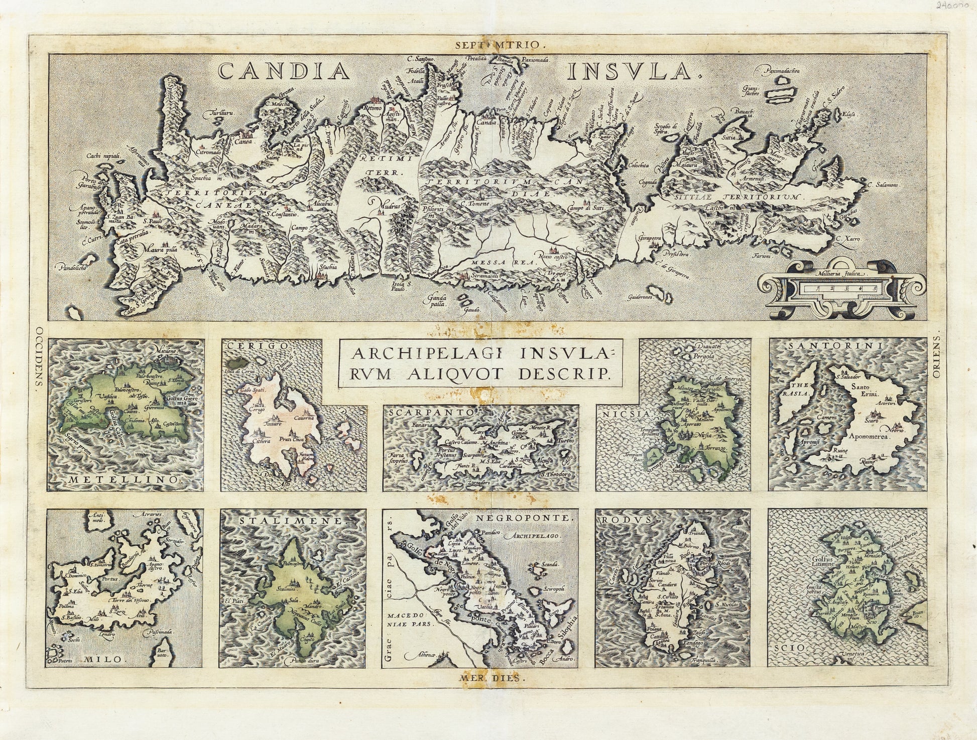
Ortelius, Abraham. Archipelagi Insularum Aliquot Descrip. Antwerp, 1617. [Crete, Metellino, Cerigo, Scarpanto, Nicsia, Santorini, Milo, Stalimene, Negroponte, Rodus and Scio].
Ortelius, Abraham. Archipelagi Insularum Aliquot Descrip. Antwerp, 1617. [Crete, Metellino, Cerigo, Scarpanto, Nicsia, Santorini, Milo, Stalimene, Negroponte, Rodus and Scio].
Couldn't load pickup availability
Abraham Ortelius
Archipelagi Insularum Aliquot Descrip.
Antwerp, 1617
14 3/8 x 20 inches
[Greece; Crete, Metellino, Cerigo, Scarpanto, Nicsia, Santorini, Milo, Stalimene, Negroponte, Rodus and Scio]
The map titled *"Archipelagi Insularum Aliquot Descrip."* by Abraham Ortelius, published in Antwerp in 1617, is an exquisite representation of several islands, primarily focusing on the Aegean and Ionian Seas. The map displays the archipelagos with careful attention to detail, showcasing the geographical features of the islands and the surrounding sea routes. This map is part of Ortelius’s broader work, *Theatrum Orbis Terrarum*, which is often regarded as the first modern atlas.
This map holds substantial historical importance as it is part of the earliest collection of maps that sought to present a comprehensive view of the known world during the Age of Exploration. Published in 1617, it reflects the heightened interest in maritime navigation and exploration during this era. The inclusion of these specific archipelagos is indicative of their importance in trade routes and geopolitical significance during the early 17th century. Additionally, Ortelius’s maps were known for their accuracy and detail, often drawing on the latest knowledge from explorers and scholars, making them valuable resources for both navigators and scholars of the time.
**Biography of the Mapmaker:**
Abraham Ortelius (1527-1598) was a Flemish cartographer and geographer, widely recognized as the creator of the first modern atlas, *Theatrum Orbis Terrarum* (Theatre of the World), published in 1570. Born in Antwerp, which was then a hub of commerce and culture, Ortelius began his career as a map engraver and a dealer in maps and books. His work was highly influenced by the intellectual and commercial environment of Antwerp, which was a meeting point for many scholars and traders.
Ortelius's *Theatrum Orbis Terrarum* was a groundbreaking work that compiled the best available maps of the time into a single volume, providing a standardized and accessible reference for scholars, merchants, and navigators. Ortelius was also known for his scholarly collaborations, working closely with many of the leading geographers of his day. His meticulous work and dedication to compiling accurate geographic information made him one of the most important figures in the history of cartography. Even after his death in 1598, Ortelius’s maps continued to be published and revered, with later editions, such as the 1617 version of the *Archipelagi Insularum Aliquot Descrip.*, showcasing his lasting influence on the field.
![Ortelius, Abraham. Archipelagi Insularum Aliquot Descrip. Antwerp, 1617. [Crete, Metellino, Cerigo, Scarpanto, Nicsia, Santorini, Milo, Stalimene, Negroponte, Rodus and Scio].](http://aradernyc.com/cdn/shop/files/KAS0065.jpg?v=1722957759&width=1445)