from: 1016 Map Inventory
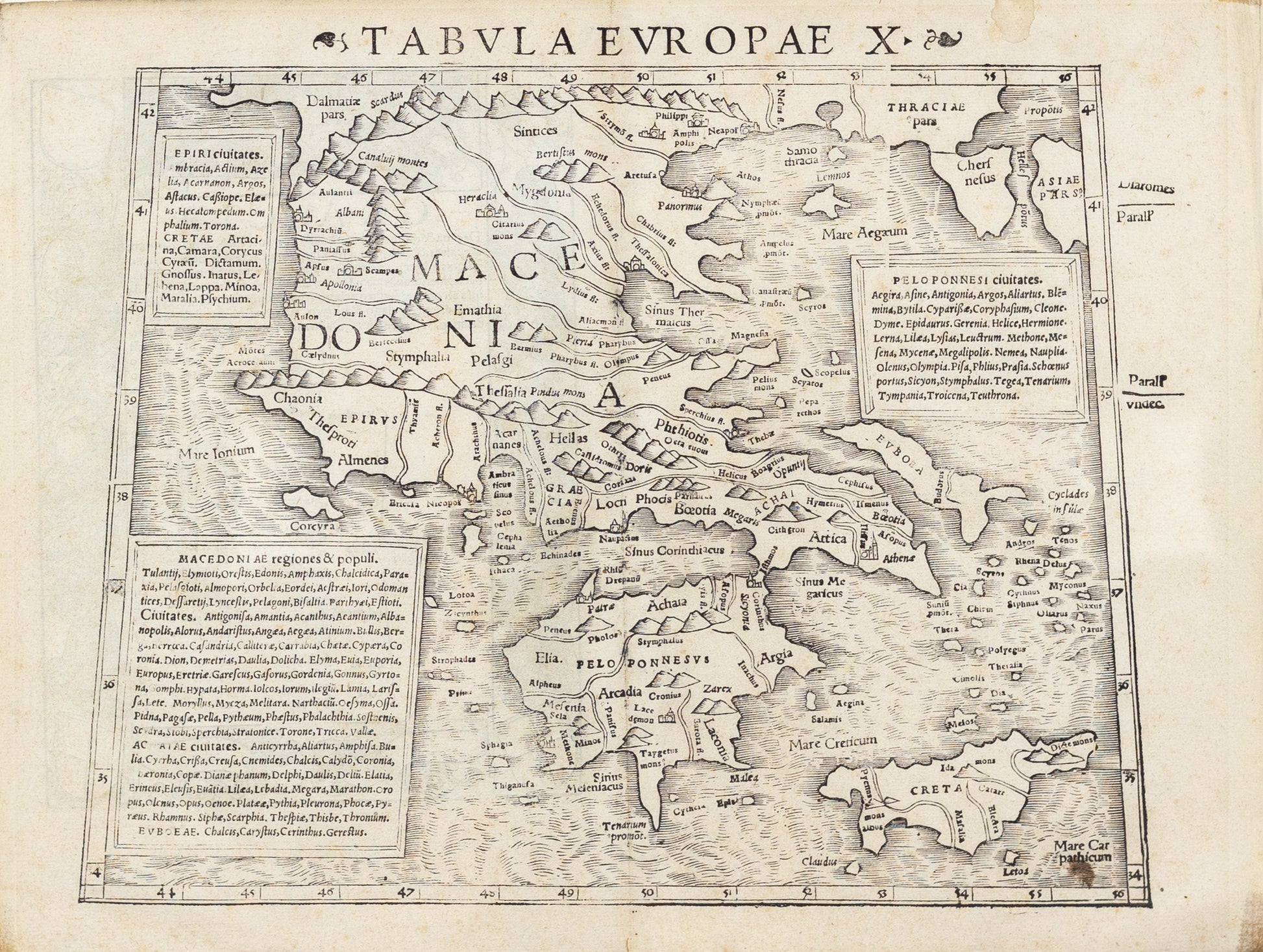
Münster, Sebastian. Tabula Europae X. Basle, 1540. [Greece, Turkey]
Münster, Sebastian. Tabula Europae X. Basle, 1540. [Greece, Turkey]
Couldn't load pickup availability
Sebastian Münster
Tabula Europae X
Basle, ca. 1540
9 4/5 x 12 3/5 inches
[Greece & Turkey]
Sebastian Münster's "Tabula Europae X," produced around 1540 in Basel, is a significant historical map that provides a detailed representation of Eastern Europe during the Renaissance period. Münster, one of the most influential cartographers of his time, was known for his contributions to geography through his work *Cosmographia*, a comprehensive description of the world that became a foundational reference in the 16th century.
This particular map, "Tabula Europae X," focuses on the regions of Eastern Europe, including modern-day Poland, Lithuania, Ukraine, Belarus, and parts of Russia. It is one of the earliest printed maps to depict this area with such specificity, reflecting the growing European interest in these regions during the early modern period. The map is part of a series that covers various parts of Europe, with "X" indicating its position in the sequence of European maps in Münster's *Cosmographia*.
Historically, the map is important for several reasons:
1. **Early Representation of Eastern Europe**: At a time when much of Eastern Europe was still relatively unknown to Western Europeans, Münster’s map provided one of the first detailed views of this area. The map includes major cities like Krakow, Vilnius, and Moscow, and it attempts to depict the complex network of rivers and the expansive forests that characterized the region.
2. **Cultural and Political Context**: The map was created during a period of significant political changes in Europe. The Grand Duchy of Lithuania, the Kingdom of Poland, and the Grand Duchy of Moscow (later the Tsardom of Russia) were all major powers influencing the political landscape of Eastern Europe. Münster’s depiction of these regions reflects contemporary European interests in the political and territorial dynamics of these states.
3. **Cartographic Style and Technique**: Münster’s map is not only a geographical document but also an artistic one. It features characteristic Renaissance cartographic elements such as decorative borders, sea monsters, and allegorical figures, which were intended to both educate and entertain. The map combines practical geography with the aesthetic and symbolic elements typical of the time, making it a valuable artifact of Renaissance cartography.
4. **Source of Knowledge**: Münster’s maps were based on a combination of ancient sources, contemporary reports, and his own scholarly interpretation. The "Tabula Europae X" thus represents the synthesis of available knowledge about Eastern Europe in the mid-16th century. As such, it is a reflection of the limits and the extent of European geographical knowledge before the scientific advancements and explorations of the later centuries.
In summary, Sebastian Münster’s "Tabula Europae X" is a historically significant map that offers a glimpse into the geographical, political, and cultural understanding of Eastern Europe during the Renaissance. It stands as a testament to the evolving knowledge of the world during a period of exploration and discovery.
![Münster, Sebastian. Tabula Europae X. Basle, 1540. [Greece, Turkey]](http://aradernyc.com/cdn/shop/files/KAS0063.jpg?v=1722957339&width=1445)