from: 1016 Map Inventory
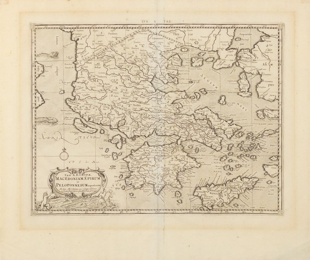
Mercator, Gerard (1512-1594). Tab.x.Europae Macedoniam Epirum ac Peloponnesum [Macedonia, Epirus, Peloponnesus]. Amsterdam, 1578.
Mercator, Gerard (1512-1594). Tab.x.Europae Macedoniam Epirum ac Peloponnesum [Macedonia, Epirus, Peloponnesus]. Amsterdam, 1578.
Couldn't load pickup availability
Gerard Mercator (1512–1594)
Tab. X. Europ. Macedonia, Epirus, et Peloponnesus
Amsterdam, 1578
Copperplate engraving
Sheet size: 19 x 22 inches
This elegant and historically rich map of Macedonia, Epirus, and the Peloponnesus was engraved by Gerard Mercator and published in the 1578 edition of his famed Ptolemaic Atlas, one of the great cartographic achievements of the Renaissance. Grounded in the geographic framework of Claudius Ptolemy, Mercator's map offers a window into classical antiquity through the refined lens of 16th-century humanist scholarship.
The map’s focus on ancient Greece makes it an essential artifact for anyone interested in classical history. Macedonia, the homeland of Alexander the Great; Epirus, seat of Pyrrhus and Hellenistic resistance; and the Peloponnesian Peninsula, the theater of Sparta, Corinth, and the Peloponnesian War—all are rendered with scholarly precision. The Aegean islands, Thrace, Crete, and the Ionian coast are also included, densely labeled with Latinized ancient place names.
The map is adorned with a graceful cartouche and sea monsters, hallmarks of Mercator’s transitional style between medieval symbolic representation and modern scientific cartography. His ambition to marry classical learning with contemporary mapping set the foundation for modern historical geography.
This 1578 engraving exemplifies the Renaissance pursuit of recovering ancient knowledge and placing it in a modern, visual context. It remains a cornerstone for understanding both the geography of antiquity and the intellectual world of early modern Europe.
![Mercator, Gerard (1512-1594). Tab.x.Europae Macedoniam Epirum ac Peloponnesum [Macedonia, Epirus, Peloponnesus]. Amsterdam, 1578.](http://aradernyc.com/cdn/shop/files/mercator.jpg?v=1750431213&width=1445)