from: 1016 Map Inventory
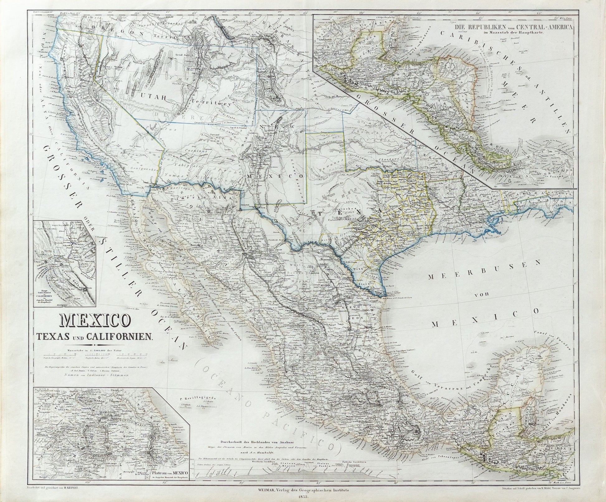
Kiepert, Heinrich. Meixco, Texas und Californien. 1853.
Kiepert, Heinrich. Meixco, Texas und Californien. 1853.
Couldn't load pickup availability
Heinrich Kiepert
Meixco, Texas und Californien
1853
22 ¼ x 26 ¾ inches
Fine large format map of Texas, California, New Mexico Territory, Utah Territory and contiguous regions, which includes Deseret (Utah Territory).
Kiepert's map of the Southwestern United States, first issued in 1847, provides a fascinating look at the changing features of the region. Over the course of approximately 20 years, the map was consistently updated to reflect the results of the explorations and surveys in the region, along with the changing geo-political borders from the Mexican-American War, Treaty of Guadalupe Hidalgo, Gadsden Purchase and the evolving Territorial Boundaries of the West, up to and immediately after the American Civil War.
An excellent study of the evolution of the west. In addition to showing Deseret (see below), the map locates the German Colony in Texas, along with a number of early counties. The results of Fremont's Explorations and Surveys are in evidence. A number of Indian Tribes still appear, along with early routes through the west.
The present edition is updated from the 1855 edition, including a delineation of Indian Territory for the first time.
The map has four insets: on of the Gold Regions, one of Central America, one of the environs of Mexico City, and a profile of the heights across central Mexico. This map would have been issued for the German market, and it would have provided many an immigrant with a first look at his or her new country. The present example also includes two pages of text in German, including a footnote identifying the primary sources of the map (Map of Oregon and Upper California (Fremont), Military Reconnaissance of the Arkansas, Rio Del Norte and Rio Gila (Emory), Memoir of a Tour to Northern Mexico (Doniphan), and Expedition in 1846 and 1847 (Wislezenis), among others.
The map appeared in Kiepert's Allgemeiner Hand-Atlas der Erde und des Himmels nach den besten astronomischen Bestimmungen, neuesten Entdeckungen und kritischen Untersuchungen entworfen. Rumsey notes "This is a marvelous atlas, full of interesting details."


