from: 1016 Map Inventory
Bourguignon d'Anville, Jean-Baptiste. Carte Generale du Tibet. Paris, 1733.
Bourguignon d'Anville, Jean-Baptiste. Carte Generale du Tibet. Paris, 1733.
Couldn't load pickup availability
Jean-Baptiste Bourguignon d'Anville
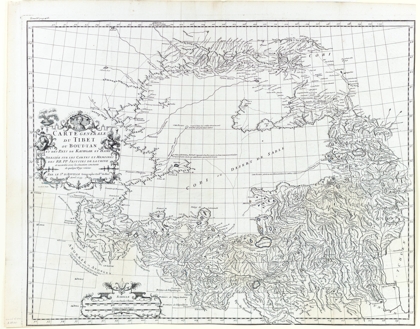
Carte Generale du Tibet ou Bout-Tan Et Des Pays De Kashgar Et Hami Dressee Sur Les Cartes Et Memoires Des RR PP Jesuits De La Chine . . .
Paris, c. 1733
19 1/8" x 24 1/4" sheet
Fine example of the Dezauche edition of the first European map of Tibet, first issued in 1737 by D'Anville.
Much of the interior is captioned "Gobi ou Desert De Sable" (Gobi, or Sandy Desert) and several rivers are shown "lost" in the sands. There are numerous place names in the mountainous terrain surrounding the desert. A portrait bust of the Dalai Lama is featured in the cartouche which also depicts a monk and incense burners.
Jean Baptiste Bourguignon d' Anville (1697-1782) was a French cartographer and compiled over 200 maps. This map is from his most important work, Nouvel Atlas de la Chine, published in The Hague 1737.
D'Anville's atlas was the principal cartographic authority on China during the 18th century. D'Anville used maps prepared by Jesuit missionaries and commissioned by Emporer-Kanyx, who in 1708-1716 ordered a surveying of the country. This map is the first accurate cartographic depiction of Tibet available in the western world.