from: 1016 Map Inventory
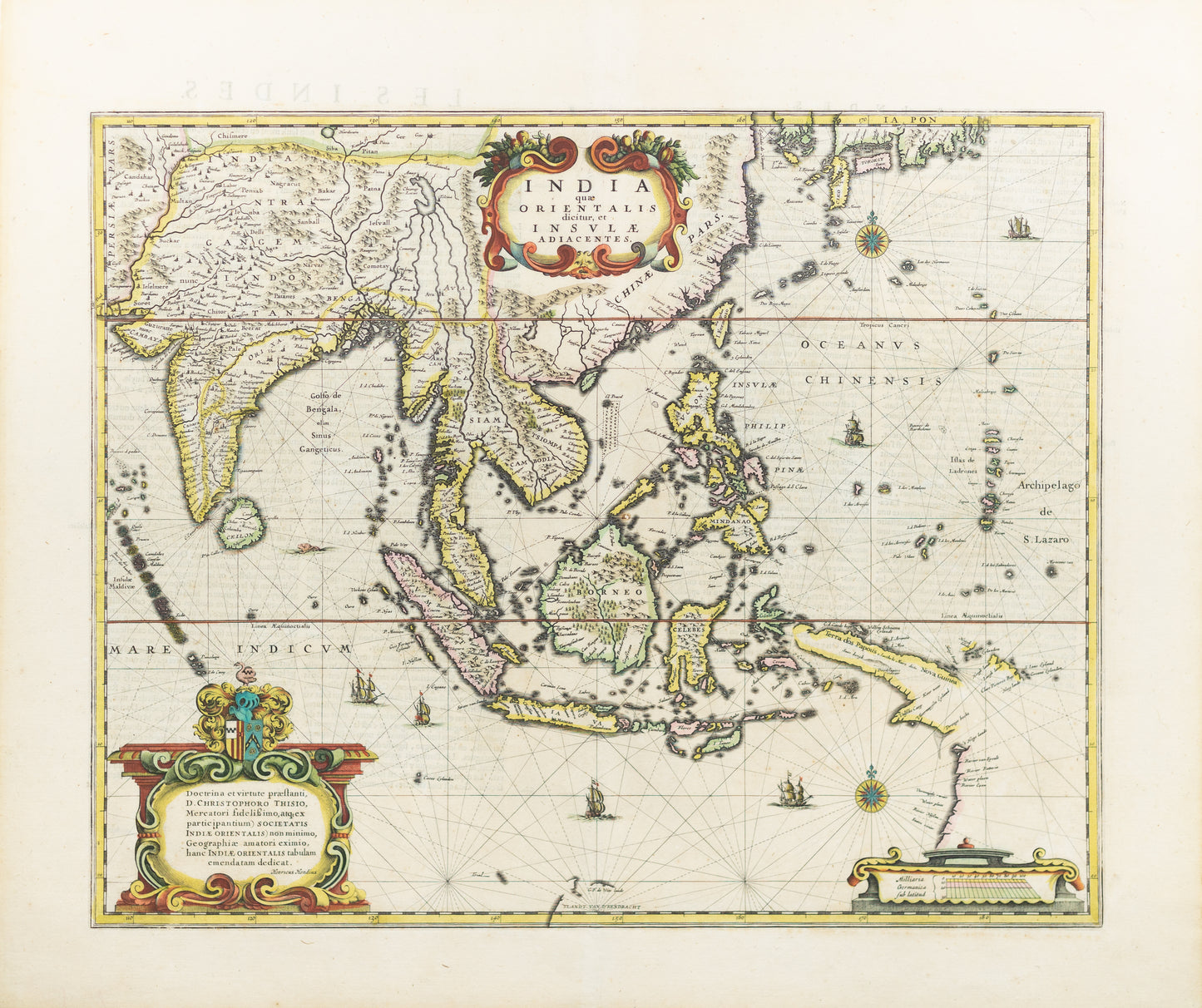
Hondius II, Hendricus. India quae Orientalis dicitur et Insulae Adiacentes. Amsterdam, c. 1636
Hondius II, Hendricus. India quae Orientalis dicitur et Insulae Adiacentes. Amsterdam, c. 1636
Couldn't load pickup availability
Hendricus Hondius II (Dutch, 1597-1651)
India quae Orientalis dicitur et Insulae Adiacentes
Amsterdam, c. 1636
Engraved map with original hand color in part
19 5/8 x 23 inches
An important Dutch map of South East Asia, noteworthy for being the second map to include the discoveries made in New Guinea and northern Queensland, Australia by the Dutch vessel Duyfken in 1605-06. Under the command of Willem Janzoon, the Duyfken explored the eastern shore of the Gulf of Carpentaria, just below the Cape York Peninsula, a venture which was famously the first recorded European contact with Australia.
This detailed map by Hendricus Hondius II captures the geography of "East India" and its adjacent islands, reflecting European knowledge and ambitions in Southeast Asia during the early 17th century. Covering the Indian subcontinent, Southeast Asia, and the islands of the Indonesian archipelago, the map highlights key trading centers, coastal settlements, and important waterways that were central to European maritime exploration and colonial commerce.
The map’s finely engraved details are complemented by original hand-coloring in outline, delineating regions and enhancing its visual appeal. Decorative elements, including ornate cartouches and sailing ships, evoke the grandeur of the Dutch Golden Age, a period when the Netherlands emerged as a dominant force in global trade and mapmaking.
Hondius’s India quae Orientalis dicitur is a significant cartographic work that combines geographic insight with artistic elegance, offering a glimpse into Europe’s evolving understanding of—and economic interests in—the rich and diverse regions of Asia.