from: 1016 Map Inventory
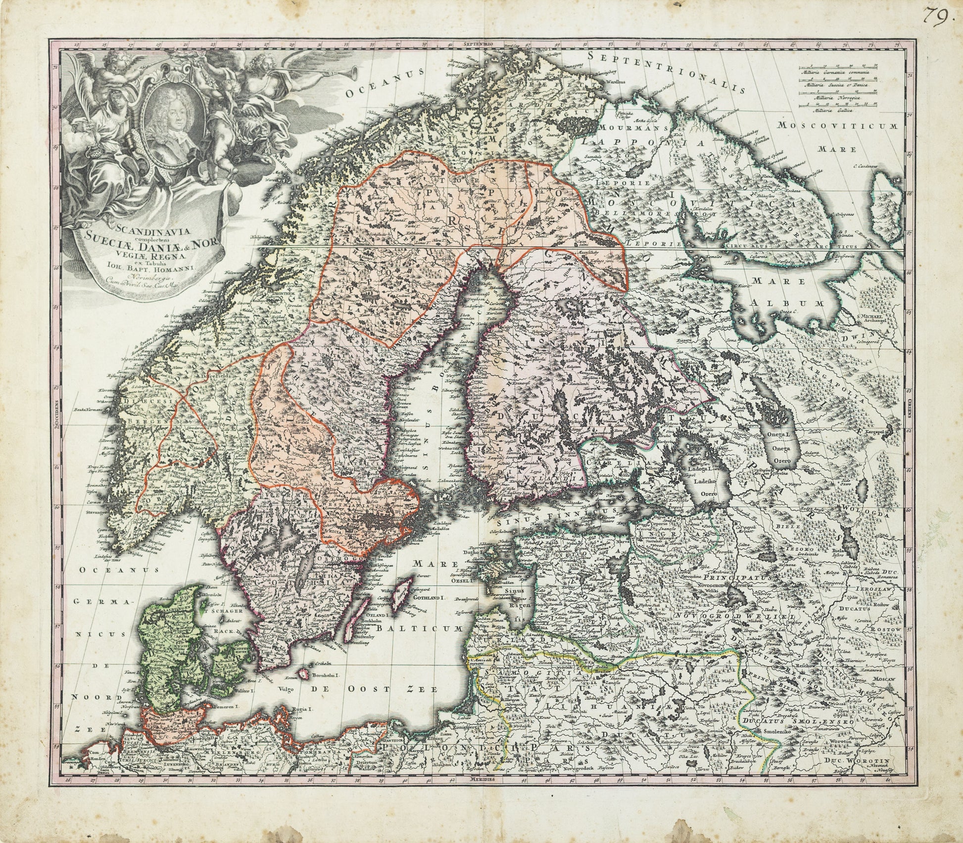
Homann, Johann Baptist (1664-1724). Scandinavia Complectens Sueciae, Daniae, & Nor Vegiae Regna [Scandinavia, Sweden, Denmark, Norway]. Nuremberg, 1720..
Homann, Johann Baptist (1664-1724). Scandinavia Complectens Sueciae, Daniae, & Nor Vegiae Regna [Scandinavia, Sweden, Denmark, Norway]. Nuremberg, 1720..
Couldn't load pickup availability
Johann Baptist Homann (1664–1724)
Scandinavia Complectens Sueciae, Daniae, & Norvegiae Regna
Nuremberg, 1720
Hand-colored copperplate engraving
Sheet size: 19 5/16 x 22 5/16 inches
This richly detailed and beautifully hand-colored map of Scandinavia by Johann Baptist Homann, published in 1720, offers a vivid snapshot of the geopolitical landscape of Northern Europe during a transformative period. Centered on the kingdoms of Sweden, Denmark, and Norway, the map captures a region that had just emerged from the Great Northern War (1700–1721)—a conflict that decisively ended Sweden’s status as a major European power.
At the time of publication, Sweden was experiencing the consequences of military overreach. Once a dominant empire around the Baltic Sea, it was now being eclipsed by a rising Russian Empire under Peter the Great. The map includes the Baltic States and large portions of Russia, reflecting how interconnected and contested the region was. Stockholm, the Swedish capital, appears as a hub of royal and military power, while Denmark’s holdings, including parts of modern-day Germany, illustrate its efforts to maintain influence.
The map is filled with topographic detail—mountain ranges, forests, rivers, and political boundaries are all finely rendered. Homann’s signature Baroque flourish is evident in the title cartouche, which features regal ornamentation and a portrait of the Swedish monarch, possibly Charles XII. His maps were as much works of political theater as geographic reference, and this composition reflects the grandeur and ambition of mapmaking during the early 18th century.
Homann’s map stands not only as a cartographic achievement but as a record of shifting powers in the North. It speaks to the interplay between geography, military conflict, and national identity in a region whose balance of power was, at the time, rapidly changing.
![Homann, Johann Baptist (1664-1724). Scandinavia Complectens Sueciae, Daniae, & Nor Vegiae Regna [Scandinavia, Sweden, Denmark, Norway]. Nuremberg, 1720..](http://aradernyc.com/cdn/shop/files/CMC0292.jpg?v=1750446344&width=1445)