from: June Map Offerings
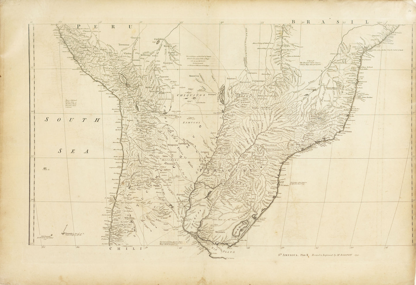
Matthew Bolton (active circa 1750s). South America...1755
Matthew Bolton (active circa 1750s). South America...1755
Couldn't load pickup availability
Matthew Bolton (active circa 1750s)
South America, Plate II
London, 1755
Copperplate engraving
[Sheet size: 24 x 18 inches]
A rare and important British map of the southern regions of South America, revised and improved by Matthew Bolton in 1755. This detailed copperplate engraving presents the territories of present-day Chile, Argentina, Uruguay, Paraguay, and southern Brazil, with exceptional attention to river systems, mountain ranges, and indigenous and colonial settlements.
Published at a time when Britain was increasingly interested in global geographic intelligence, this map reflects the nation’s strategic awareness of Spanish and Portuguese holdings in the New World, particularly around the economically and geopolitically significant Rio de la Plata. Though drawing on earlier Iberian and possibly French sources, Bolton’s revision reasserts British cartographic authority during a period of expanding imperial ambition and navigational precision.
This engraving exemplifies the Enlightenment-era pursuit of knowledge through cartography, offering a valuable record of 18th-century territorial claims, natural geography, and colonial infrastructure in South America. A compelling addition to any collection of British cartography or early South American mapping.