from: 1016 Map Inventory
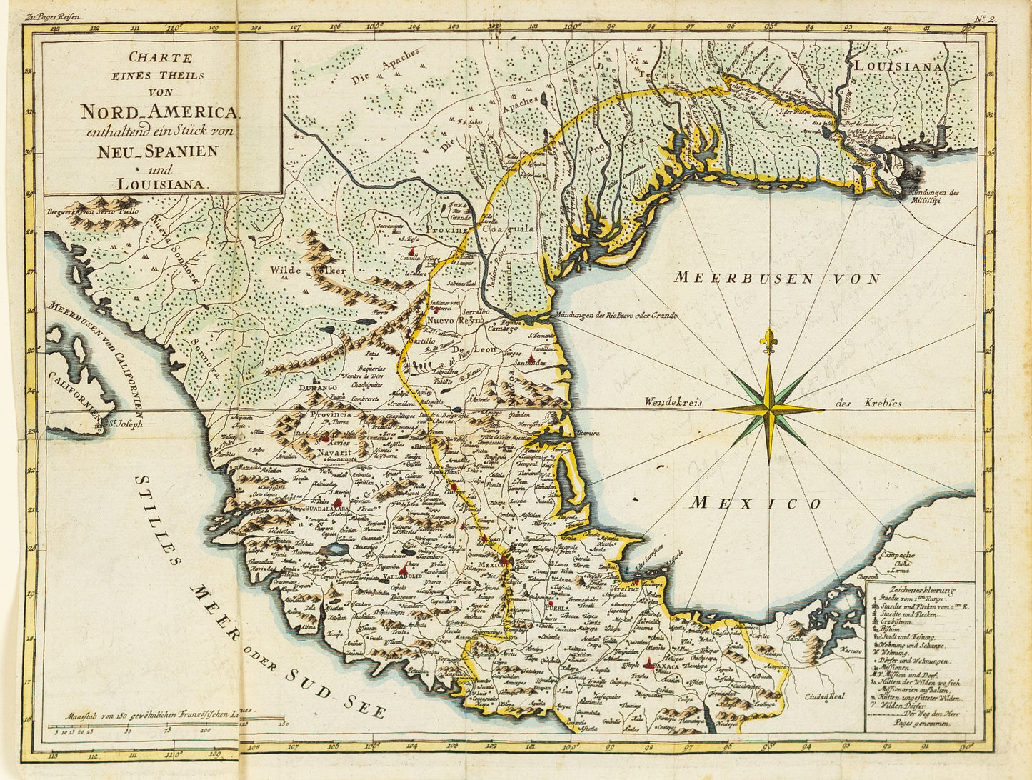
Johannes Georg Fleisher. Charte Eines Theils von Nord America enthaltend ein Stück von Neu Spanien und Louisiana. Frankfurt, 1786.
Johannes Georg Fleisher. Charte Eines Theils von Nord America enthaltend ein Stück von Neu Spanien und Louisiana. Frankfurt, 1786.
Couldn't load pickup availability
Johannes Georg Fleischer (active late 18th century)
Charte Eines Theils von Nord America enthaltend ein Stück von Neu Spanien und Louisiana
Frankfurt, 1786
Engraving on paper
[Sheet size: 13 1/2 x 18 in.]
This 1786 German-language map by Johannes Georg Fleischer presents a European perspective on the shifting geopolitical landscape of North America in the aftermath of the American Revolutionary War. Centered on parts of New Spain and Louisiana, the map reflects contemporary European interest in the continent's territorial claims, trade routes, and indigenous regions. Published in Frankfurt, it reveals how German mapmakers interpreted transatlantic developments, often synthesizing French, Spanish, and English sources to chart newly contested and colonized lands. Fleischer’s map is a valuable artifact of Enlightenment-era cartography, offering insight into how knowledge of North America circulated across Europe during a time of rapid imperial change.