from: 8_6_2024
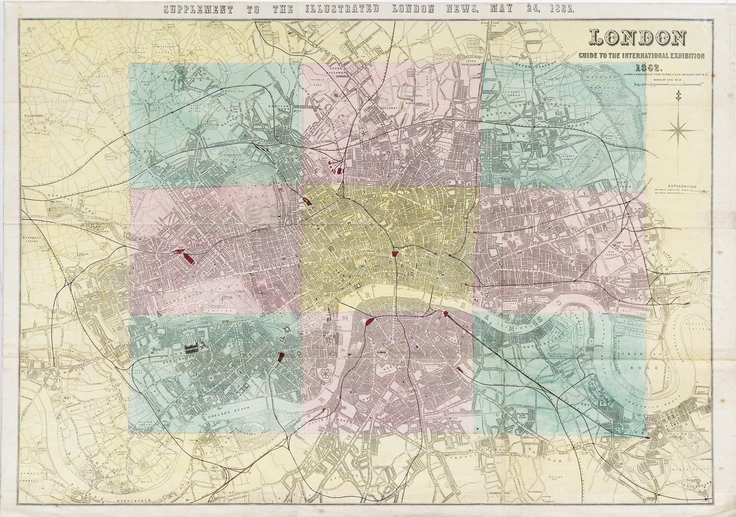
Dower, John. London: Guide to the International Exhibition. London, 1862.
Dower, John. London: Guide to the International Exhibition. London, 1862.
Couldn't load pickup availability
John Dower
London: Guide to the International Exhibition
London, 1862
Hand colored lithograph
31 x 44 3/4 in.
The map titled "London: Guide to the International Exhibition" by John Dower, created in 1862, is a hand-colored lithograph that served as a guide to one of the most significant events of the 19th century—the International Exhibition of 1862 in London. This exhibition, also known as the Great London Exposition, was a world's fair that followed the famous Great Exhibition of 1851. The map was designed to help visitors navigate the vast exhibition space and the surrounding areas in London, offering a detailed layout of the various pavilions, gardens, and major landmarks.
Historical Significance:
-
Representation of Technological and Industrial Progress: The International Exhibition of 1862 was a showcase of the latest advancements in technology, industry, and the arts from around the world. The map is significant as it represents a pivotal moment in the Industrial Revolution, highlighting how nations presented their innovations and cultural achievements on a global stage.
-
Urban Development: The map also reflects the urban landscape of London in the mid-19th century, showing how the city had developed as a global hub of commerce, industry, and culture. The exhibition itself spurred further development in the South Kensington area, which became known as the "Albertopolis," a district dedicated to the arts and sciences.
-
Cultural Exchange: The International Exhibition was not just a display of material progress; it was also an event of cultural exchange. The map illustrates the international nature of the event, with exhibits from numerous countries, making it a significant document for understanding the global interconnectedness of the time.
-
Legacy: The 1862 exhibition influenced future world’s fairs and exhibitions, setting a precedent for international cooperation and competition in the fields of technology and culture. The map by John Dower thus serves as a historical artifact that provides insight into how such events were organized and experienced by the public in the 19th century.
This map, therefore, is not just a practical guide but a document of historical importance, capturing the essence of a landmark event in the history of London and the wider world during the Victorian era.


