from: 1016 Map Inventory
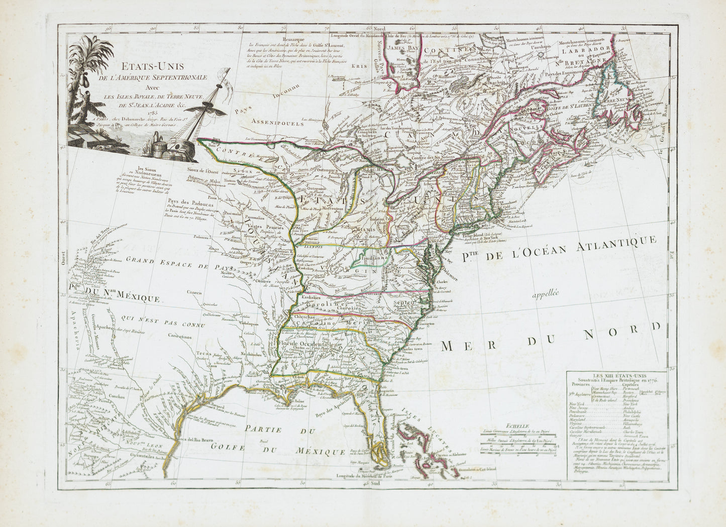
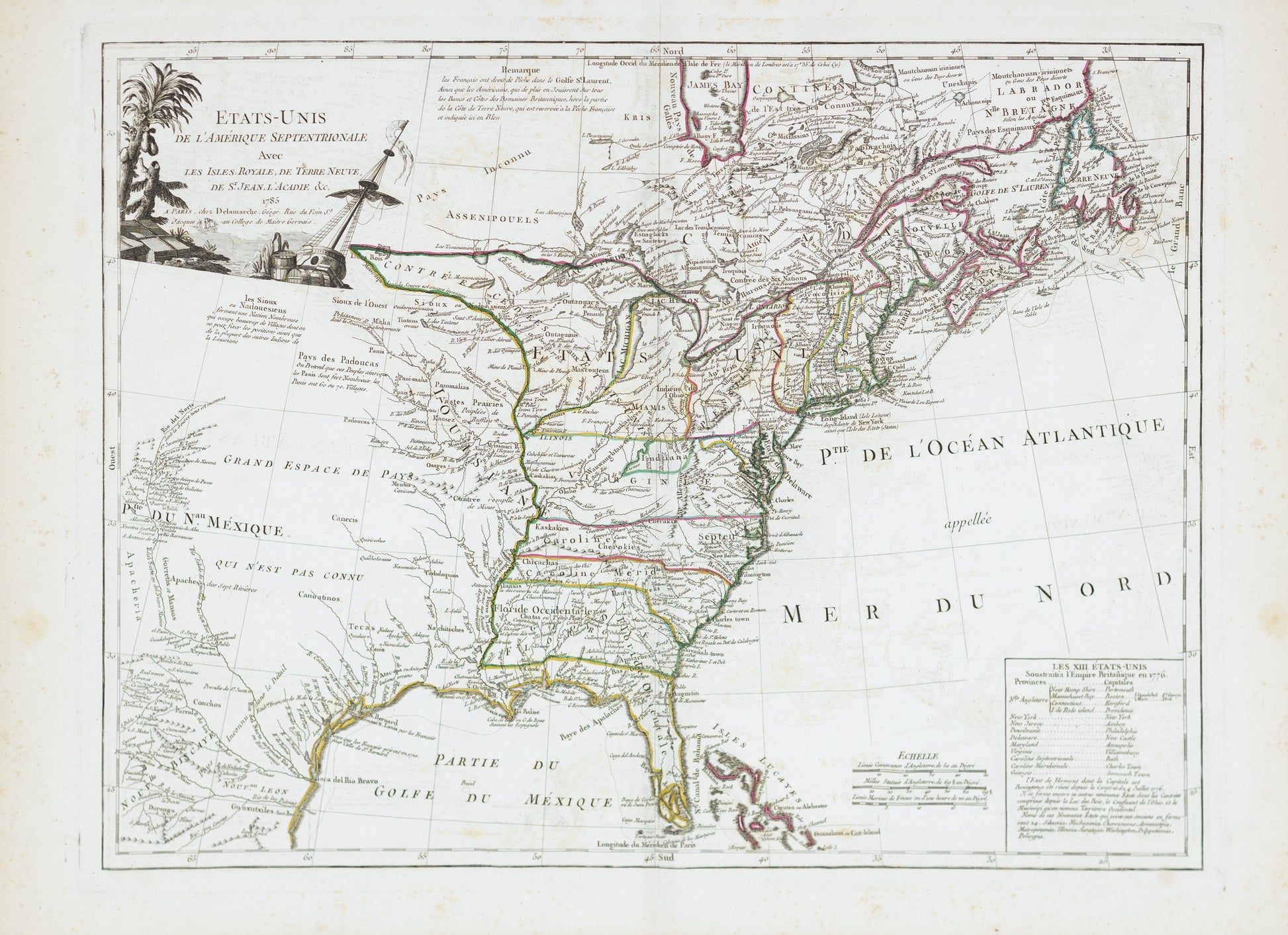
Delmarche, Charles Francois. Etats-Unis de L'Amerique Septentrionale avec les isles royale... Paris, 1785.
Delmarche, Charles Francois. Etats-Unis de L'Amerique Septentrionale avec les isles royale... Paris, 1785.
Couldn't load pickup availability
Charles Francois Delmarche
Etats-Unis de L'Amerique Septentrionale avec les isles royale...
Paris, 1785
22" x 30"
Thomas Jefferson's Ten Proposed States in the West -- First Appearance of Michigan As A Regional Place Name
Scarce early map of the newly created United States, published by Delamarche in Paris, shortly after American independence. The map appeared primarily in late editions of DeVaugondy's Atlas Universel, reissued by Delamarche.
The map is of particular note for being one of the earliest maps to illustrate the 10 new proposed states proposed by Thomas Jefferson--Silvania, Michigania, Chersonesus, Arsenistpia, Metropotamia, Illinoia, Saratoga, Washington, Polypotamia, and Pelisypia.
The map is highly detailed, extending to the Rio Grande and including notes on the Sioux Indians and the Country of the Padoucas.
Extensive notes throughout, including notes on early explorers such as De Soto and La Sale, Indians, Forts and other points of early interest.
Jefferson's Western States
Following the conclusion of the American Revolution, the newly formed United States found itself with an unorganized new territory – including what would become Ohio, Indiana, Illinois, Michigan and Wisconsin, which had been secured during the war by Gen. George Rogers Clark. There was no question that America would expand westward.
In 1784, Jefferson drafted an ordinance to the Confederate Congress concerning the government of the western territory. His plan was to create 10 new states – using rivers and latitudinal lines as boundaries – that would be equal in stature to the original 13 states.
Jefferson suggested high-sounding names that harkened to classical roots, Native American names and the Revolution: Sylvania, Michigania, Cherronesus, Assenisipia, Metropotamia, Illinoia, Saratoga, Washington, Polypotamia and Pelisipia.
The most notable part of Jefferson’s plan was the resolution that after the year 1800 “there shall be neither slavery nor involuntary servitude in any of the said states.”
This was the second attempt by Jefferson, a slave owner himself, to have the fledgling nation officially denounce slavery. His first draft of the Declaration of Independence attacked slavery as “execrable commerce,” but Southern delegates objected and the passage was cut.
The same fate befell the slavery ban. Congress stripped the language regarding slavery, along with the boundaries and names of the proposed states, and passed the Ordinance of 1784. It was superseded by the Ordinance of 1787, which created the Northwest Territory.


