from: 1016 Map Inventory
De L'Isle, Guillaume. Hemisphere Meridional pour voir plus distinctement les Terres Australes. Paris, 1714. [South Pole, Australia, New Zealand]
De L'Isle, Guillaume. Hemisphere Meridional pour voir plus distinctement les Terres Australes. Paris, 1714. [South Pole, Australia, New Zealand]
Couldn't load pickup availability
Guillaume de L'Isle
Hemisphere Meridional pour voir plus distinctement les Terres Australes. [South Pole, Australia, New Zealand]
Paris, 1714
21 1/2 x 25 1/4 inches sheet
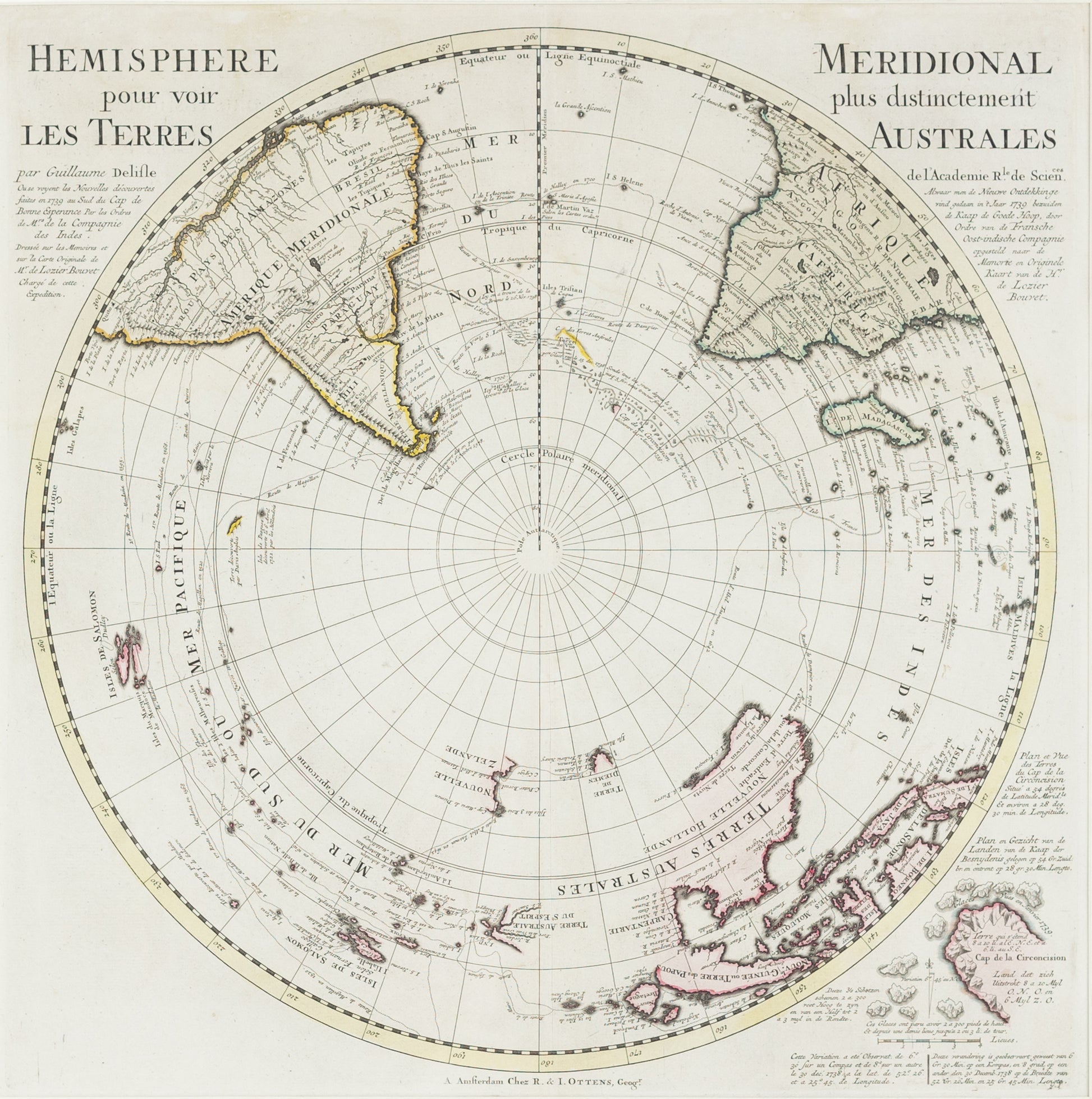
Map of the South Pole, showing early coastlines for Australia and New Zealand.
**Guillaume de L'Isle's "Hemisphere Meridional pour voir plus distinctement les Terres Australes" [Southern Hemisphere, Australia, New Zealand], Paris, 1714**
This is the first edition of Guillaume de L'Isle's significant map of the Southern Hemisphere, originally published in 1714. De L'Isle's map is a landmark in the cartographic representation of the South Polar regions and served as a foundational reference for French and Dutch mapmakers throughout the 18th century. It was widely copied by notable cartographers such as Covens & Mortier, Buache, and Dezauche.
The map is particularly renowned for its detailed depiction of the routes of major voyages of exploration during the 16th and 17th centuries. These include the expeditions of Magellan (1520), Mendaña's first and second voyages (1568 and 1595), Quiros and Gallegos (1616), Le Maire (1616), Halley (1700), Dampier (1700), S. Louis (1708), and Tasman (1642).
In addition to tracing these pivotal journeys, De L'Isle's map illustrates early, primitive coastlines of New Zealand and Australia, offering a glimpse into the evolving European understanding of these distant lands. The map also features speculative territories in the south polar regions, including a landmass attributed to the discovery by "Davis Anglois."
Historically, this map is of great significance as it reflects the growing interest and ambition of European powers in exploring and mapping the unknown Southern Hemisphere. It represents a crucial period in the history of cartography, where explorers' reports and imagination were combined to chart the farthest reaches of the Earth. The map's influence persisted for decades, shaping the work of subsequent mapmakers and contributing to the broader narrative of exploration and discovery.
![De L'Isle, Guillaume. Hemisphere Meridional pour voir plus distinctement les Terres Australes. Paris, 1714. [South Pole, Australia, New Zealand]](http://aradernyc.com/cdn/shop/files/SSV0521.jpg?v=1722960468&width=1445)

